


Valle Nevado, Chile – A potentially historic winter storm is bearing down on Chile’s central Andes, and if current forecasts verify, Valle Nevado could receive between 12 and 20 feet (3.5–6 meters) of snowfall over the next eight days.
The powerful storm cycle is expected to bring relentless snowfall, hurricane-force ridge-top winds, dangerous avalanche conditions, and enough snow to temporarily cut off access to one of South America’s premier ski resorts.
Roads to Valle Nevado Closed Ahead of the Storm
With the most intense snowfall still on the way, Chilean authorities have preemptively closed Routes G-21 and G-251, the only roads providing vehicle access to Valle Nevado.
The closure began late Wednesday night and is currently expected to remain in effect until 6:00 a.m. Saturday, July 18, although officials have made it clear that reopening will depend entirely on weather, avalanche danger, and road conditions.
These mountain roads are notorious for hairpin turns, steep grades, and avalanche exposure. During major Andes storms, closures lasting several days are not uncommon while crews clear snow and perform avalanche mitigation.
Atmospheric River Set to Hammer the Central Andes
Meteorologists say the storm is being fueled by a long-duration atmospheric river feeding abundant Pacific moisture into the Andes.
Combined with the ongoing El Niño, the setup is expected to produce exceptional snowfall totals across central Chile. NOAA’s Climate Prediction Center recently confirmed that El Niño conditions are active and are expected to strengthen through the end of 2026, increasing the likelihood of wetter-than-normal conditions across portions of western South America.
Avalanche Danger Will Rise Quickly
As exciting as 12–20 feet of snow sounds, it comes with serious hazards.
Forecasts are calling for:
- 12–20 feet of snowfall
- Strong to potentially damaging ridge-top winds
- Significant wind loading
- Rapidly increasing avalanche danger
- Whiteout conditions
- Possible prolonged road closures
Heavy snowfall combined with high winds can create unstable slabs and dramatically increase avalanche risk both inside and outside ski area boundaries. Even after snowfall tapers off, avalanche control work often delays terrain openings and road access.
Valle Nevado Working With Guests
Valle Nevado says the safety of guests and employees remains its highest priority.
Before the roads closed, the resort contacted guests scheduled to arrive and offered early check-in so they could safely reach the resort before access was suspended.
Guests unable to arrive because of the government-mandated closure are being offered several options, including:
- Credit for unused nights toward another stay this season (subject to availability)
- A credit worth 50% of unused nights toward the 2027 season
- Applying the value of unused nights toward other resort services
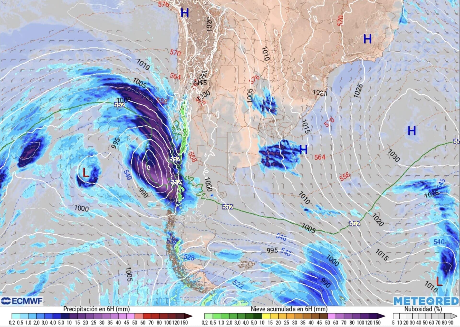
Could This Become One of the Biggest Storms of the Season?
If snowfall totals approach the upper end of the forecast, this storm could rank among the largest events of the Southern Hemisphere ski season so far.
The central Andes have already seen an active winter, but prolonged atmospheric river events are capable of producing enormous snow totals in a relatively short period of time. Once skies clear, the payoff could be outstanding skiing—assuming crews can safely reopen roads, perform avalanche control, and dig out lifts and facilities.
For anyone currently in Santiago planning to drive to Valle Nevado this week, patience will likely be the safest option.
We’ll continue monitoring the storm and will update this story as new snowfall totals, photos, road conditions, and operational updates become available.