

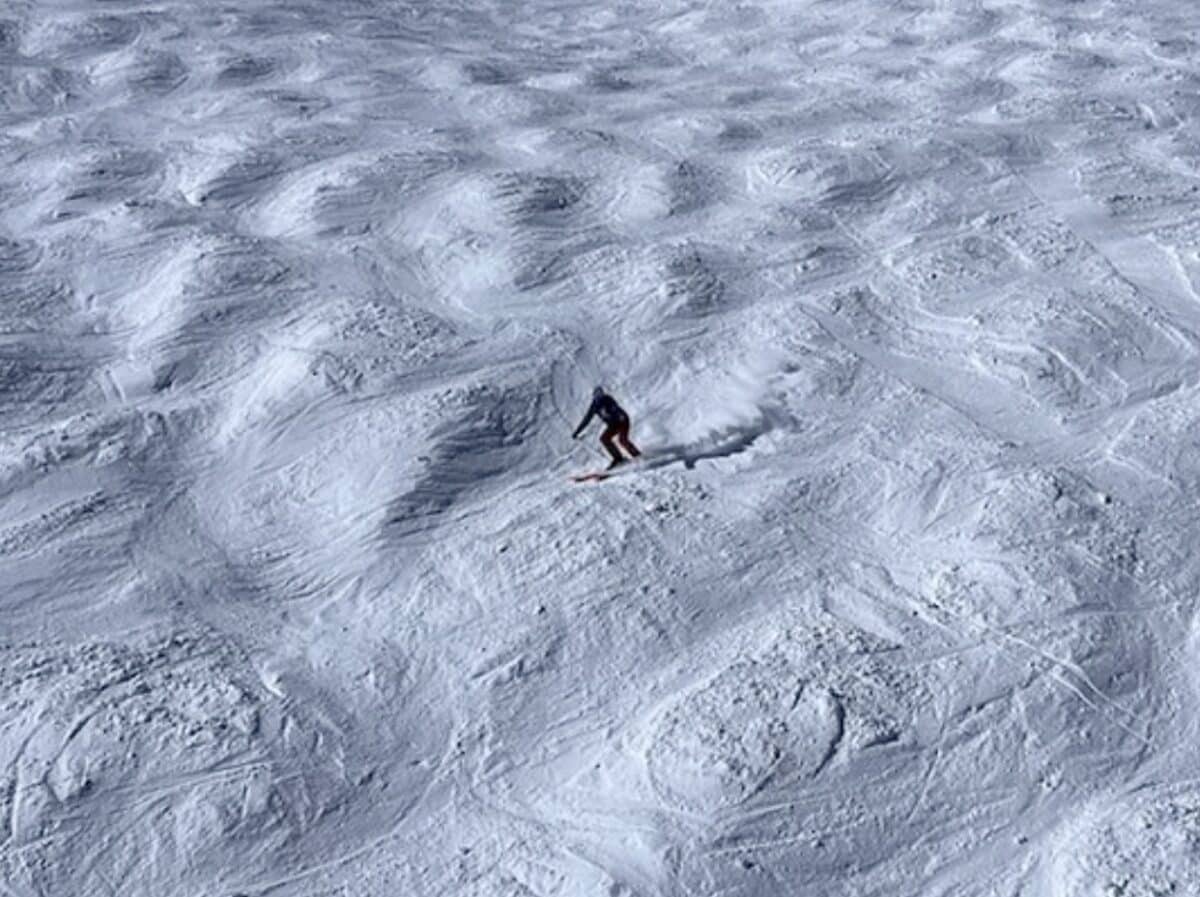
Skiers and snowboarders across the Northwest should plan for a warmer, drier, and more variable 2026-27 season, with El Niño tilting the odds away from classic deep mid‑winter powder (especially in Idaho, Oregon, and Washington) while Alaska sees a different mix of stormy fall and relatively drier, milder winter conditions.
El Niño 2026–27: Setting the Stage
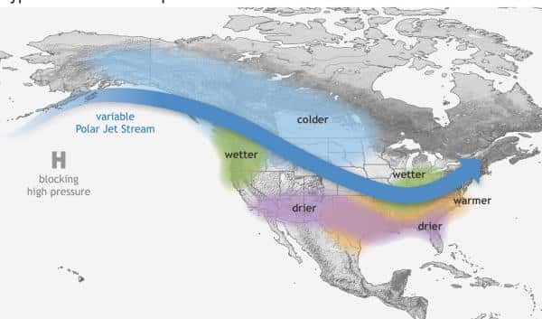
NOAA’s Climate Prediction Center has confirmed that El Niño is underway in the Pacific and is expected to strengthen through late 2026, with high odds of a very strong event by November-January. In these phases, warmer than average sea surface temperatures in the central and eastern equatorial Pacific alter the jet stream, typically favoring stormier, cooler conditions across the southern United States and warmer, drier conditions across much of the northern tier. For skiers, that broad pattern translates into a snowpack signal: fewer cold storms tracking into the Northwest and a greater tendency for marginal‑temperature events where precipitation falls as rain at lower and mid elevations.
What Northwest Riders Can Expect
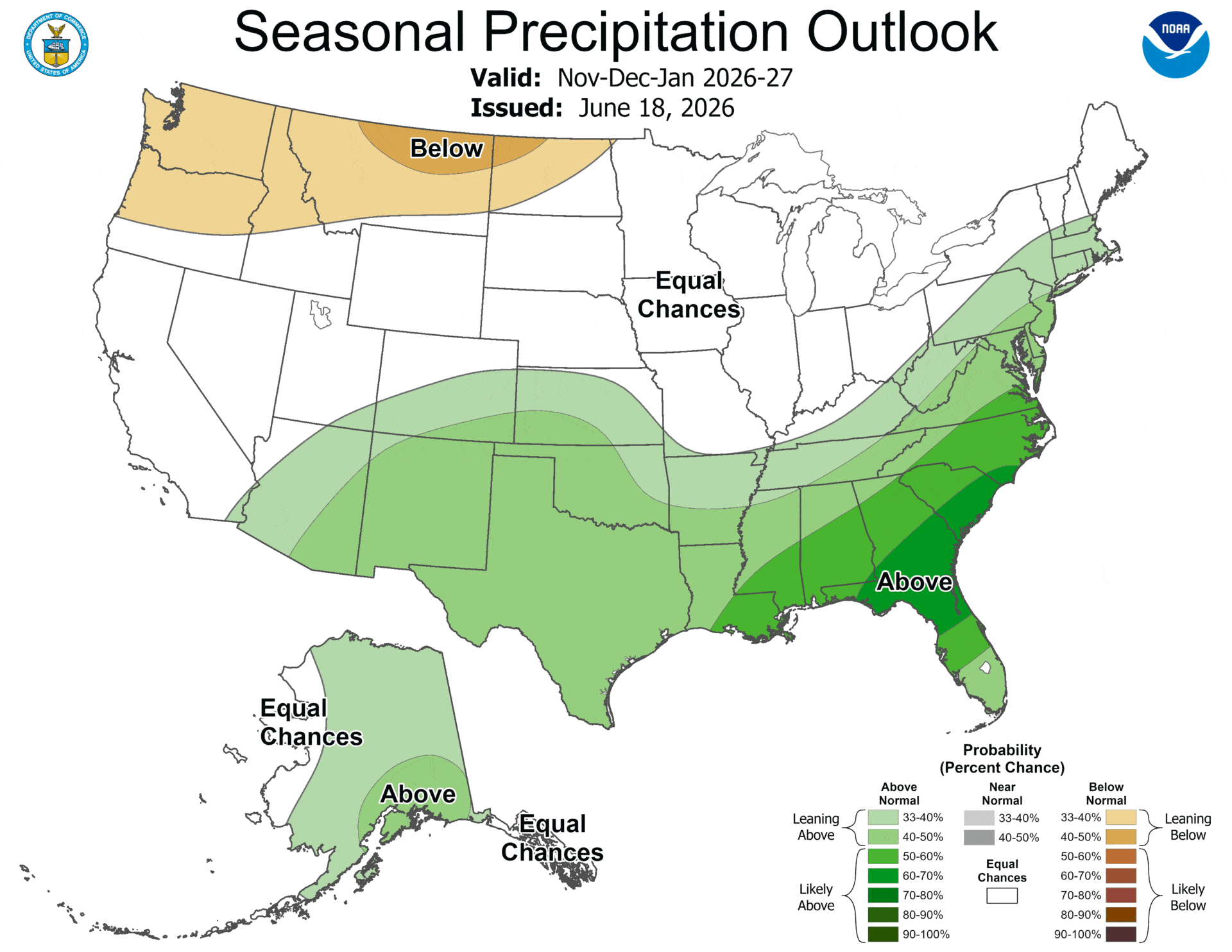
Idaho, Oregon, and Washington usually experience warmer and drier fall and winter conditions during El Niño episodes, with more precipitation falling as rain instead of snow. For the 2026–27 season, NOAA’s outlook shows increased chances of below normal precipitation across parts of these states during November-January, consistent with reduced overall snow accumulation. Skiers and snowboarders should anticipate thinner early season bases, more pronounced mid‑winter melt freeze cycles, and a snowpack that may build in fits and starts rather than sustained deep.
Expect more mixed bag type storm days with wet snow, heavy powder, and rain transitions, and fewer cold‑smoke events. Travel planning for powder trips may require shorter notice flexibility, chasing individual colder systems rather than banking on a consistently snowy pattern.
Alaska: Stormy Fall, Mild Winter
Alaska’s response to El Niño differs from the rest of the Northwest: past events typically bring wetter falls, more storms (especially around the Gulf of Alaska), and somewhat warmer conditions in both fall and winter, while winters tend towards drier overall.
NOAA’s seasonal outlook for November 2026-January 2027 indicates elevated odds of above normal precipitation over much of Alaska, alongside generally higher temperatures. That means coastal and maritime influenced mountains could see a stormy shoulder season with substantial early snow at higher elevations but more variability in snow quality as warm intrusions occasionally switch snow to rain.
As winter progresses, the combination of relative warmth and drier conditions can yield extended high‑pressure stretches, with firm surfaces, crusts, and occasional mid‑winter corn on sun exposed aspects. High latitude backcountry travelers should remain attentive to complex weak layers that can form when warm storms overlay older, faceted snow and then are followed by dry, cold spells. With that all said, Alaskan skiers and riders may experience a front loaded season in some ranges, followed by longer windows of stable but less frequently refreshed snow.
Snowpack, Runoff, and Backcountry Hazards
El Niño’s tendency to reduce snow accumulation and shift precipitation toward rain in Idaho, Oregon, and Washington has downstream consequences for snowpack structure and spring conditions. Drier, warmer winters typically produce less total snow and more pronounced mid‑season melt events, which can generate crusts, rain layers, and complex interfaces in the upper snowpack. For backcountry skiers and splitboarders, this means avalanche problems may persist longer and evolve in unusual ways compared with colder, snowier La Niña winters.
Reduced snowpack leads to decreased runoff and lower summer water availability, which is important not only for rivers and salmon but also for late spring touring conditions. The window for safe, continuous snow approaches may shorten with more exposed ground and mixed travel surfaces.
Looking Beyond One Season
Some climate projections suggest the possibility of more frequent and intense ENSO events of both El Niño and La Niña types, which would mean more pronounced boom and bust seasons in regional ski climates over coming decades.
For the 2026-27 El Niño, the big takeaway for skiers and snowboarders is to expect a season that leans toward warmth and variability in the Northwest, with better odds of consistent early season storms in parts of Alaska and more marginal, elevation‑dependent snow in Idaho, Oregon, and Washington.
As always, El Niño tilts the odds rather than guaranteeing specific outcomes, and local mountain microclimates can most definitely defy the regional signal for stretches of weeks at a time. Skiers and riders who track NOAA outlooks through the winter, watch freezing levels closely, and remain flexible about destinations and timing. Fingers crossed this El Niño shaped season will shake out in your favor.
