
A powerful heat wave is set to blanket large portions of the Central, Southern, and Eastern United States around the Fourth of July holiday, with federal forecasters warning of extreme heat conditions that could pose serious health risks.
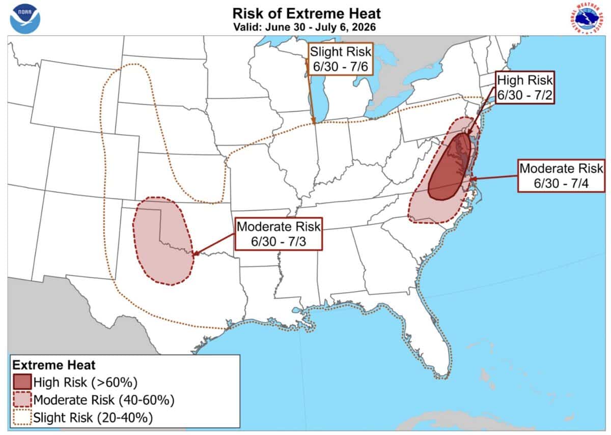
The National Oceanic and Atmospheric Administration’s Climate Prediction Center says strong mid-level high pressure currently centered over the Southeast will shift westward and expand north and northwest in the coming days, driving dangerous heat across a broad swath of the country.
The most immediate threat falls on parts of the Mid-Atlantic, where NOAA has issued a High Risk designation, indicating greater than a 60 percent chance of extreme heat from June 30th through July 2nd. Washington, D.C. is among the areas under that elevated alert, with temperatures potentially climbing to 95°F and heat index values possibly hitting 105° or higher.
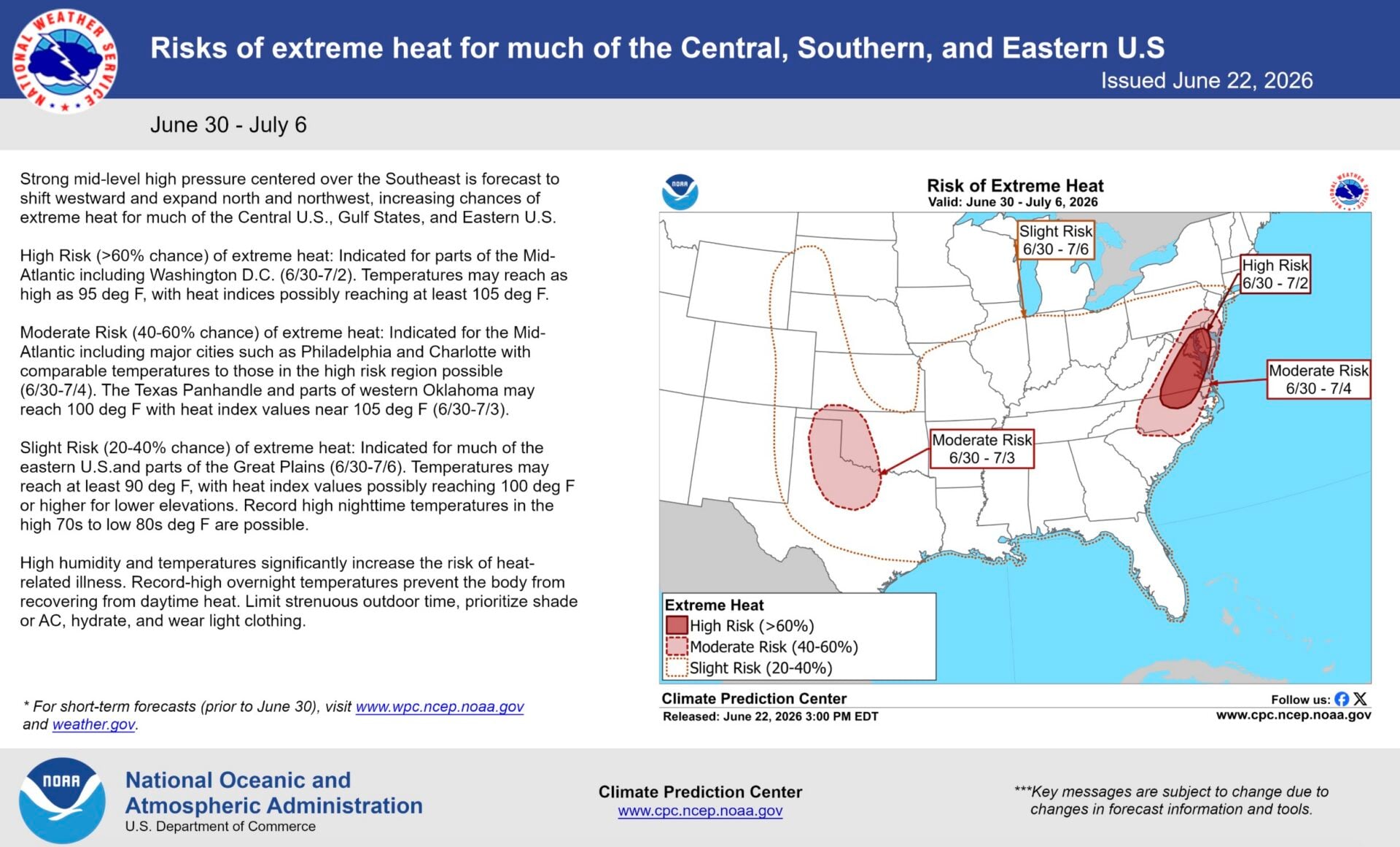
A Moderate Risk covers a wider Mid-Atlantic corridor, including Philadelphia and Charlotte, through July 4th, with similarly dangerous temperatures possible. The Texas Panhandle and parts of western Oklahoma could also see triple-digit heat and heat index values near 105° through July 3rd.
A broader Slight Risk of extreme heat stretches across much of the eastern U.S. and parts of the Great Plains through July 6th. Temperatures in those areas may reach at least 90°, with heat index values potentially topping 100° at lower elevations. Record high overnight lows in the high 70s to low 80s are possible, which is particularly dangerous because the body needs cooler nighttime temperatures to recover from daytime heat stress.
NOAA advises limiting strenuous outdoor activity, seeking shade or air conditioning, staying well hydrated, and wearing lightweight clothing throughout the days surrounding the holiday.