

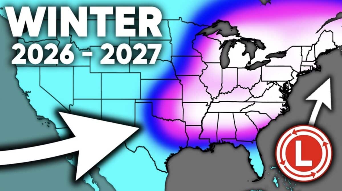
New long range forecast updates shared by Direct Weather suggest that portions of the United States could be in for a colder and snowier winter than many might expect from a strong El Nino pattern. The latest analysis compares updated seasonal guidance from the Canadian Seasonal to Interannual Prediction System and the Climate Forecast System, with both models showing notable similarities despite some important differences.
While seasonal outlooks remain highly uncertain months in advance, Direct Weather noted that the growing agreement between multiple models is worth watching as August begins.
Central And Eastern States Could Trend Colder
According to Direct Weather, both long range models increasingly favor below average temperatures across the central United States as autumn transitions into winter. Cooler air is projected to expand from the Plains into the Midwest before spreading farther east during December, January, and February.
The analysis suggests that much of the eastern United States could experience temperatures that are closer to normal or slightly below normal during the heart of winter rather than significantly warmer than average. The coldest anomalies remain focused over the central states, but colder air reaching the East Coast would improve the chances for winter storms.
Direct Weather also pointed out that both models indicate February could become the coldest month of the season, with some guidance even extending wintry conditions into March.
East Coast Snowstorm Potential Increases
Perhaps the biggest takeaway from the forecast is the potential for an active storm track across the eastern half of the country.
Direct Weather said both seasonal models consistently depict frequent storm systems tracking through the southern United States before moving up the East Coast. If colder air is present when those storms arrive, the setup could favor significant snowfall across the Appalachians, Ohio Valley, Mid Atlantic, and portions of the Northeast.
The forecast also raises concerns for a wetter than average fall and winter across the Southeast, where repeated storm systems could increase the risk of heavy rain and severe weather before colder air becomes more established.
Western Forecast Shows Regional Differences
The outlook is less consistent across the western United States. Both models generally favor warmer than average temperatures along much of the West Coast for much of the cold season. However, Direct Weather believes the Southwest, including the southern Rockies and Sierra Nevada, could benefit from an active storm track capable of delivering substantial mountain snowfall.
The Pacific Northwest appears less favorable for widespread precipitation in the current guidance, though Direct Weather cautioned that confidence remains lower there and future model updates could change the outlook.
Early Forecast Still Subject To Change
Despite the colder projections, Direct Weather emphasized that seasonal outlooks should not be viewed as final forecasts. The analysis noted that additional climate drivers beyond El Nino, including the Pacific North American pattern, Arctic Oscillation, North Atlantic Oscillation, and Pacific Decadal Oscillation, may be contributing to the colder signals appearing in multiple models.
Additional seasonal forecast updates are expected later this month when new guidance from the European model and JAMSTEC becomes available, providing another opportunity to see whether the colder and snowier trend continues.
