

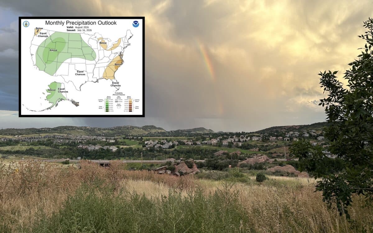
The latest monthly outlook from NOAA’s Climate Prediction Center points toward a warmer than normal August across much of the United States while precipitation patterns are expected to vary significantly depending on the region. The forecast, issued this month and valid for August 2026, highlights a broad area of increased odds for above average temperatures stretching from the Southeast through the Mid Atlantic and into parts of the Northeast. Meanwhile, much of the northern Rockies and portions of the northern Plains are favored to see cooler than average conditions.
Above Average Heat Expected Across The South And East
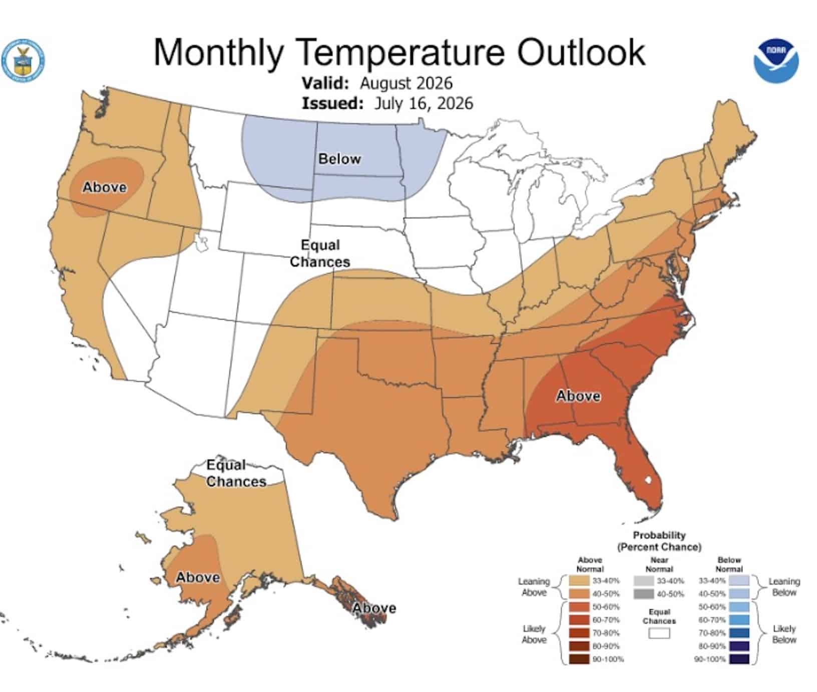
NOAA’s monthly temperature outlook shows the strongest signal for above normal temperatures centered across the Southeast. Florida, Georgia, South Carolina, North Carolina, and surrounding states have the highest probabilities of experiencing a warmer than average month.
The warmth is also expected to extend westward across the Gulf Coast and parts of Texas while much of the Ohio Valley and the Northeast also lean toward above normal temperatures. The West Coast including much of California, Oregon, and Washington is forecast to trend warmer than average as well.
For millions of Americans, the outlook suggests that persistent summer heat could continue well into August. Higher than normal temperatures can increase energy demand, elevate wildfire concerns in already dry regions, and place additional stress on outdoor recreation and agriculture.
Cooler Pattern Forecast For Northern Rockies
Not every part of the country is expected to bake in above average heat. The Climate Prediction Center identifies portions of Montana, Wyoming, North Dakota, and South Dakota as having increased odds for below average temperatures during August. While this does not guarantee a cool month, it means historical climate data and current atmospheric patterns favor temperatures finishing below the long term average.
Several areas across the interior West and central United States remain in the equal chances category. That designation means forecasters do not see a strong signal favoring above normal, near normal, or below normal temperatures.
Wetter Conditions Favored Across The West
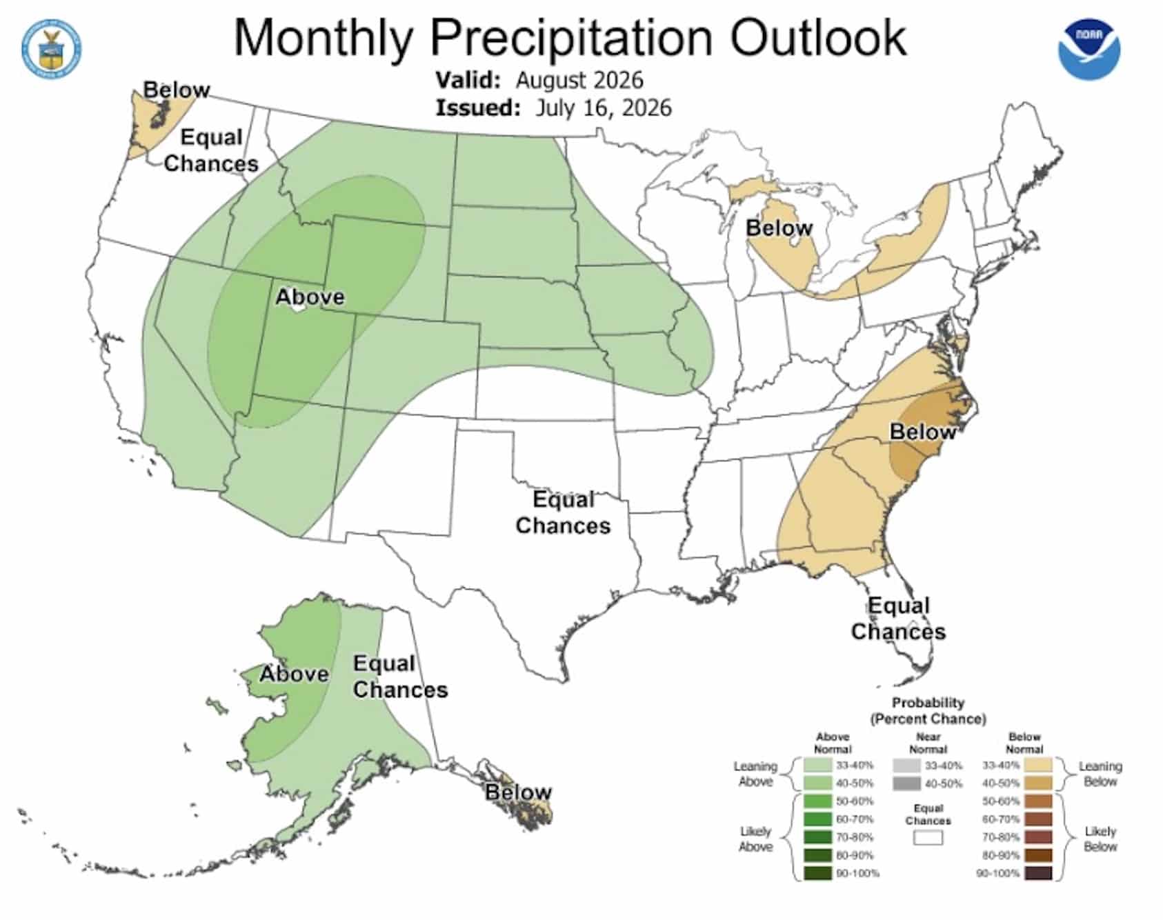
The August precipitation outlook paints looks quite a bit different. Large portions of the western United States including the Great Basin, the Rockies, and parts of the northern Plains are favored to receive above average precipitation. Alaska also shows an increased likelihood of wetter than normal conditions across many areas.
These forecasts could bring welcome moisture to some regions that have dealt with persistent dryness during the summer. Increased precipitation can also improve water supplies and reduce wildfire potential if rainfall materializes as forecast.
Drier Outlook For The Great Lakes And Southeast Coast
While much of the West leans wetter, portions of the eastern United States are forecast to trend drier than average. NOAA indicates increased odds for below normal precipitation across parts of the Great Lakes as well as a corridor stretching from the Carolinas into the Mid Atlantic. Areas along the Southeast coast could experience fewer rainfall events than is typical for August.
Much of Texas and the southern Plains fall into the equal chances category, meaning forecasters do not have a strong climate signal pointing toward either a wetter or drier month.
Monthly Outlook Reflects Climate Trends Rather Than Daily Weather
It is important to note that NOAA’s monthly outlook is not a day by day weather forecast. Instead, it estimates the probability that average temperature and precipitation over the entire month will finish above, below, or near long term climate averages.
Individual heat waves, thunderstorms, heavy rainfall events, or cool spells can still occur regardless of the monthly outlook. However, these forecasts provide valuable guidance for emergency managers, farmers, utility companies, ski resorts planning offseason work, and outdoor enthusiasts looking ahead to late summer conditions across the country.
