

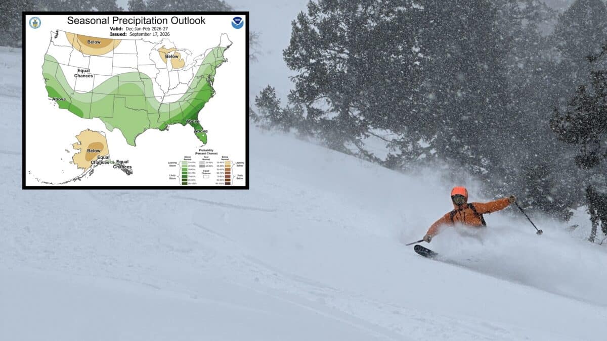
NOAA has released an updated outlook for the upcoming winter, giving skiers a fresh look at what December through February could bring across the United States. The new forecast was issued on September 17th, 2026, and the latest maps continue to show a winter pattern heavily influenced by the strengthening El Niño.
The updated NOAA Climate Prediction Center outlook favors above-normal precipitation across much of the southern United States, including California, the Southwest, southern Rockies and Southeast. Meanwhile, portions of the northern Rockies and Great Lakes are showing a drier signal.
For skiers, the precipitation forecast is particularly interesting because several major ski regions are now positioned beneath the wetter southern storm track. However NOAA’s temperature outlook also shows widespread warmth across the northern United States, creating an important caveat for snowfall prospects.
NOAA’s Latest Winter Precipitation Outlook
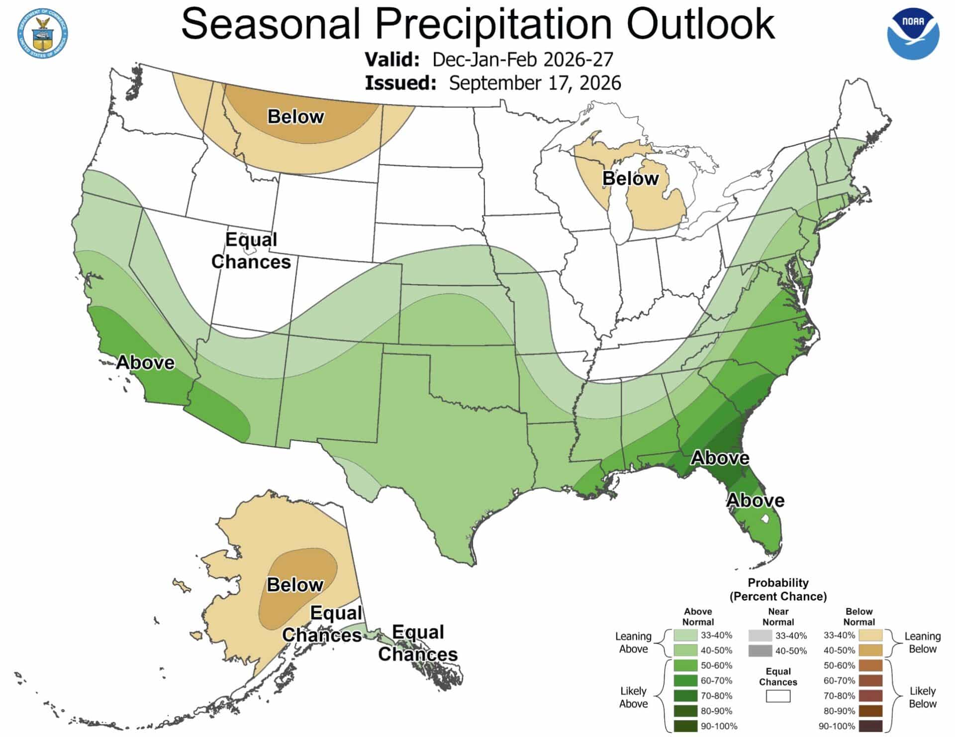
The new forecast covers December 2026 through February 2027, commonly referred to as DJF. Unlike a short-range weather forecast, the seasonal outlook does not predict individual storms or snowfall totals. Instead, it shows the probability of temperatures and precipitation finishing above, near or below normal over the three-month period.
The September 17th precipitation map shows a pronounced wet signal across the southern half of the country.
Above-normal precipitation is favored across California, Arizona, New Mexico, much of Texas and portions of the southern Rockies. The signal becomes especially strong across parts of the Southeast and East Coast.
At the same time, portions of Montana and the northern Rockies are showing below-normal precipitation odds. The Great Lakes also feature a below-normal signal, while much of the Pacific Northwest remains closer to equal chances.
This represents an important distinction for the 2026-27 ski season. The latest NOAA outlook does not suggest that the entire West will experience a uniformly wet winter.
California And The Southwest Stand Out
California remains one of the most interesting areas on the new map. NOAA favors above-normal precipitation across much of the state during the core winter months. That puts major ski destinations including Mammoth Mountain, Palisades Tahoe and other Sierra Nevada resorts in a region where an active Pacific storm track could deliver substantial moisture.
The forecast also favors wetter conditions across Arizona and New Mexico. That could be significant for resorts such as Arizona Snowbowl, Taos Ski Valley and Ski Santa Fe. These mountains are positioned to benefit when El Niño shifts the Pacific storm track toward the southern United States.
More precipitation does not automatically mean more snow however. Storm temperatures and snow levels will determine how much of that moisture actually contributes to a ski area’s snowpack.
Southern Colorado Remains Interesting For Skiers
The NOAA latest outlook also shows above-normal precipitation extending into portions of Colorado, particularly the southern part of the state. That puts the San Juan Mountains in an interesting position heading into winter. Resorts including Wolf Creek, Telluride and Purgatory could benefit if the southern storm track repeatedly delivers moisture into the Four Corners region.
Central and northern Colorado are less clearly defined on the precipitation map, with parts of the state closer to equal chances. The September outlook really does not provide a clear wet or dry signal for every major Colorado ski area.
Northern Rockies Face A Different Pattern
The forecast becomes less favorable farther north. Parts of Montana and the northern Rockies are shaded for below-normal precipitation. The Pacific Northwest also lacks the strong wet signal appearing farther south, with portions of Washington and Oregon falling into equal-chance territory.
That could be notable for ski areas such as Big Sky, Whitefish, Jackson Hole and Grand Targhee. The precipitation outlook does not mean these resorts will have poor snow seasons. Seasonal maps cannot predict individual powder cycles, and a few major storms can dramatically change a ski area’s season.
Still, the latest NOAA forecast suggests the southern half of the country has a more pronounced precipitation signal heading into the heart of winter.
NOAA Forecasts Above-Normal Temperatures Across Much Of The North
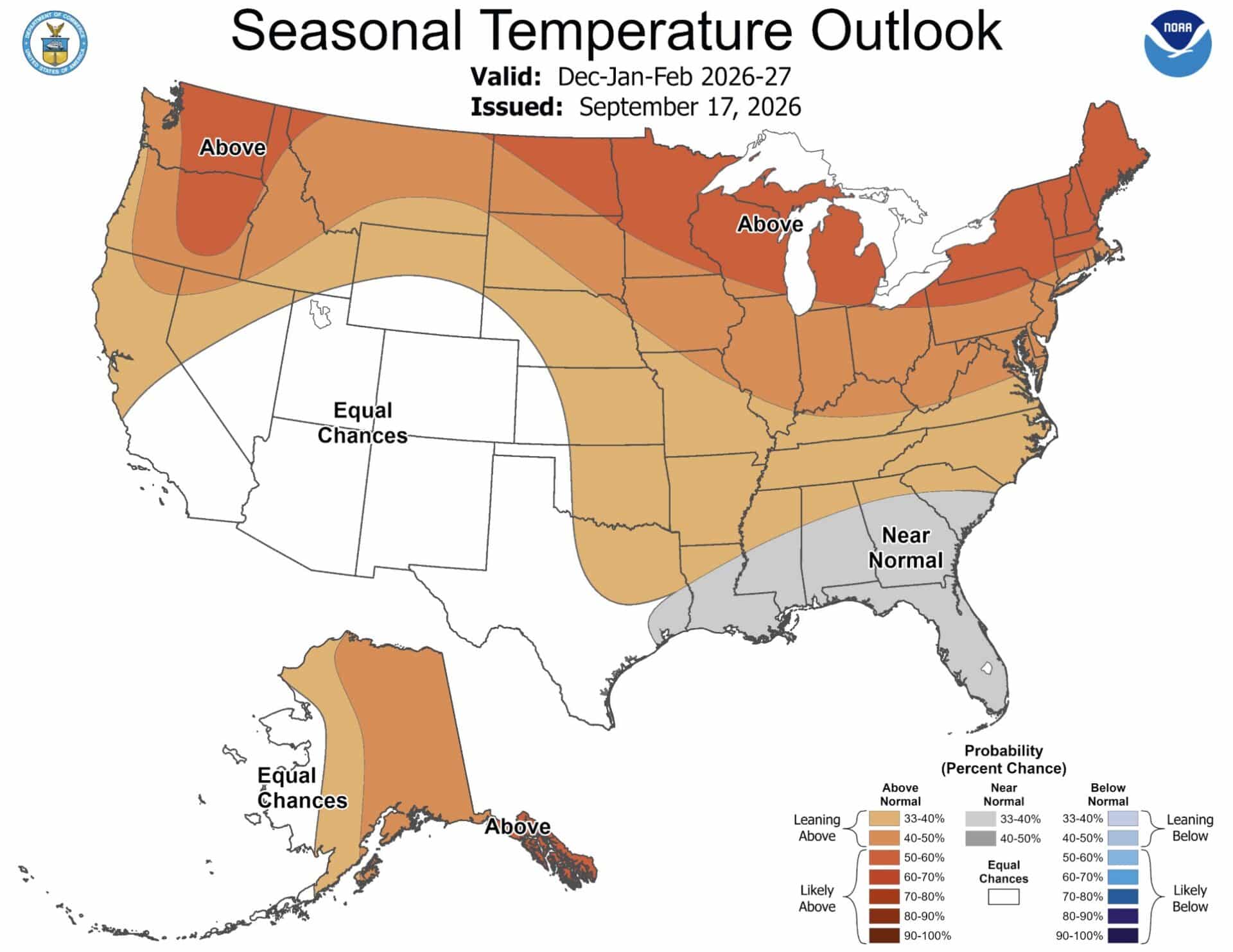
The temperature outlook adds another layer to the forecast. NOAA favors above-normal temperatures across much of the northern United States, including the northern Rockies, Great Lakes and Northeast. Warmer-than-normal conditions are also favored across parts of the West.
Colorado, Utah and portions of the Southwest are closer to equal chances in the latest temperature outlook. The Northeast has a particularly notable combination of above-normal precipitation and above-normal temperatures. That could mean an active winter storm pattern, but the amount of snow that reaches the ground will depend heavily on whether individual storms can maintain sufficient cold air.
For skiers, elevation will be an important factor. Higher-elevation resorts can remain cold enough for snow even when valleys and lower mountain elevations experience rain or mixed precipitation.
What The New NOAA Forecast Means For Skiing
The biggest takeaway from the September 17th update is that the 2026-27 winter forecast continues to favor an active southern storm track.
California, Arizona, New Mexico and southern Colorado have above-normal precipitation probabilities on the latest NOAA map. Meanwhile, portions of the northern Rockies are facing a drier signal.
The temperature forecast creates a more complicated picture. Warmer conditions across the northern tier could raise snow levels during some storms, while the equal-chance temperature forecast across Colorado and Utah leaves more uncertainty for those major ski regions.
It is also important to remember that NOAA’s precipitation outlook measures total precipitation rather than snowfall. A wet winter can still produce rain at a ski resort, while a season with near-normal precipitation can produce excellent skiing if the storms arrive at the right temperatures. NOAA will continue updating its seasonal outlook as the winter approaches.
