
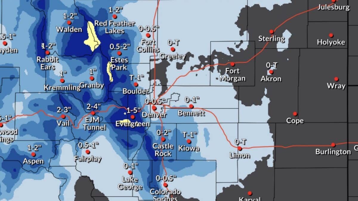
A pair of Winter Weather Advisories issued by the National Weather Service early Friday morning point to a legitimate late-season powder opportunity for Colorado skiers and riders willing to brave the elements.
The first advisory covers the mountains of Summit County, the Mosquito Range, and the Indian Peaks, along with the Southern Front Range Foothills. That zone, which includes Berthoud Pass, Breckenridge, Winter Park, and the area around Eisenhower Tunnel, could pick up between 2 and 7 inches of new snow. That advisory runs from 9am through 5pm MDT this afternoon.
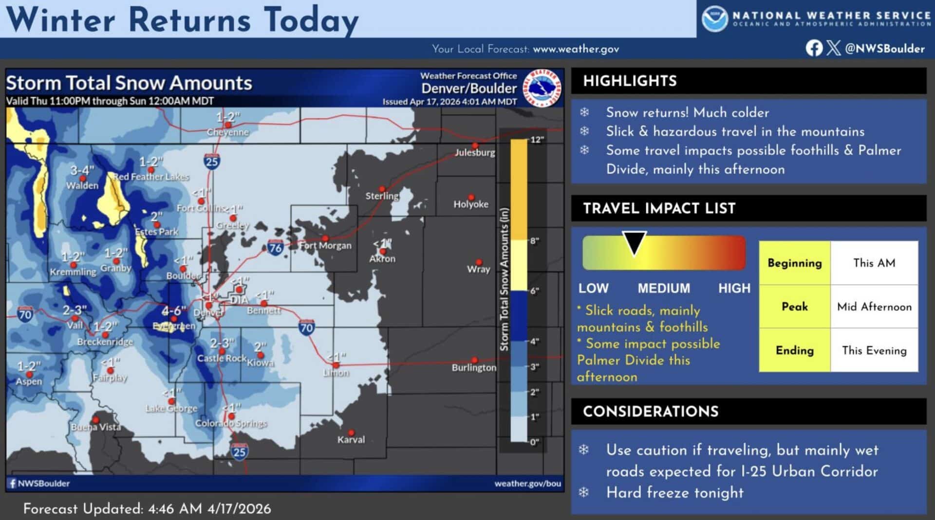
Further north, a separate advisory covers Rabbit Ears Pass, Rocky Mountain National Park, and the Medicine Bow Range through 3pm MDT. That zone is looking at the better numbers, with 3 to 9 inches of total accumulation possible before the snow wraps up. Both areas could see wind gusts topping out near 45 mph, which will play a factor in how snow distributes across open terrain and ridgelines.
Both advisories are active during morning and early afternoon hours, meaning anyone heading to the hill today could find fresh snow actively falling during first and second chair. By the time afternoon crowds thin out, the snowpack should be settled and consolidated.
Drivers heading into the mountains should plan accordingly. Mountain passes including Berthoud and Rabbit Ears are expected to become slippery, and the National Weather Service flagged both morning commutes as potentially hazardous. Real-time road conditions are available through COtrip.org or by calling 511.