
As Denver is preparing for a night of rain and a little bit of snow, many of Colorado’s mountains are expecting a nice helping of powder.
A Winter Storm Warning in effect from today, March 3, to 5pm tomorrow, March 4, forecasts snow accumulation between 2 and 14 inches in the mountains paired with wind gusts reaching as high as 60 mph. The warning specifically applies to Rocky Mountain National Park and the Medicine Bow Range, the mountains of Summit County, the Mosquito Range, and the Indian Peaks.

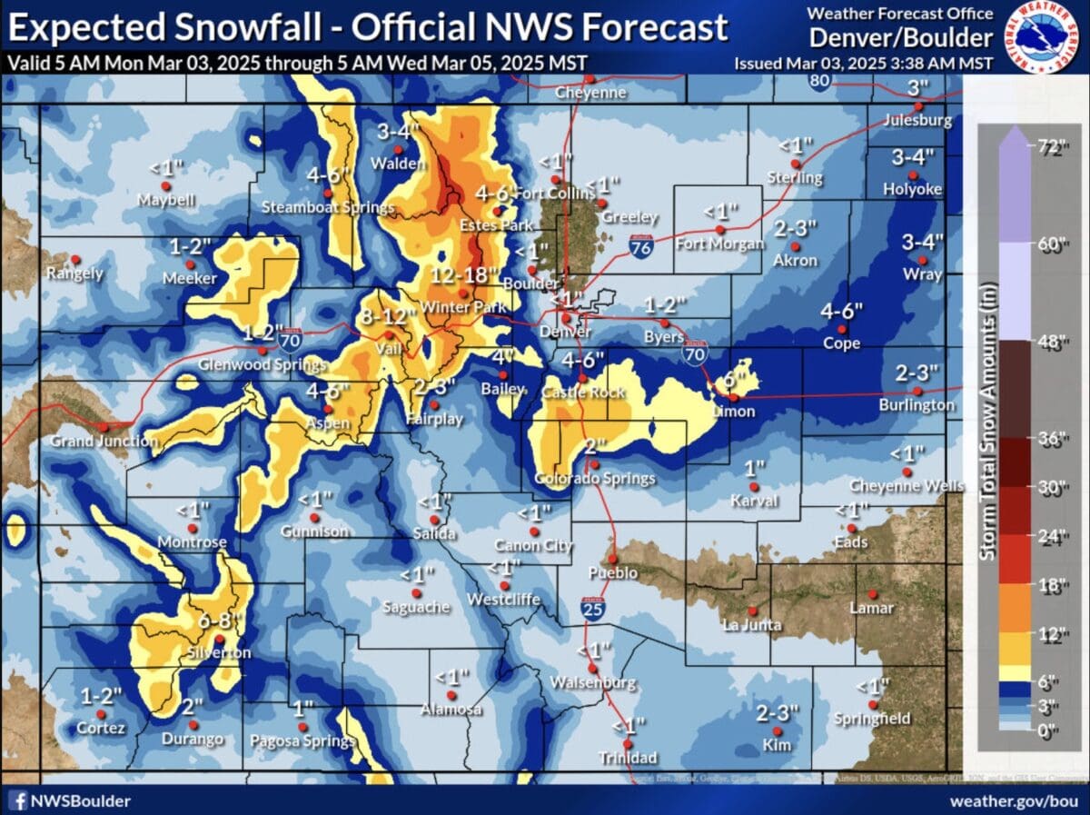
The National Weather Service’s Expected Snowfall forecast places 4-6 inches of new snow landing around Steamboat Springs and Aspen and 6-8 inches landing further south around Silverton. Further East, Vail and the resorts along the eastern I-70 Corridor could see closer to 8-12 inches, while Winter Park is sitting in the 12-18 inch range.
The Denver area is expected to see less than an inch of snow accumulation, but Castle Rock could see 4-6 inches. Snow covered roads and difficult travel are expected in the mountains. Visibility will be heavily reduced due to snow and blowing. The National Weather Service recommends altering travel plans during the storm.