
Forecast by our friends at Powderchasers.
128 INCHES IN 8 DAYS! POWDER UPDATE FOR THE WEST WITH MORE STORMS ON TAP.
03/01/2023
SIERRA
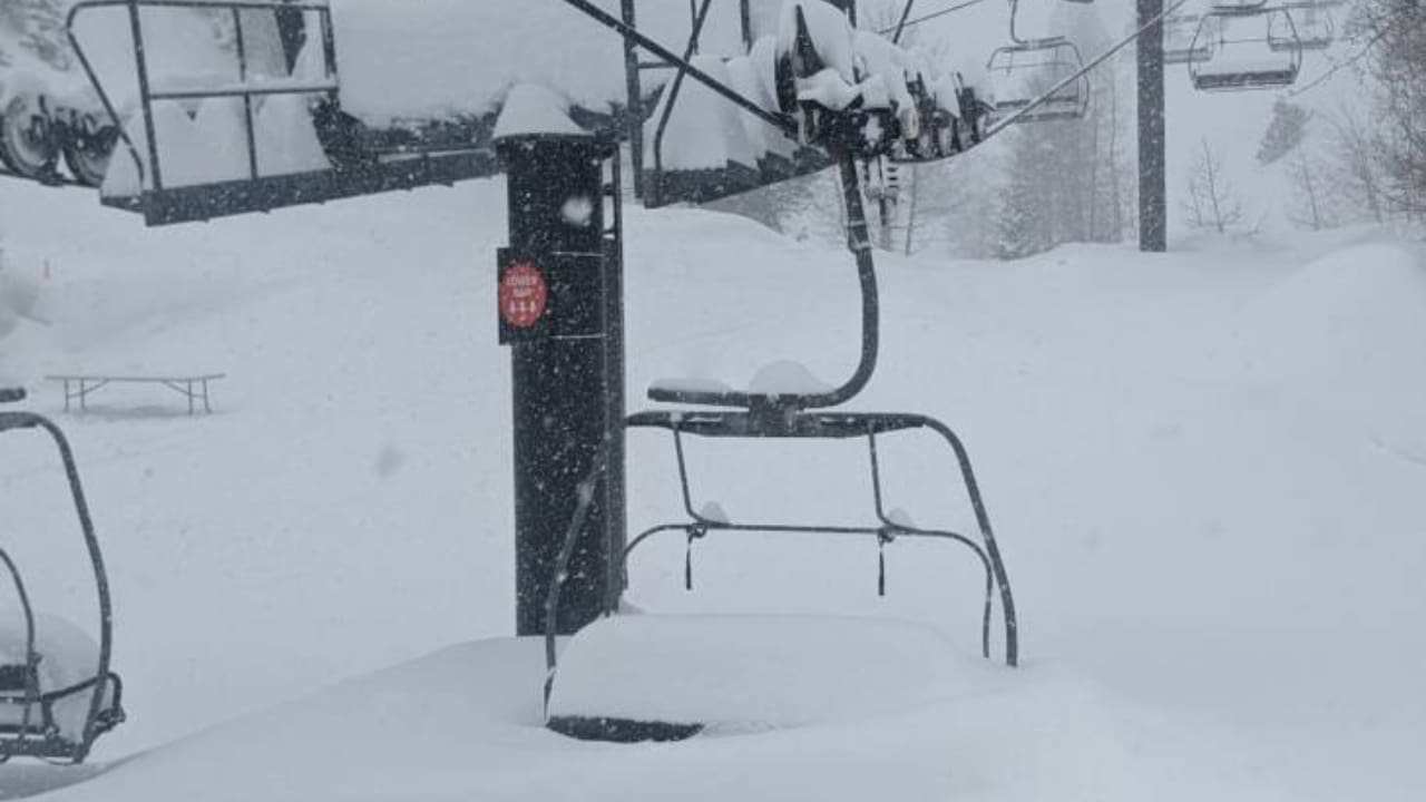
What an incredible week with snow totals being measured in 8-10 feet for the Sierra on the past storm cycle that brought blizzard conditions to much of California and Nevada. As of Wednesday, Palisades has had 148 inches in 8 days!. On Wednesday morning snow telemetry is showing another 18 inches has fallen (All overnight) and lifts have not spin at many areas in Tahoe on Tuesday. Today and the next several days will be as epic as it gets as things open.
Most all the mountain ranges in the Sierra picked up significant snow Tuesday night with the bulk of precipitation moving south from I-80 over the central and southern regions as of 4AM Wednesday. While many of you have been shut down due to closed roads, and ski areas (Wind closures)
Wednesday morning if the lifts spin in the Sierra might end up being one of the top deep double snorkel days in recent history. It’s likely many areas will return to somewhat normal operations soon.
ANNOUNCEMENT– We are now offering some great apparel, featuring high-quality US-made beanies and sweatshirts. This store will be expanded in the future but we are offering pre-release pricing on some great items. Please check out our store and support us with some Powderchasers gear that supports our site: https://powderchasers.com/store.
Don’t forget to join our Concierge program for custom chase forecasts or donate here. Our concierge program will provide you with custom forecasts to insure you get into the deepest snow next week (Our chase secrets). Donations keep our free forecasts going. Members rarely miss the deepest days.
On with the forecast!
Most of the moisture for the Sierra will be over by mid morning Wednesday if not sooner, especially up north. Bottom Line: Winds are calming for the Sierra, 1-2 feet of blower on top of 5-7 feet will ride as good as it gets! Don’t leave! Upper peaks will begin to pop in the next few days before another storm rolls in on Saturday.
Elsewhere in the West
For the Rockies, the bulk of the energy from the Sierra (Final wave) is headed south over Arizona, southern Utah, and most of southern Colorado. New Mexico is a solid wildcard. Heavy snow will fall Wednesday later AM through Thursday. 12-20 inches are possible for these areas making last chair a good bet especially for northern Arizona and to some extend Colorado. Snow will continue in the San Juan Range focussing on the southern ranges from Purgatory to Wolf Creek. Thursday could be a decent deep day for first chairs. New Mexico scores later Wednesday afternoon into Thursday with a bit less snow (6-11).
Below: Short term high resolution models showing the deepest snow over the next 24 hours into Thursday morning (Southern Sierra, 4 corners, some snow noted in Mexico, and the PNW is just beginning on Thursday.

Chases later this week?
A Pacific Storm moves over the Cascades and coastal BC on Thursday. This will also bring some strong winds with intense snowfall during the day, especially for central and northern regions from I-90 to Mt Baker up north. Snow creeps further south over Crystal later Thursday morning. Amounts look decent (double digits) for areas that do well with a PSCZ (Stevens Pass, Alpental). Bottom Line: Decent storm totals. Day storm may be a bit less desirable to an overnight dump. Snow continues Thursday evening especially southern zones in Washington (Crystal could sneak up). If winds keep things closed on Thursday, Friday could be deeper.

Below: The PNW storm Thursday could be decent, especially for Washington and coastal BC. Timing is not perfect for the overnight big dump but Friday could still deliver a chase as well as storm skiing Thursday.

That system races over the northern Rockies bringing a good chance of some moderate snow for the Rockies Friday. Amounts look to stay on the moderate end with some upside possible in the Tetons.
A stronger system moves from the Pacific to “Guess where” the Sierra with a good round of heavy snowfall for Tahoe that should peak from Midday Saturday to Sunday. This will bring double digits. That system will then move east late this weekend impacting most of the central or southern Rockies (More on this storm in a future post).
Below: 48 hour snowfall ending Sunday afternoon. Decent totals for the Sierra with the bulk of the weekend snow edging due east over the central and Southern areas of the northern Rockies. The PNW also is noted to have some additional snowfall. The Sierra will be deepest.


This post is being generated from the base of LCC on another chase for powder on Wednesday. LCC is closed for avalanche mitigation (Ditto, Ditto). The only hope this morning for additional powder is in the Cottonwoods and perhaps areas near Ogden. Overnight totals Wednesday in the Cottonwoods are only in the 1-3 inch range as of 6AM. Snow will increase Wednesday morning peaking from 7AM to 11AM bringing 4-9 inches by your last chairs. This could ride really well on top of the wind denser snow that fell for Tuesday. Snow will also increase near Provo (Sundance) so look for a possible surprise dump there by mid morning. I am cautiously optimistic with a bit of uncertainty on exactly where the heaviest snow showers set up Wednesday.
Below: New England finally scores POW Saturday to Sunday. The models are not in agreement with who sees the highest totals with the American showing deeper snow in the southern areas and the European pretty much equal for all regions.
European Model– New England for total snowfall through Sunday morning.

Please follow my chase for powder on Instagram @powderchasersteve for the deepest snow in the west. Don’t forget to follow our social pages @powderchasers. thanks for following.
Forecaster- Powderchaser Steve.
Featured Image Credit: Palisades Tahoe