


While Colorado and Utah sit high and dry, the mountains stretching along the west coast are completely buried after a series of winter storms dumped their payload on everything from Mt Baker>Mammoth Mountain.
Related: La Niña Moves In For The Winter
According to our unofficial calculation, the Sierra (*including Nevada and California) are currently at 333% of their normal, although a lot of that precipitation has fell as rain at the lower elevations. However above 8,000, the snow is falling hard and fast.
This morning, Mammoth Mountain is reporting 6 FEET of snow on its summit!
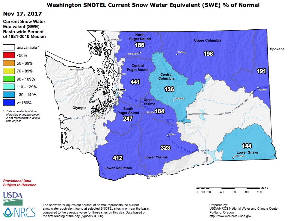
Washington and Oregon are also boasting deep snowpacks. Oregon is currently leading the charge with an overall statewide Snow Water Equivalent (SWE) of 284% of normal. Washington is slightly behind with 246% of its normal snowpack for November 17th.
LET IT SNOW!
[protected-iframe id=”5eee54868c0aec5a7e4aa6dc877486ab-65244901-84409940″ info=”https://www.facebook.com/plugins/post.php?href=https%3A%2F%2Fwww.facebook.com%2FMammothMountain%2Fposts%2F10154353333182395&width=500″ width=”500″ height=”553″ frameborder=”0″ style=”border:none;overflow:hidden” scrolling=”no”]
Westwide SNOTEL Current Snow Water Equivalent (SWE) % of Normal:

Calfornia/Nevada (Sierras): 333% of Normal (SWE)

Oregon: 284% of Normal (SWE)

Washington: 246% of Normal (SWE)
Also Read: 2018 Winter Weather Forecast | Long Range Prediction From NOAA