

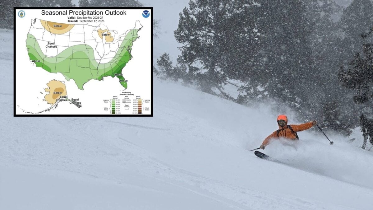
NOAA’s Climate Prediction Center issued its updated seasonal outlook on 17 September 2026, covering December 2026 through February 2027. For skiers and snowboarders it is the most consequential map of the autumn, because it shows where the storm track is expected to set up before anyone has booked a trip.
The driver this winter is El Niño, and a strong one. NOAA now puts the odds of a very strong event through the heart of winter above 90%, and gives a 69% chance that the October to December period finishes at or above +2.5°C on the relative Niño index, which would put it ahead of every El Niño in the record back to 1950. In practice that means a loaded southern storm track, a wetter south and southeast, and a northern tier that gets its cold in sharp bursts rather than long settled freezes. More on the ENSO upgrade here.
NOAA Winter Precipitation Outlook
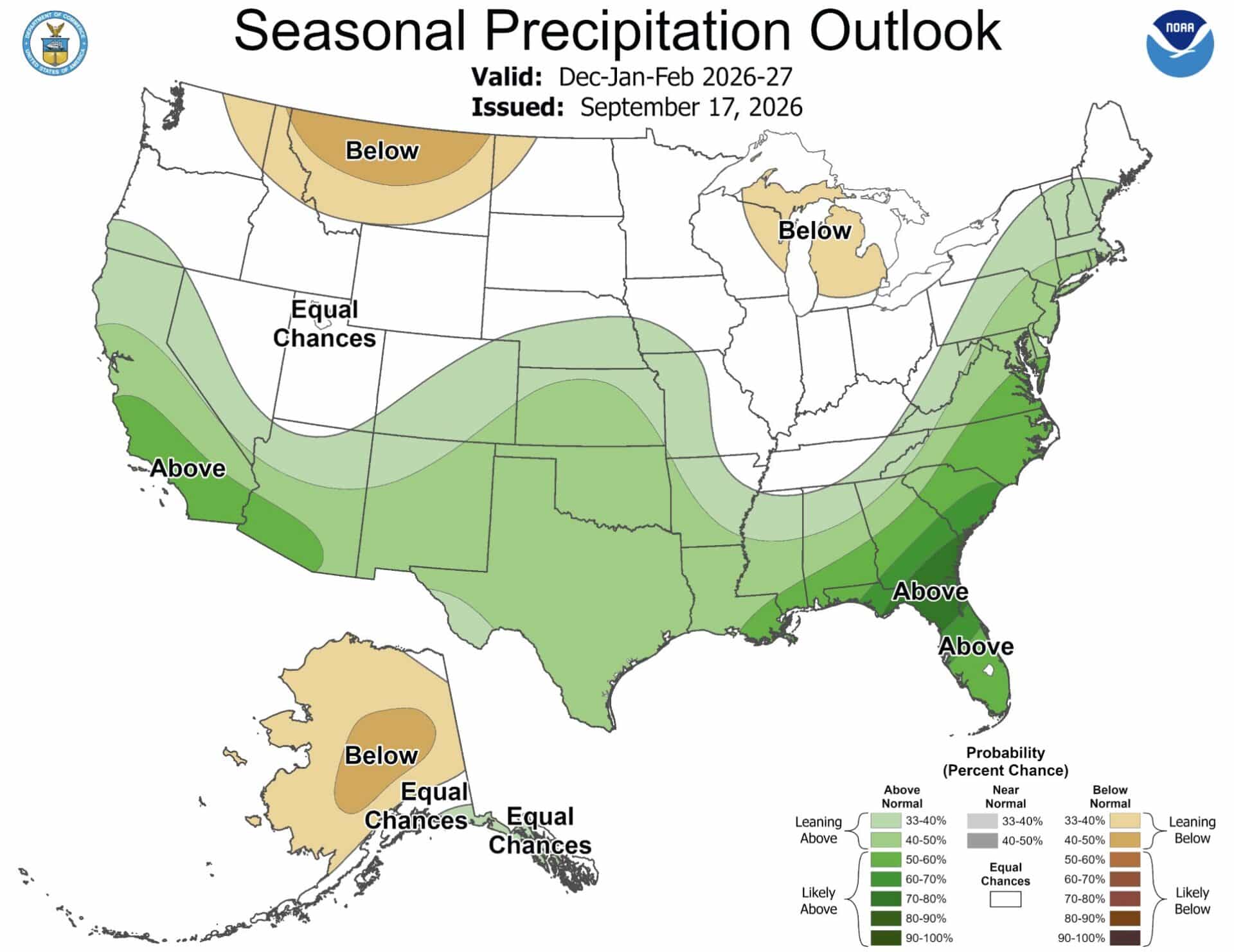
The September map shows a pronounced wet signal across the southern half of the country. Above normal precipitation is favoured across California, Arizona, New Mexico, much of Texas and parts of the southern Rockies, and the signal is strongest across the Southeast and up the East Coast. Montana and parts of the northern Rockies carry below normal odds, the Great Lakes show a drier signal, and much of the Pacific Northwest sits near equal chances.
That distinction matters. This is not a forecast for a uniformly wet West. It is a forecast for a wet southern tier, which is a different thing entirely and puts Mammoth Mountain, Palisades Tahoe and the rest of the Sierra in the favoured zone while leaving Mount Baker and Whitefish on the wrong side of the line.
NOAA Winter Temperature Outlook
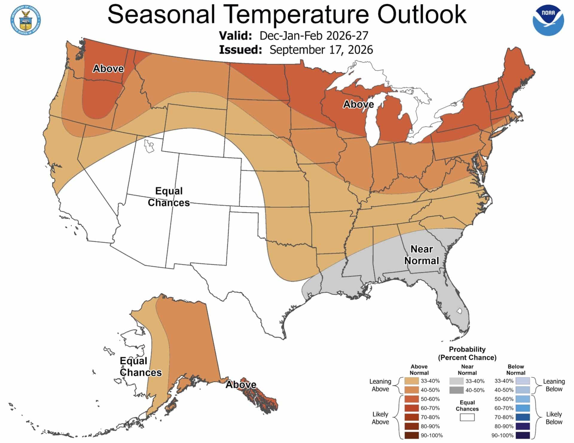
The temperature map is the caveat to everything above. NOAA favours above normal temperatures across much of the West, the northern tier and parts of the East. Warmth does not cancel a wet forecast, but it does raise snow levels, and at lower elevations it is the difference between a powder day and a rain day. The Farmers’ Almanac takes a slightly colder view, expecting near normal temperatures across the West, northern Plains, Upper Midwest and Great Lakes, with sharp, short cold shots rather than sustained freezes.
What A Seasonal Outlook Actually Tells You
A CPC outlook is not a snowfall forecast. It does not predict individual storms or totals. It gives the probability that a three-month average finishes above, near or below normal, and a 40 to 50% tilt still leaves plenty of room for the other outcome. Use it to decide which regions to watch, not which weekend to book.
Planning Around It
- Favoured: the Sierra Nevada, southern Rockies, Arizona and New Mexico high country.
- Mixed: the Northeast, wetter but warmer, so storm-by-storm.
- Least favoured: the northern Rockies and the Great Lakes on precipitation, and anywhere low-elevation on temperature.
- Always: favour altitude and snowmaking in a warm-leaning winter, and keep bookings flexible.
NOAA updates these outlooks monthly, so check back before committing to a trip. Our full write-up of the 17 September update is here, and Direct Weather’s snowfall forecast is here.