

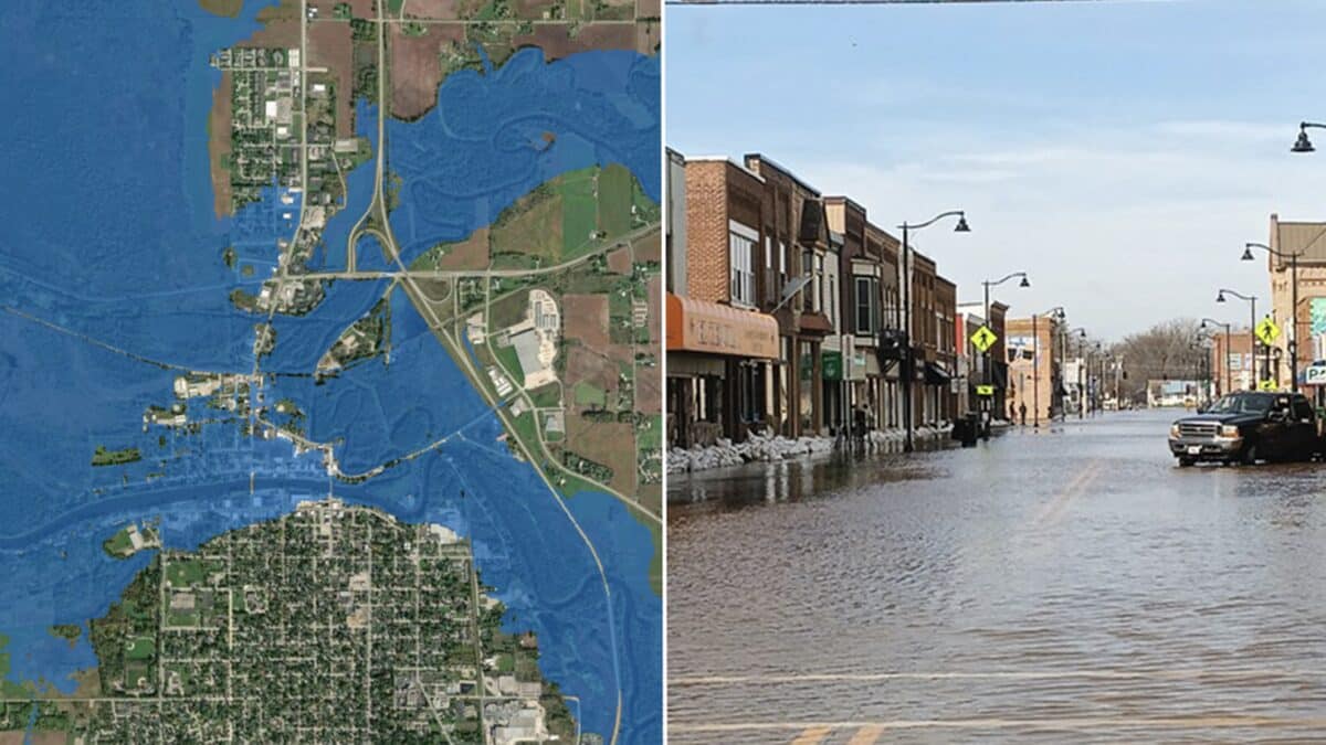
The National Weather Service has significantly expanded its experimental Flood Inundation Mapping system, giving nearly 100 percent of the U.S. population access to detailed maps showing where river and stream flooding could occur.
The expansion marks a major increase from the 60 percent population coverage available through the system previously. The Flood Inundation Mapping tool, known as FIM, uses forecast river flows and current conditions to estimate which areas could be covered by floodwaters in the days ahead.
The maps are designed to provide information beyond traditional river crest forecasts by showing potential flooding impacts at a neighborhood scale.
New Flood Mapping Coverage
The latest expansion adds several areas that previously had limited or no FIM coverage. These include the southeastern U.S. coast and Florida, the Great Lakes region, New England, the Rocky Mountains, the Dakotas and western Nebraska.
Overall, FIM now depicts potential flooding along approximately 3.3 million river miles across the continental United States, Hawaii and U.S. territories.
NOAA says the tool is intended to help forecasters, emergency managers, first responders and members of the public better understand potential flood impacts and make decisions before water reaches vulnerable areas.
Flood Maps Have Already Helped Communities
The National Weather Service says FIM has already played a role in several flood emergencies.
In Tennessee, the Nashville NWS office used FIM information to help a senior assisted living facility evacuate residents before floodwaters reached the building in spring 2025. In Arkansas, officials in Hardy used FIM information during flooding in April 2025 and went door to door to evacuate residents.
The system was also used during rapidly developing storms in central Texas in July 2025 to help emergency managers close roads and evacuate residents. Officials in Oklahoma and Louisiana have similarly used FIM information during major river rises.
More recently, the NWS office in Grand Rapids used FIM during major to record flooding along Michigan’s Muskegon River in April 2026.
How To Access NOAA Flood Maps
FIM services launched in 2023 with coverage reaching roughly 10 percent of the U.S. population before expanding to 60 percent in 2025.
The expanded maps are available through NOAA’s National Water Prediction Service and include current condition analyses and forecasts extending as far as five days for much of the Lower 48. Coverage does not yet include northern and western Alaska, Guam, the Northern Mariana Islands or American Samoa.