
North America — Maps are a popular commodity for outdoorsy people. For skiers and riders, they serve as a way to get around the mountain, find secret stashes, and find a good spot to have an overpriced burger and fries.
One of my favorite traditions during the ski season is checking out the new trail maps that debut. These new maps showed these ski resorts in a different light, and give skiers better perspectives on how a mountain skis.
For the past several years, I’ve done an end-of-season review of the new North American maps that debuted during the ski season. Here’s a rundown of the new trail maps that debuted during the 2025-26 ski season, and the new ones that could be coming down the road.
New Maps
Big Rock has seen quite the transformation over the past few years. Recent additions include a new quad chairlift and significant snowmaking upgrades. Last year, Big Rock partnered with Rad Smith to create a trail map that displayed these changes, showing the beauty of the modestly sized non-profit ski area.

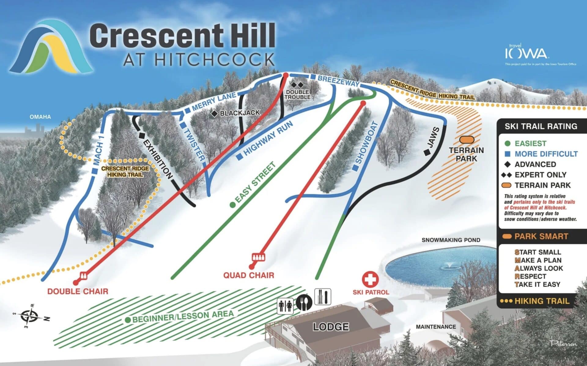
Crescent Hill at Hitchcock has been under new ownership, with Pottawattamie County connecting it to the nearby Hitchcock Nature Center. This new map, created by Dave Petersen in partnership with Travel Iowa, shows the evolving experience. This includes the four-season hiking trail and the new Highway Run, which connects the upper-mountain pistes to the Easy Street piste.
Granby Ranch transitioned from a James Niehues map to one designed by Gary Milliken VistaMap. This new map details the various lodging options on the property, along with Renegade Ridge, a new trail experience on West Mountain.

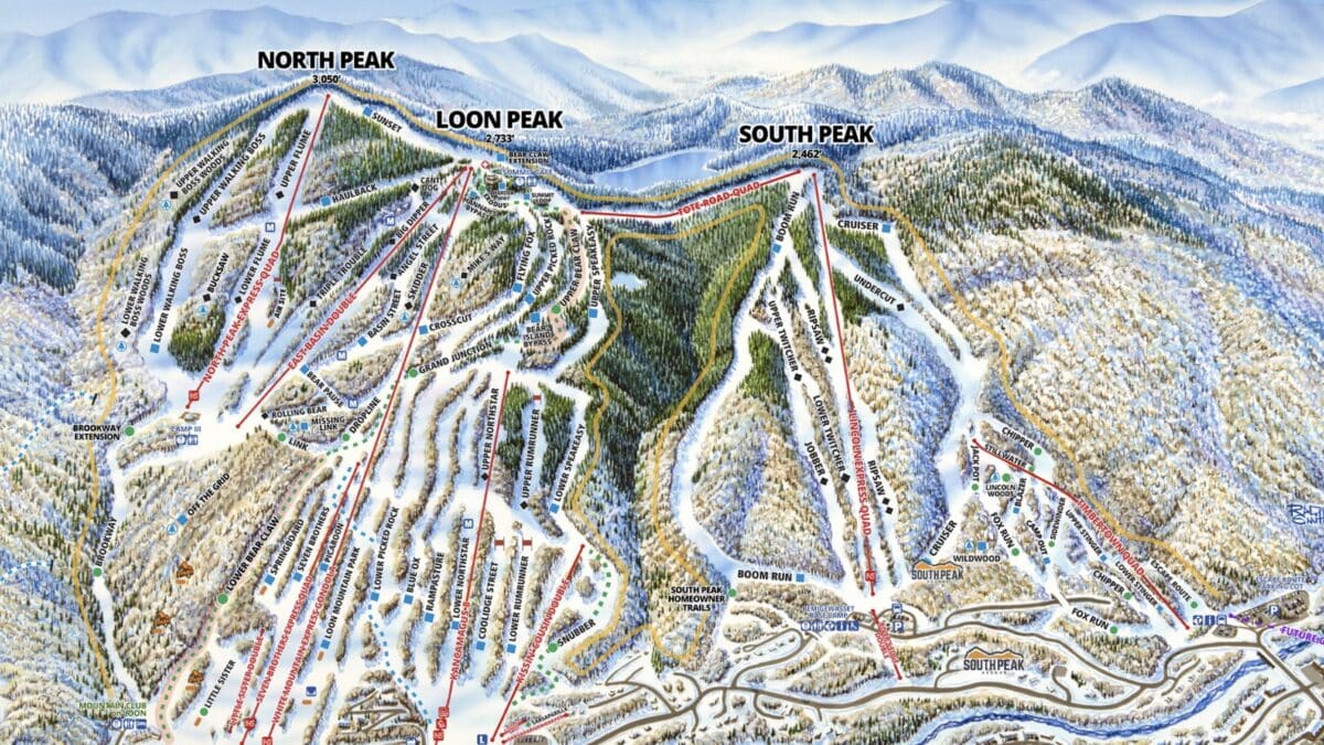
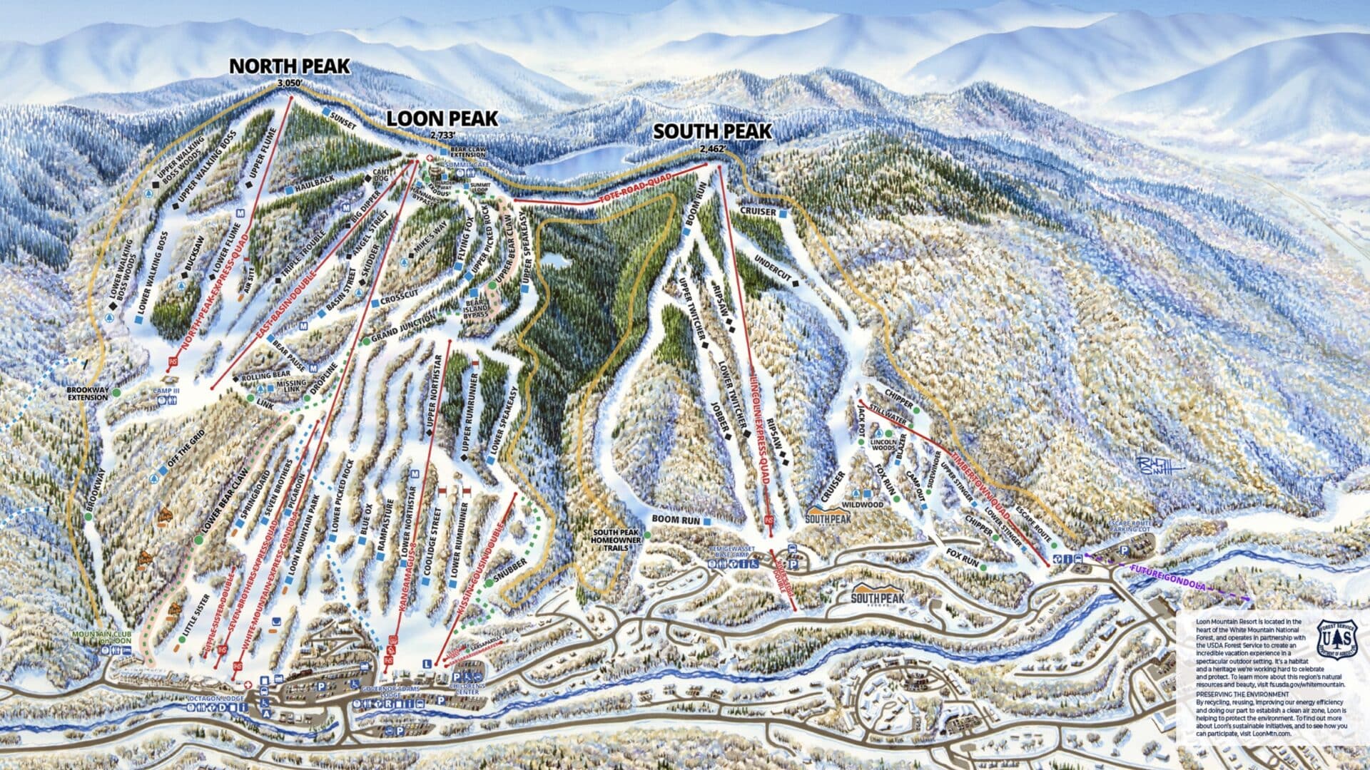
Loon Mountain has a new map thanks to Rad Smith. The new map places greater focus on the South Peak and Timbertown sides of the mountain, which could undergo significant changes in the years ahead.
Lusten Mountains is the Midwest’s largest ski resort. Its wonky format can be tricky to put together. VistaMap put together its version for this past winter, showing why it’s the biggest in the Midwest.


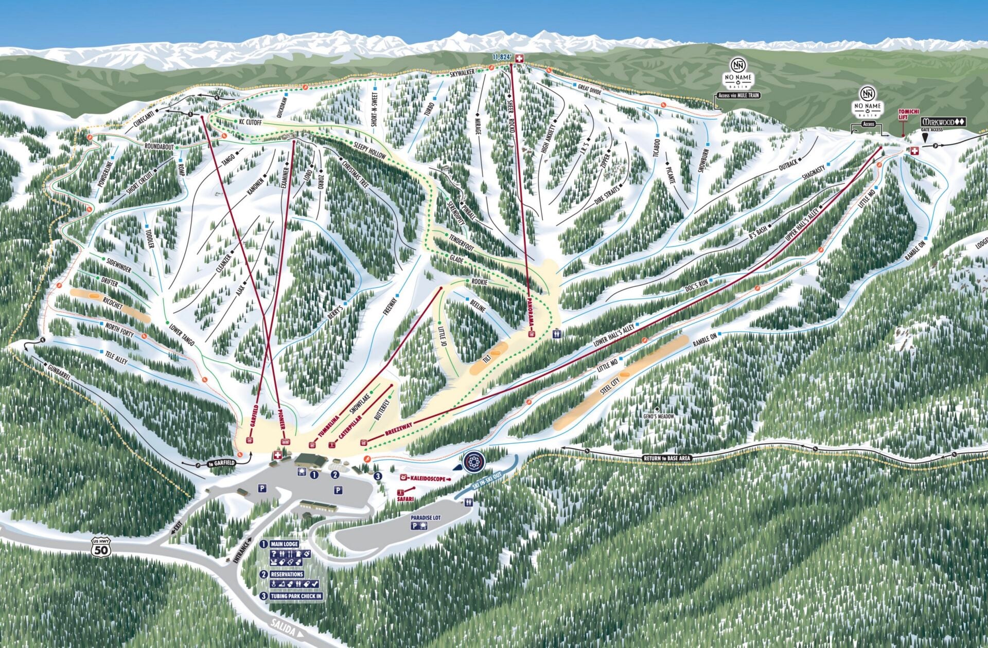
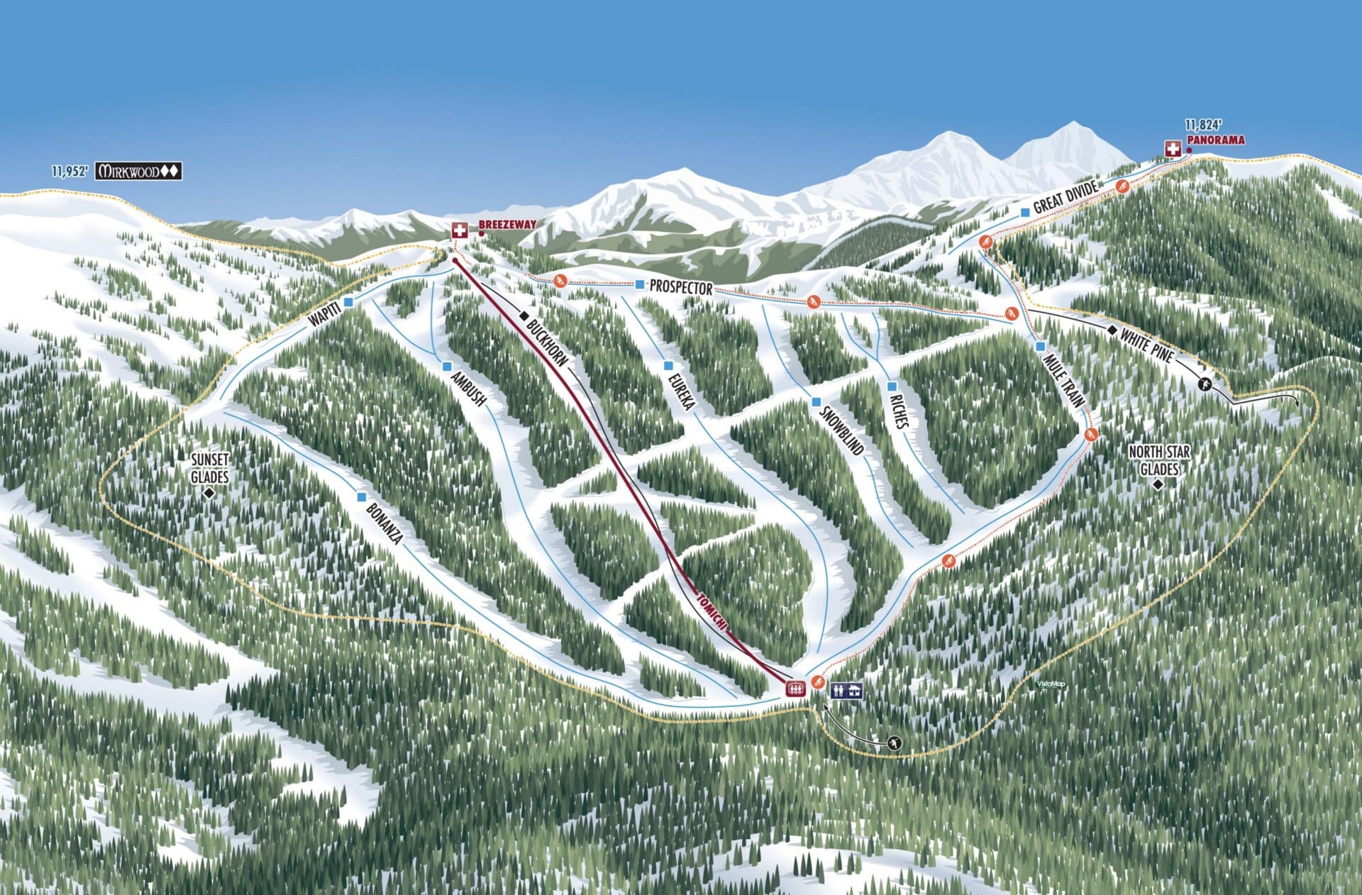
This past winter, Colorado’s Monarch Mountain opened its much-anticipated No Name Basin expansion. To reflect these changes, they brought in VistaMap to show how to navigate the new terrain.
Maine’s Mt. Abram saw its trail map modernized. This new map was designed in-house by Abram’s Allie Masten. The new map shows the services available at both base areas and the routes uphill skiers or splitboarders can take. Abram also created a new map for their growing bike park.

The prior trail map for Mt. Jamieson in Ontario made it look flat. Rad Smith took a go at this complicated-to-display ski resort, showcasing its steep spots.

British Columbia’s Troll Resort opened the new phase of its terrain expansion this past winter. Here’s a look at their new map, which hasn’t been released online yet. The map will be modified in the years ahead as more trails open in the Pinegrove expansion pod (located on the bottom left of the photo below).

Paul Bunyan has seen some changes in recent years, including new trails. The new map by Dave Petersen and Peter Brooks shows off the expanded trail network at the Wisconsin ski area.

Swiss Valley is under new ownership, as the Perfect family acquired the Michigan ski area in 2025. With changes like bringing back an old trail and upgrading snowmaking. The new map features a design similar to Timberline Mountain’s, which is also owned by the Perfect family.

Oregon’s Willamette Pass had a confusing trail map beforehand, which made it tricky to navigate. The new map by Stefan Bast removes potential future trails and Nordic pistes, creating two separate maps that focus on the alpine terrain. This is reportedly not the final version, as some more edits are planned.


Modified Maps
There are also some maps that are not exactly new but have made notable adjustments.
At Black Mountain in New Hampshire, they have seen many major changes since its acquisition by Entabeni Systems. For the 2025-26 season, they added a new building (the Sugar Shack) and new hike-to double-black terrain. This map was created by Senan Gorman of North Pole Design.

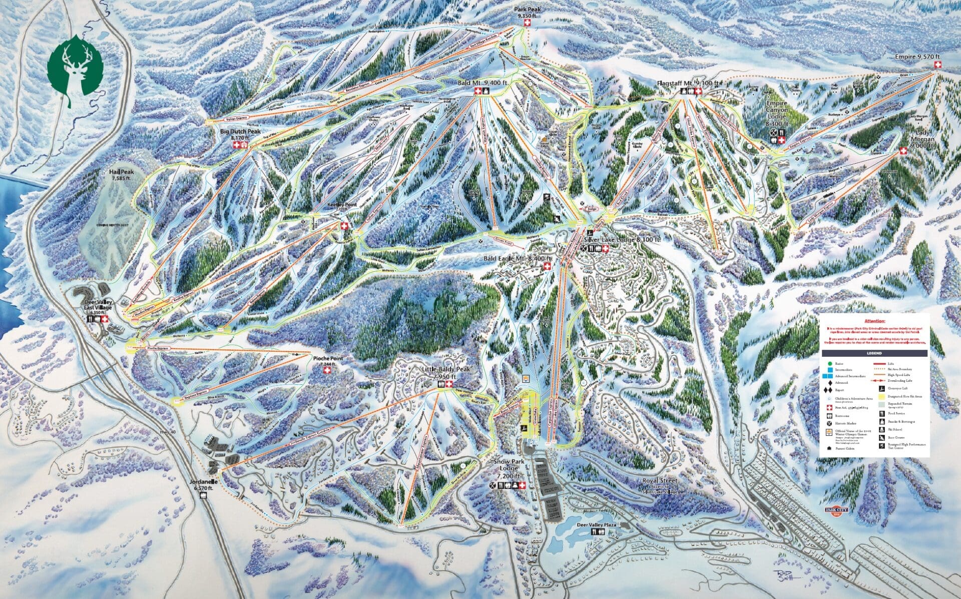
Last winter, Deer Valley opened the second phase of its Expanded Excellence project, adding around 80 trails and 7 lifts to the massive Utah ski resort. Their new Rad Smith-designed map debuted in 2024. Previously covered over by a green layer, the new trail names and lifts have now been added. Another shaded section, Hail Peak, could debut next winter.
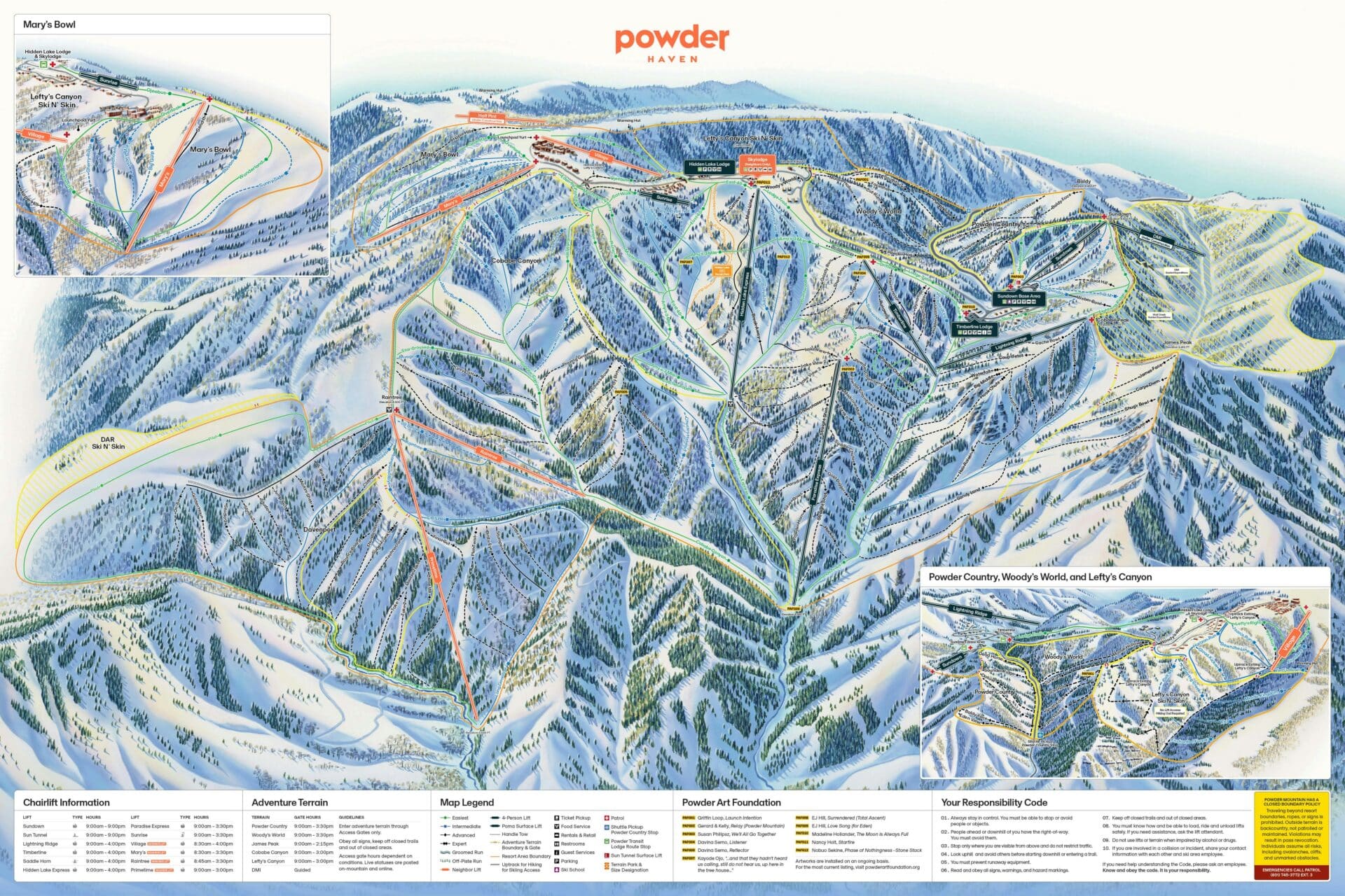
Another worthwhile revision to look over is Powder Mountain’s private side: Powder Haven. The James Niehues map now shows various lifts shaded in orange, indicating they are only accessible to members of Powder Haven. They’ve installed three new lifts and converted two other lifts (Mary’s and Village) to the private side. Next winter will see three new lifts on the public side and two more on the private side. This likely means the map is due for another refresh.
What’s Up Next
Rad Smith has been working on various projects, including maps for Brian Head, Montage Mountain, and Sundance.
Image/Video Credits: Big Rock, Crescent Hill at Hitchcock, Granby Ranch, Loon Mountain Resort, Monarch Mountain, Mt. Abram, Mount Jamieson, Paul Bunyan, Troll Resort, Swiss Valley, Willamette Pass, Black Mountain, Deer Valley Resort, Powder Haven