

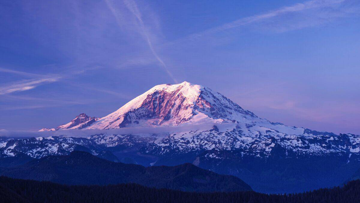
A winter weather advisory is in effect across much of Washington’s Cascade Range, with up to a foot of snow expected in parts of the mountains between Tuesday evening and Wednesday afternoon. The incoming snowfall could bring early-season winter conditions to several mountain passes and ski resort areas.
The National Weather Service has issued winter weather advisories covering multiple portions of the Cascades from 5 p.m. Tuesday, October 27, through 5 p.m. on Wednesday, October 28. Snowfall will be heaviest at higher elevations, with some areas expected to receive more than six inches.
Where the Most Snow Is Expected
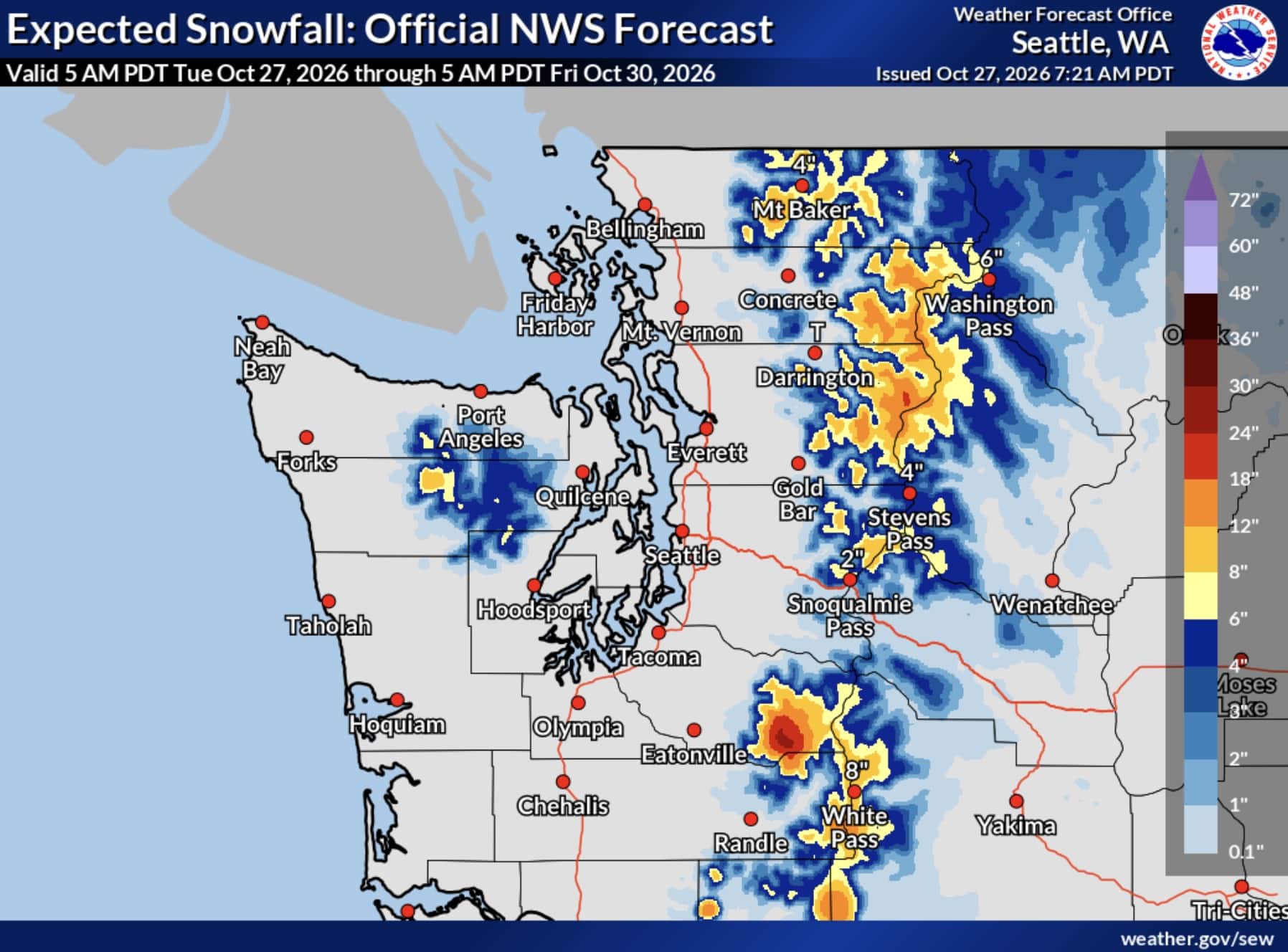
The highest snowfall totals are forecast for the southern Washington Cascades, where the National Weather Service expects 6 to 12 inches of snow across the mountains of Pierce and Lewis counties. The advisory includes Mount Rainier, Paradise, White Pass, and Crystal Mountain.
Crystal Mountain could see accumulating snow as the storm moves through, although the forecast does not specify resort-level totals. Snowfall will be heaviest above 4,000 feet.
Farther north, the Cascades of Snohomish, King, Whatcom, and Skagit counties are forecast to receive 4 to 8 inches of snow above 4,000 feet. The advisory includes Stevens Pass and the Mount Baker area, where accumulating snow could create difficult travel conditions.
The southern King County Cascades are also expected to receive 4 to 8 inches above 4,000 feet. However, snowfall at Snoqualmie Pass is forecast to be lighter, with just 1 to 3 inches expected as snow mixes with rain at times.
In the eastern Washington Cascades, the National Weather Service is forecasting 3 to 7 inches of snow above 4,000 feet. The advisory covers the upper slopes of the Eastern Washington Cascades Crest, including the areas around Easton and Roslyn.
Western Chelan and Okanogan counties could receive 2 to 8 inches of snow above 3,000 feet, with the highest totals expected along the Cascade crest. Snow levels are forecast to fall from around 4,000 feet Tuesday evening to between 2,500 and 3,000 feet Wednesday morning.
What It Means for Ski Resorts
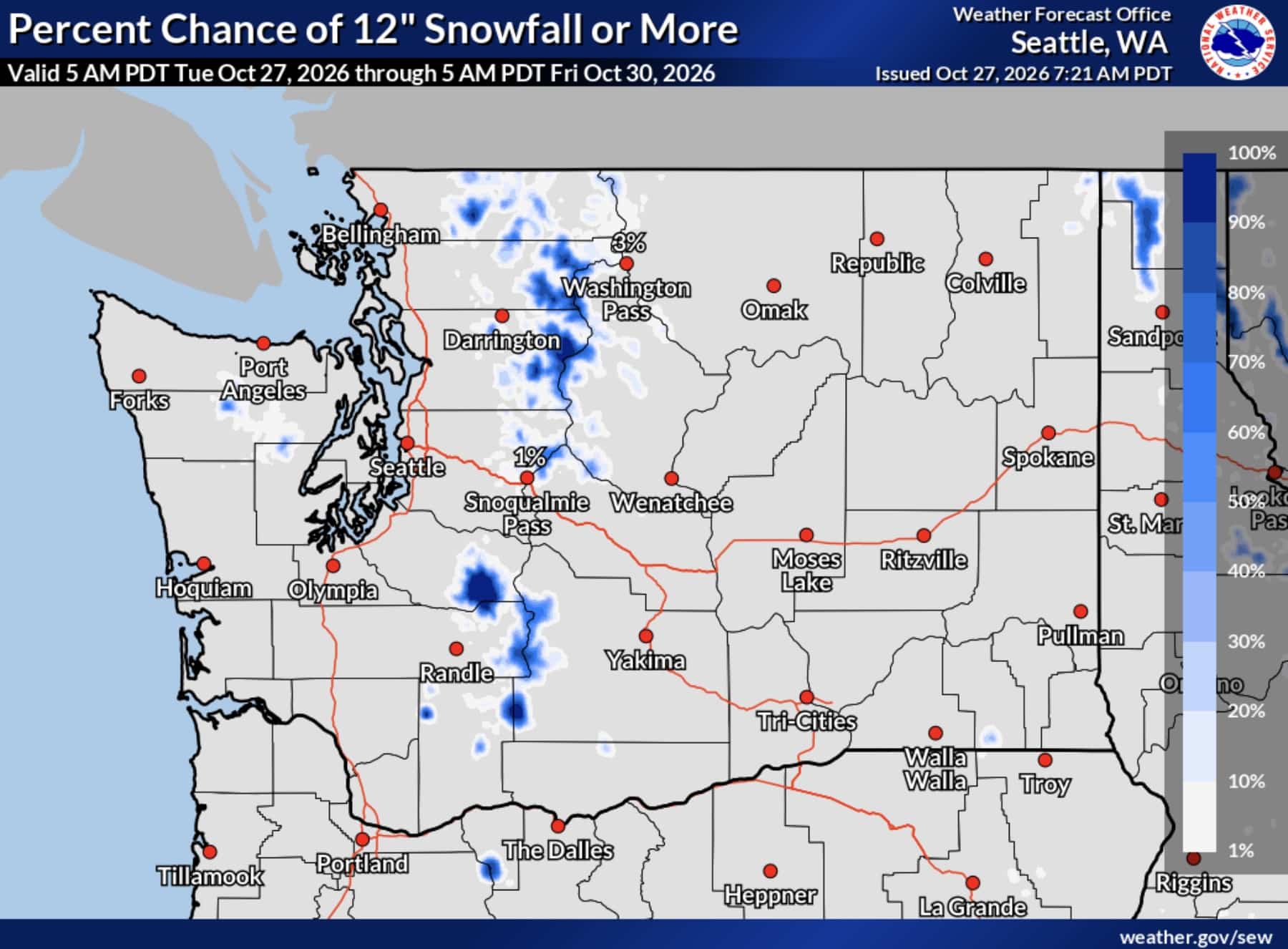
The storm could deliver fresh snow to several Washington ski areas, including Crystal Mountain, Stevens Pass, and the Mount Baker region. Higher elevations are expected to receive the most substantial accumulations, but the National Weather Service has not provided specific snowfall forecasts for individual resorts.
The snowfall comes as Washington’s ski areas approach the start of the 2026-27 season. While the incoming snow could provide a boost to early-season mountain conditions, it doesn’t mean any resort will be ready to open.
Travel Conditions Could Deteriorate
Drivers traveling through the Cascades should prepare for slick roads, reduced visibility during heavier snowfall, and potentially hazardous conditions on mountain passes. Bridges and overpasses may become particularly slippery.
The National Weather Service recommends slowing down and using caution while traveling. Drivers can check current Washington road conditions through the Washington State Department of Transportation before heading into the mountains.