

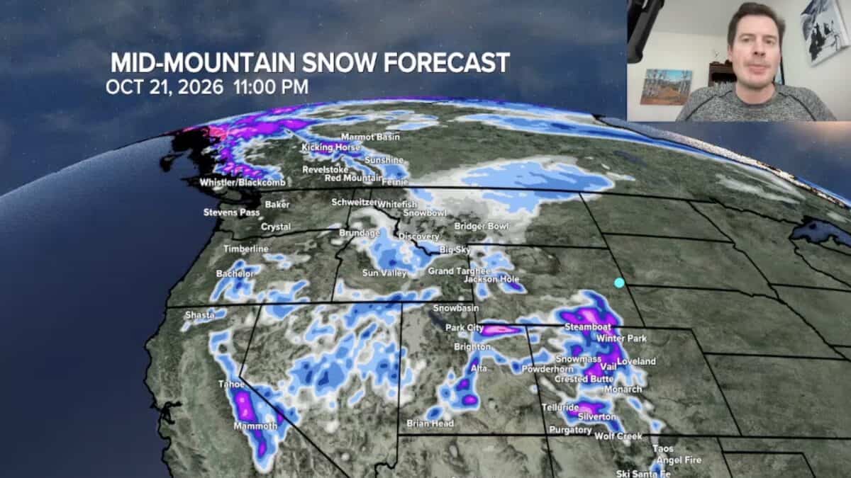
Early-season snow is piling up across parts of the West, and the next storm could deliver significantly more snow to several mountain ranges. Meteorologist Chris Tomer says a developing low-pressure system will bring colder air and additional precipitation to Colorado, Utah and Wyoming through the middle of the week, with some of the highest elevations potentially receiving a foot or more of snow.
The forecast has improved for Colorado, where a southward shift in the storm’s projected track could produce stronger upslope conditions and increase snowfall totals across several major ski regions.
Montana Already Seeing Significant Snowfall
Montana received some of the earliest significant snowfall from the storm system. Showdown Ski Area reported 19 inches, while Great Divide Ski Area near Helena was approaching a foot of snow.
Big Sky also saw a good chunk of snow. Additional snowfall is possible around Big Sky and Red Lodge, although most of Montana’s snowfall from this system has already hit the ground. The focus is now shifting south as colder air moves into the central and southern Rockies.
Colorado Snow Forecast Improves
Colorado is positioned for one of the more promising rounds of snowfall, particularly across the San Juan Mountains and the central and northern mountain ranges. Tomer expects the system to linger over Colorado, allowing precipitation to continue through Wednesday, October 14th and potentially into Thursday.
The San Juan Mountains could see one to two feet of snow, including areas around Telluride, Silverton Mountain, Purgatory and Wolf Creek. The West Elks and Grand Mesa are also positioned for additional accumulation.
Farther north, Winter Park, Eldora and Steamboat could pick up a handful of inches. Tomer’s forecast also calls for around a foot of snow on Colorado’s 14ers across the northern, central and southern parts of the state. Loveland Ski Area could receive around five inches at mid-mountain and eight to ten inches near the summit.
Utah and Wyoming Could See More Mountain Snow
Utah’s Wasatch Mountains are also expected to benefit as colder air lowers the rain-snow line. Alta could receive around 10 inches at mid-mountain over the next two to three days, while the summit could see 18 to 20 inches. Little Cottonwood Canyon and Big Cottonwood Canyon are both in line for additional snowfall.
Wyoming could also meaningful accumulation as well, particularly in the Wind River Range, where another six inches or more is possible. The Tetons may receive another one to three inches at mid-mountain including around Jackson Hole.
Another Storm Could Follow Next Week
Tomer is also monitoring another potential storm system that could reach the Intermountain West around October 21st to 23rd. Moisture from the remnants of Hurricane Simon could move north into New Mexico and southern Colorado later this week, potentially increasing snowfall totals in the San Juans.