

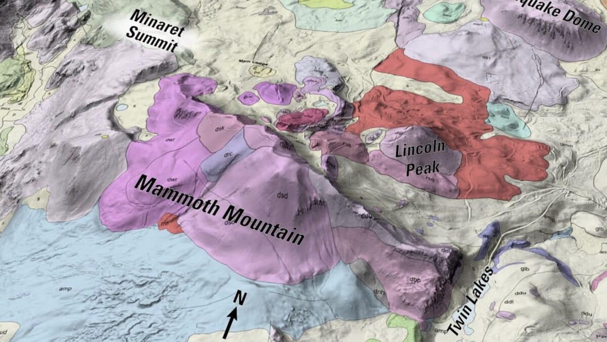
Mammoth Mountain is not simply a ski resort located near volcanic terrain. The mountain itself is a volcano, and a new visualization from the U.S. Geological Survey shows just how complicated the ground beneath its ski runs really is.
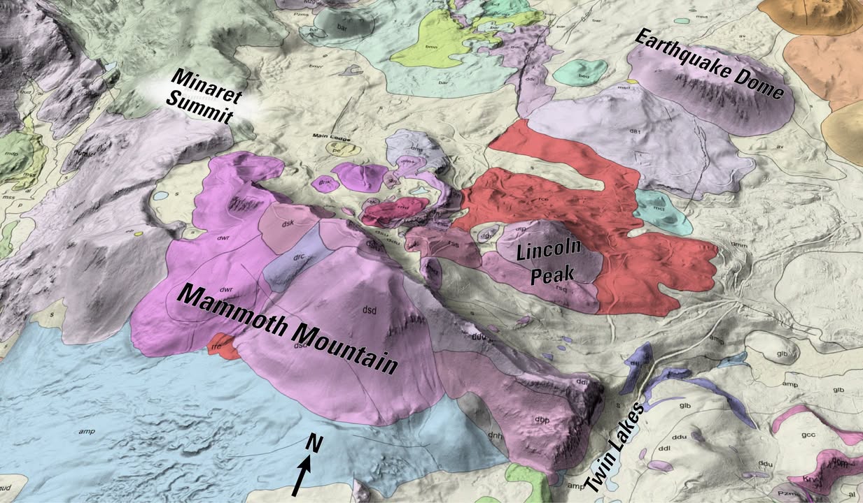
The USGS California Volcano Observatory highlighted Mammoth’s geology this week as part of a look at how scientists map the volcanic history of California’s Long Valley region. The agency also published a new 3D geologic visualization showing some of the 24 overlapping lava domes that make up Mammoth Mountain.
Today, those ancient volcanic formations support more than 3,500 acres of skiable terrain, 180 named trails and 25 lifts at one of California’s largest ski resorts. Mammoth’s summit reaches 11,053 feet, which is also the summit of the volcano itself. In other words, anyone skiing Mammoth is skiing directly across the remains of repeated volcanic eruptions.
Mammoth Mountain Was Built One Lava Dome At A Time
Mammoth Mountain is what geologists call a lava-dome complex. Unlike more fluid basaltic lava that can travel for miles, the thick magma involved in building much of Mammoth did not flow particularly far after reaching the surface. Instead, it accumulated close to its vents, gradually building individual lava domes. Repeated eruptions stacked those features on top of and beside one another until they formed the mountain skiers recognize today.
USGS says Mammoth Mountain was constructed during approximately 25 eruptive episodes between about 100,000 and 51,000 years ago. Its latest magmatic eruptions occurred roughly 50,000 years ago.
The agency’s newly published 3D geologic visualization of Mammoth Mountain shows how several of those lava domes overlap beneath the modern mountain. Different colors represent different volcanic rocks, lava flows and surface deposits. It is a much different way to look at terrain most skiers recognize by chairlift, trail and ridgeline.
Skiing On A Volcano
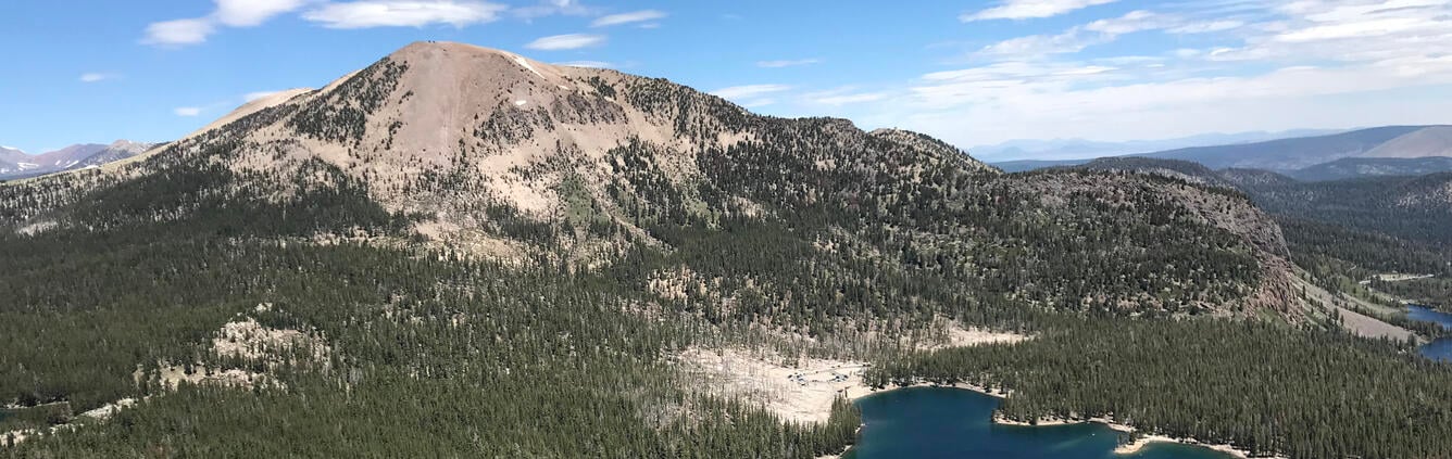
The volcanic origins of Mammoth are not particularly difficult to find once you know what to look for. USGS describes the mountain as an 11,053-foot lava-dome complex sitting along the southwestern topographic rim of Long Valley Caldera. Mammoth is the largest post-caldera volcanic feature in the Long Valley area.
Its geology has also created some distinctly unusual terrain around the ski area. Earlier this year, a snowboarder was filmed riding through a natural lava-tube formation in the Mammoth Lakes backcountry, another visible reminder of the region’s volcanic past.
The mountain itself was built primarily from much thicker volcanic material. USGS says many of Mammoth’s 24 domes consist of dacite and rhyolite lava, with pumice and other sedimentary deposits covering portions of the original volcanic surface. That pumice tells another remarkable part of the story.
Another Eruption Helped Reshape Mammoth Centuries Ago
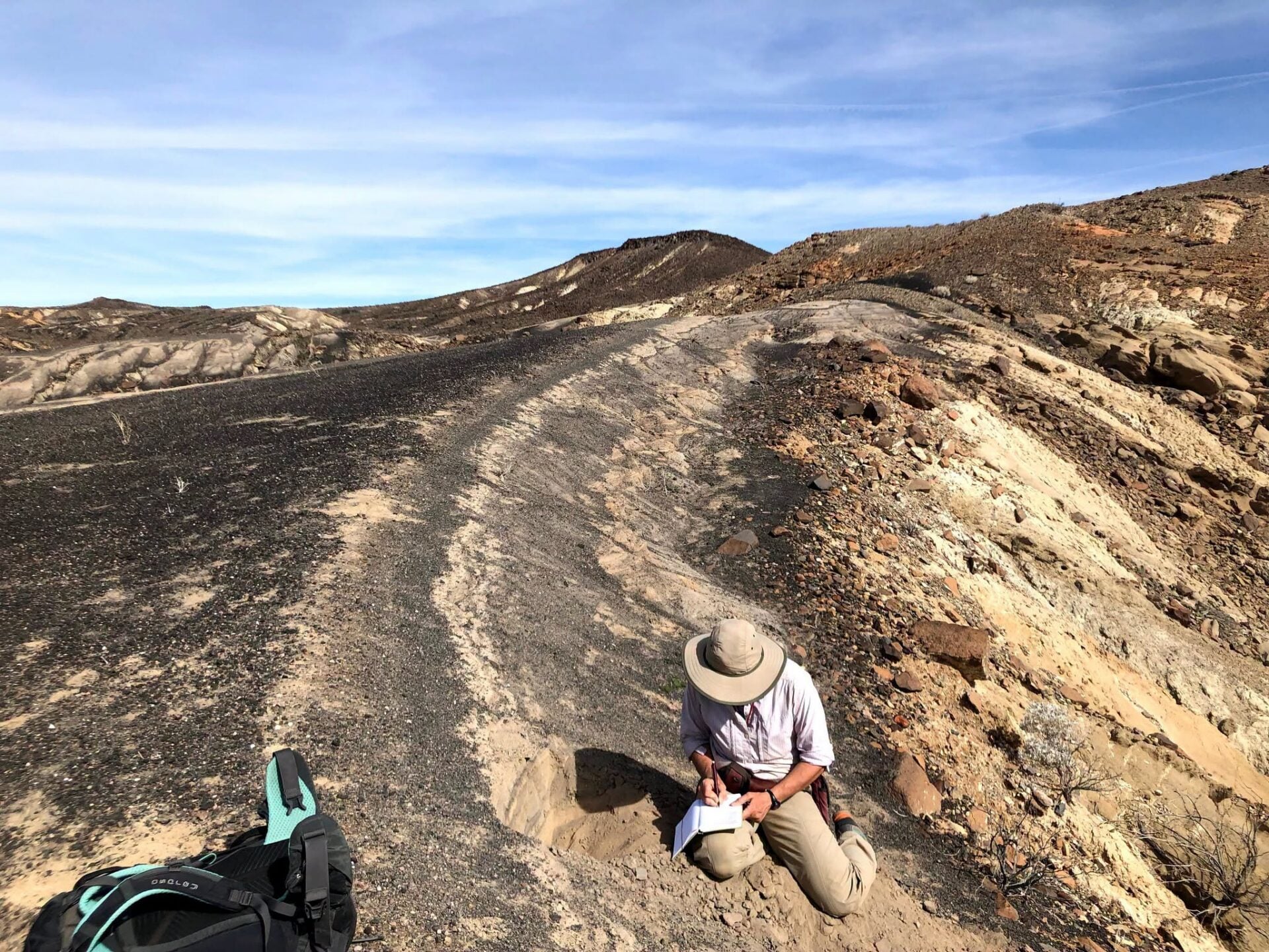
Mammoth Mountain’s dome building eruptions ended tens of thousands of years ago, but volcanic activity continued nearby. Around 1350, an explosive eruption occurred at the Glass Creek vent of the Inyo volcanic chain north of Mammoth. According to USGS, the eruption blasted enough pumice into the atmosphere to cover large portions of Mammoth Mountain approximately 8 miles away. That layer of volcanic material helped smooth portions of the mountain’s surface.
USGS specifically points to that smoother terrain as one factor that helped Mammoth develop into the mountain-biking destination it is today. The same volcanic landscape sits beneath the resort’s winter trail network.
The region includes several other examples of volcanic terrain. Red Cones, located several miles south of Mammoth, were formed by more fluid basaltic eruptions. North of the mountain, some of the Inyo Craters formed when underground heat caused groundwater to flash into steam and explode.
Mammoth Is Not The Long Valley Caldera
One distinction is important, Mammoth Mountain sits beside Long Valley Caldera, but USGS considers Mammoth’s magmatic system separate from the system responsible for the enormous Long Valley eruption roughly 767,000 years ago. It is also considered distinct from the younger Mono-Inyo volcanic chain.
The Long Valley eruption was on an entirely different scale. So much magma was removed from beneath the surface that the ground collapsed, forming a depression roughly 20 miles wide and 10 miles from north to south. Volcanic ash from that eruption has been identified as far away as Nebraska.
Mammoth Mountain formed much later. USGS research indicates that the eruptions responsible for building Mammoth occurred over tens of thousands of years, gradually creating the overlapping domes that ultimately became the mountain.
Why USGS Keeps Mapping The Area
The latest California Volcano Observatory feature is primarily about the importance of geologic mapping rather than announcing a change in volcanic conditions. Scientists combine field mapping with chemical analysis and radiometric dating to distinguish between lava flows that may appear nearly identical on the surface. Those techniques allow researchers to reconstruct when eruptions occurred, where material came from and how volcanic systems evolved.
That history is important for understanding future volcanic and seismic hazards around Mammoth Lakes and the wider Long Valley region. USGS currently lists Mammoth Mountain as having a moderate volcanic threat potential. The agency says its most recent eruption was a steam-driven, or phreatic, event roughly 700 years ago, while its most recent magma-producing eruptions occurred about 50,000 years ago.
For skiers, though, the new USGS visualization offers a simpler takeaway. Mammoth’s famous bowls, ridges and ski runs are not merely sitting on an old volcanic landscape. The 11,053-foot mountain beneath the lifts is itself the product of repeated eruptions, built from 24 overlapping lava domes over tens of thousands of years.
And with Mammoth currently targeting Nov. 13 for the start of its 2026-27 ski season, thousands of skiers will soon be sliding across that volcanic terrain again.
