
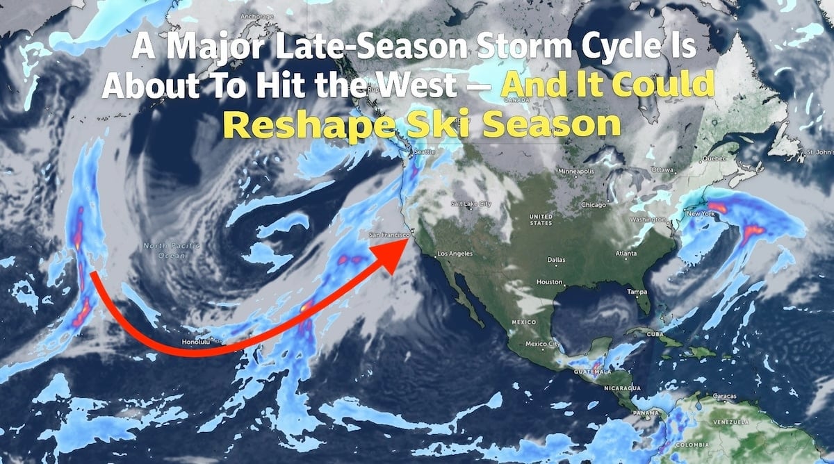
After a stretch of inconsistent conditions across parts of the West, the pattern is finally lining up in a way skiers and snowboarders have been waiting for. Forecasters are tracking a multi-day Pacific storm cycle that’s expected to bring widespread snowfall to the Sierra Nevada, Wasatch, Tetons, Colorado Rockies, and beyond. If current projections hold, this could be the game-changer skiers have been waiting for.
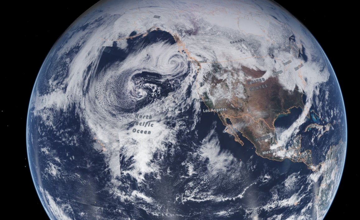
Instead of a quick, one-and-done system, models are showing a series of storms riding an active Pacific jet aimed directly at the West Coast. That setup matters. A storm “train” means multiple rounds of snowfall over several days, giving resorts the chance to stack totals rather than relying on a single burst. Early waves may come in a bit heavier and wetter in places like the Cascades and Sierra, with colder air filtering in behind them. If temperatures drop as expected, areas in Utah, Wyoming, and Colorado could see significantly lighter snow as the cycle matures.
For ski areas that have been dealing with thin coverage at lower elevations or variable off-piste conditions, even a solid 12–24 inches can dramatically change the feel of the mountain. A sustained cycle has the potential to rebuild bases, improve tree skiing, and set the basis for a strong March. Late February storms often play an outsized role in how long the season ultimately stretches, particularly in the Rockies where snowpack depth can determine whether lifts spin deep into spring.
That said, this isn’t just a powder headline. Rapid loading from heavy snowfall combined with wind will almost certainly drive avalanche danger higher across the Intermountain West. Persistent weak layers have been a concern in several zones this season, and a significant load event can quickly tip the balance. Backcountry travelers should expect danger ratings to rise and terrain choices to become more limited. Even inbounds, deep storms mean delayed openings while ski patrol teams conduct avalanche mitigation. The payoff can be all-time conditions — but patience will be required.
Travel is also likely to be impacted. Mountain passes including Donner, Parley’s Summit, Teton Pass, Vail Pass, and Berthoud Pass could see chain controls, whiteout conditions, or temporary closures during periods of intense snowfall and high winds. Anyone planning a road trip into the mountains should build in extra time and monitor state transportation updates. National parks such as Yosemite, Yellowstone, and Rocky Mountain could also see access restrictions depending on how this pattern unfolds.
Beyond recreation, a strong late-season storm cycle has importance for the western water supply. February and March are critical months for building snowpack that feeds reservoirs during spring runoff. For basins that have been hovering near or below average, a multi-day event like this can meaningfully shift seasonal totals and improve outlooks heading toward summer.
Even though exact snowfall totals will fluctuate in the coming days, confidence is increasing in the overall pattern. The biggest impacts will likely come during stronger frontal passages when colder air fully wraps into the system and snowfall rates intensify. In classic fashion, some of the best conditions may arrive just after the center of the storm, when skies clear, and temperatures stay cool.
In short, this is the kind of late-winter setup that can reset a season. It could refresh tired terrain, boost snowpack, complicate travel, and deliver some of the best powder days of the year — all within the same week. If you’re heading to the mountains, now is the time to watch forecasts closely, prepare for winter driving, and make conservative decisions in avalanche terrain.
The West may be about to get the refresh it’s been waiting for.