

After a slow start to the winter of 2023, South American ski resorts have been seeing significant snowfall lately. Heavy snowfall last week led to some all time conditions. This weekend, more snowfall is on the way. Powderchasers latest forecast for the ski resorts in South America is below.
POWDER ALERT: Triple Digits For South America Again!
Yet another massive winter storm cycle will hammer South America this week and weekend into next week, bringing several feet of snow to local resorts. Similar to the last massive storm cycle, the best odds for scoring powder will be found further north.
PLEASE support Powderchasers free forecasts with a donation here or join our concierge package for custom chases. If you are interested in becoming a sponsor please reach out to powderchasersmedia@gmail.com. Check out our swag on the website.
This upcoming cycle will be composed of two different storms, one from Thursday to Friday in the south and Thursday night to Sunday in the north, and one from Tuesday to Wednesday in the south and Monday night to Thursday in the north. The winds with these storm are looking more mild than last week’s storm, but keep in mind that wind can cause lift holds and closures on higher elevation terrain.
Precipitation will fill into southern and central ski resorts on Thursday afternoon and night. By the time lifts are spinning on Friday morning, Cerro Catedral will have picked up the most snow, with 6-10” (15-25cm) with totals decreasing as you go further north. Most resorts in this region will see 3-6” of overnight snow. During the day on Friday, steady snowfall will bring consistent refills all day to the central and southern resorts and snowfall will begin to fill into the north. The north won’t see much snow during the day, but enough to freshen up the snow surface by the time the lifts close for the day.
On Friday night, things start to dry up a bit in the south and central mountains as the faucet turns on in the north. A combination of intensifying precipitation and dramatically falling temperatures will cause the snow to really crank up on Friday night, especially at Portillo. Portillo is looking at 12-18” (30-45cm), with Valle Nevado/El Colorado/La Parva looking at 7-11” (18-28cm). On Saturday, showers will linger, bringing free refills in the north, and things will likely be mostly clear in the south with below-average temperatures throughout the region. A great day for riding.

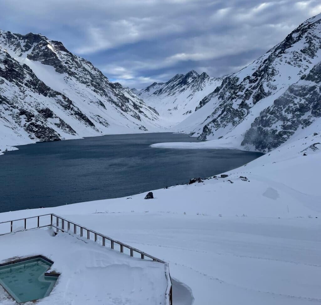
Above: Slightly below average temperatures in the region will make for a nice day of skiing on Saturday.
On Saturday night, northern resorts are looking at 6-12” (15-30cm) overnight. The day on Sunday will look similar to Saturday; cold temperatures everywhere and 3-6” (7-15cm) of daytime snow in the north. Things will clear up on Sunday afternoon, but not before snow returns on Monday afternoon! Monday night will bring 2-7” (5-18cm) totals for resorts in the north and south. If you want to chase slightly deeper totals, Corralco and Portillo are the best bets for being on the higher range of or exceeding this range. Snowfall rates will increase into Tuesday afternoon/evening, bringing free refills all day.
Next week: More Pow!
Tuesday night is poised to be very deep, but keep in mind that there’s still a lot of time for the forecast to change. Right now, we’re looking at 14-20” (35-50cm) in the north and 3-6” (7-15cm) in the south. The exceptions to these numbers will be Portillo, looking at 18-25” (45-65cm), and Corralco, looking at 10-15” (25-40cm). Again, this is pretty far out and these numbers will almost certainly change before then. Beyond Tuesday night, most resorts will pick up some more decent snow until things are poised to clear up on Thursday morning. Some models, however, keep the precipitation going into the weekend; if this solution prevails, the totals could stack up pretty quickly.

Above: huge 10 day total projections from the European model showing triple digits in inches and up to 300CM or more.
Looking ahead beyond Thursday, another storm looks likely next weekend. As of right now, it’s looking like global circulation patterns will relegate the snow a bit more to the south. There’s a ton of time until that system, so things could change in just one model run. Stay optimistic about that next system, but don’t get your hopes up just yet.
PLEASE support Powderchasers free forecasts with a donation here or join our concierge package for custom chases. If you are interested in becoming a sponsor please reach out to powderchasersmedia@gmail.com. Check out our swag on the website.
Welcome Skis.com as a new sponsor from one of the largest and oldest online retailer for all your winter gear and clothing needs.

Powderchasers Weather Staff