

- Around a foot of snow forecasted for high peaks of Montana, Wyoming
- Eastern Idaho slightly behind.
- Dusting for the 14’ers of Colorado
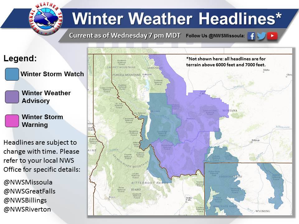
Winter Storm Watches have been issued a large portion of the northern rockies, stretching all the way from Glacier National Park in Montana down to Jackson, WY.
Related: 2018 Winter Weather Forecast | Long Range Prediction From NOAA
The forecasted snow totals continue to vary but most meteorologists are settling at around of foot of new snow for the high peaks of Montana and Wyoming. Idaho will come in slightly behind with somewhere between 2-8″ of new snow.
Just talked to @NWSBillings, said the Beartooth Pass could get up to a foot of snow tonight through Sat. afternoon. #mtwx #freshies
— Sam Wilson (@s_wilson__) September 14, 2017
The great news is that the devastating wildfire season in the northern rockies is nearly over. In addition to threatening homes and businesses, the fires have been a larger than normal stress on aquatic environments, including streams and lakes. The cold temps and precipitation will give those fish and those who call the river home– a much-needed cool off.
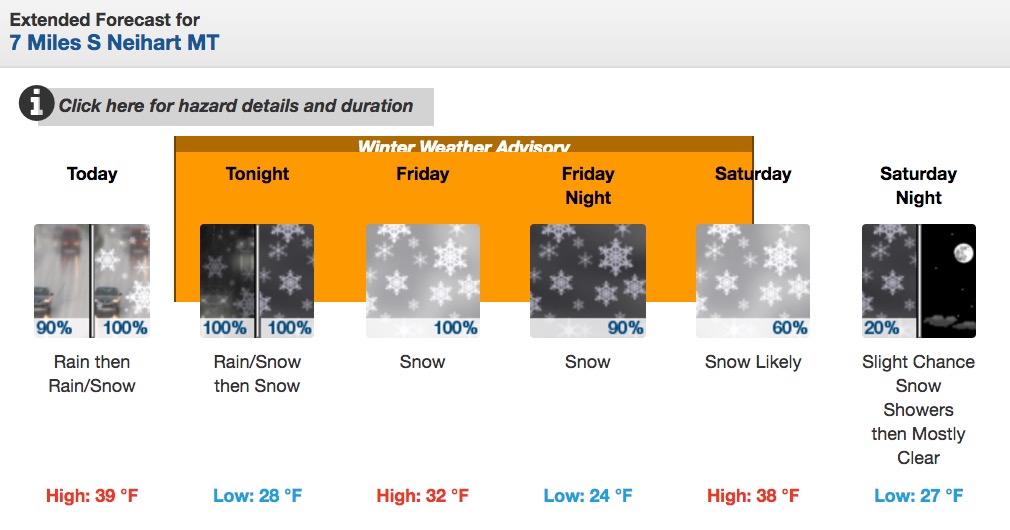
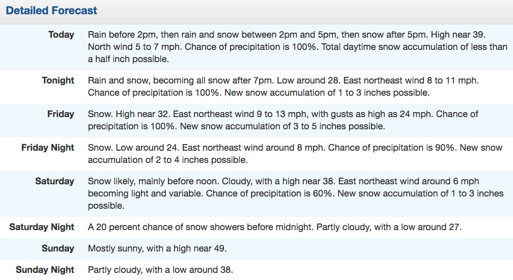
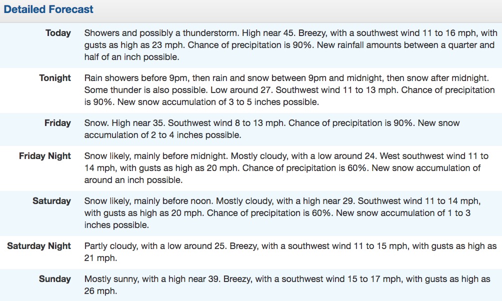
Little Belt Mountains, MT:
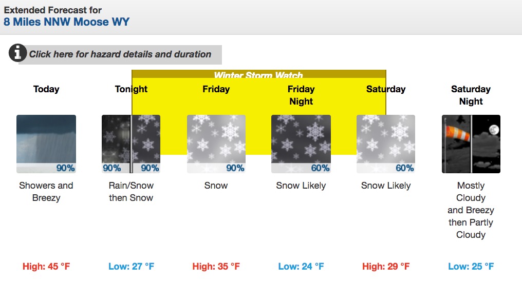
Grand Teton, WY:


Winter Storm Watch in effect for western/central mountains from Thursday night til Saturday AM. Heavy snow expected above 8500 feet . #wywx pic.twitter.com/yNmnwkaEL6
— NWS Riverton (@NWSRiverton) September 13, 2017
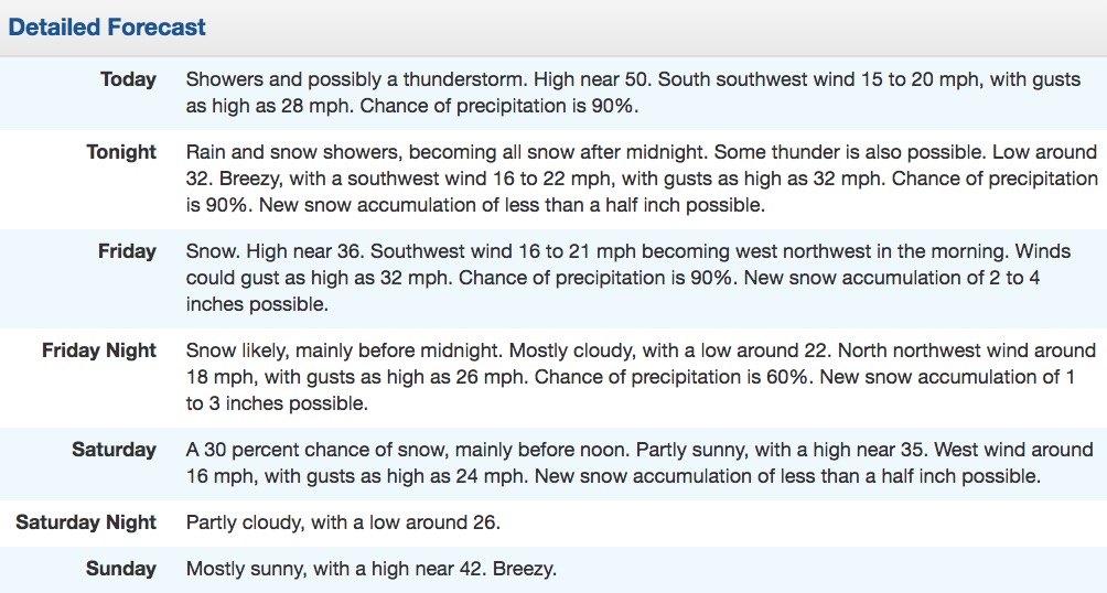
Lost River Range, ID:

And so begins our transition to the cool season. Widespread rain with mountain snow thru Saturday. pic.twitter.com/D3Yd0bkdgF
— NWS Pocatello (@NWSPocatello) September 14, 2017
Winter Weather Advisory [Montana]
…WINTER WEATHER ADVISORY REMAINS IN EFFECT FROM 6 PM THIS EVENING TO NOON MDT SATURDAY FOR ELEVATIONS ABOVE 6000 FEET…
* Locations: Logan Pass, Kings Hill Pass, Flesher Pass, MacDonald Pass, Boulder Hill, Elk Park Pass, and Homestake Pass.
* Timing: Rain will change to mountain snow today. Snowfall rates will peak Tonight and Friday. Mountain snow will continue through Friday, gradually ending from west to east by Saturday morning.
* Accumulations: Snow accumulation of 2 to 5 inches, with up to 12 inches on mountain peaks above 7000 feet.
* Winds: Northeast 10 to 15 mph with gusts up to 25 mph.
* Snow Level: 7000 feet Thursday, lowering to 5000 feet by
Thursday night.
* Impacts: Slushy snow accumulations will cause some travel
difficulties over mountain passes. Wet and raw conditions could
cause hypothermia issues for firefighters, hunters, and anyone
else caught unprepared in the backcountry.
* Web Page: To see a graphical representation of this hazard,
please visit our web page and mouse over the Current Hazards
menu, then select Detailed Hazards.
Winter Storm Warning [Wyoming]
…WINTER STORM WATCH REMAINS IN EFFECT FROM LATE TONIGHT THROUGH SATURDAY MORNING…
* TIMING…Rain will turn to snow above 8500 feet after midnight tonight with the snow level lowering to 6500 feet by Friday night. The snowfall will be heavy at times through Friday night.
* SNOW AMOUNTS…3 to 6 inches possible above 8500 feet and 6 to 10 inches above 10000 feet.
* MAIN IMPACT…Togwotee and Teton Pass as well some elevated roads in Yellowstone Park may become slick making travel difficult.
* OTHER IMPACTS…Hikers and campers should prepare for sharply colder weather along with potentially significant snow accumulations on hiking trails.
[protected-iframe id=”52892a03b2d4f168c2fc7a5a5932dab4-65244901-84409940″ info=”https://www.facebook.com/plugins/video.php?href=https%3A%2F%2Fwww.facebook.com%2FNWSBillings%2Fvideos%2F1645777255494979%2F&show_text=0&width=560″ width=”560″ height=”315″ frameborder=”0″ style=”border:none;overflow:hidden” scrolling=”no”]