


NOAA’s Climate Prediction Center has updated its winter outlook for December 2026 through February 2027, and the regional detail is where it gets useful. Below is the breakdown for each part of the country, with what it means for the ski season, and where the Farmers’ Almanac sees it differently.
The driver this winter is El Niño, and a strong one. NOAA now puts the odds of a very strong event through the heart of winter above 90%, and gives a 69% chance that the October to December period finishes at or above +2.5°C on the relative Niño index, which would put it ahead of every El Niño in the record back to 1950. In practice that means a loaded southern storm track, a wetter south and southeast, and a northern tier that gets its cold in sharp bursts rather than long settled freezes. More on the ENSO upgrade here.
Seasonal Temperature Outlook
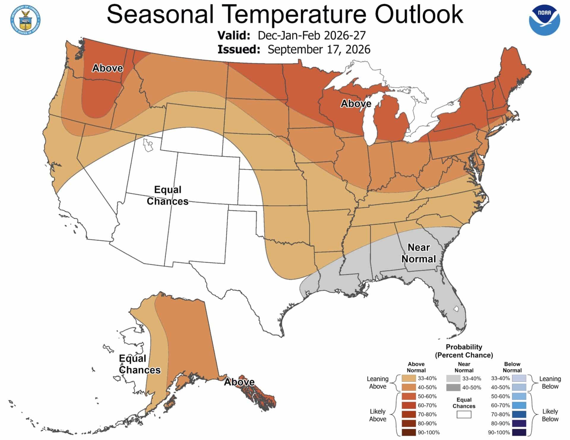
- Pacific Northwest: leaning above normal. Milder air pushes snow levels up, and valley precipitation falls as rain more often than usual.
- Northern Rockies and Plains: leaning above normal, which is a change from recent winters and a caution for early season snowpack in Montana and northern Idaho.
- Central US: near equal chances, with the Almanac expecting frequent thaw-freeze cycles rather than a settled pattern.
- Southwest: above normal, although this is the region with the wettest forecast, so elevation decides the outcome.
- Southeast: NOAA leans above normal; the Almanac calls it cool overall. Take the disagreement as a sign that cold shots will be sharp and short.
- Northeast: leaning above normal, with the inland high country still cold enough for repeated heavy, wet snow events in January and February.
Seasonal Precipitation Outlook
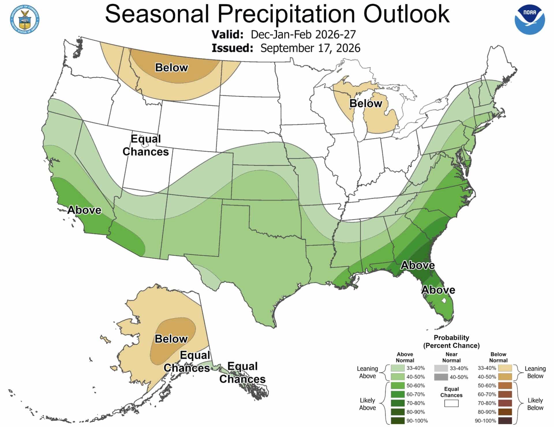
- California, the Southwest and southern Rockies: above normal, the strongest and most consistent signal on the map. This is the El Niño storm track doing exactly what it is expected to.
- Southeast and East Coast: above normal, and notably strong. Wet does not mean white here, but it does raise the odds of ice events.
- Texas and the South Central states: above normal, with an ice risk at Dallas, Oklahoma City and Tulsa when cold air arrives with the moisture.
- Northern Rockies and Montana: below normal. The quietest storm track in the country.
- Great Lakes: below normal on the seasonal map, although lake effect runs on cold air over open water and can still deliver big local totals in the snowbelts.
- Pacific Northwest: equal chances, so neither forecast is committing.
What This Means For Skiers And Snowboarders
The Sierra Nevada and the southern Rockies are the two regions where the temperature caveat matters least, because the terrain is high enough to convert a wet pattern into snow. The Pacific Northwest and northern Rockies are the ones to watch carefully: both forecasts have them warmer, and NOAA has them drier. The Northeast is a storm-by-storm season, which historically means excellent conditions immediately after a system and rapid degradation between them.
Read the Farmers’ Almanac 2026-2027 forecast alongside this, and Direct Weather’s snowfall map for a third view.
