

The 2021 Caldor Fire forever changed the terrain at Sierra-at-Tahoe. This wildfire swept through the California ski resort, burning most of the trees in its skiable footprint. Over the past couple of years, they’ve had to remove these trees from the mountain. After not opening for most of the 2021-22 season, they reopened with a powder-filled 2022-23 season.
As shown by PeakRankings’ video below, the mountain has been drastically altered by this wildfire, which is easy to recognize when you’re there.
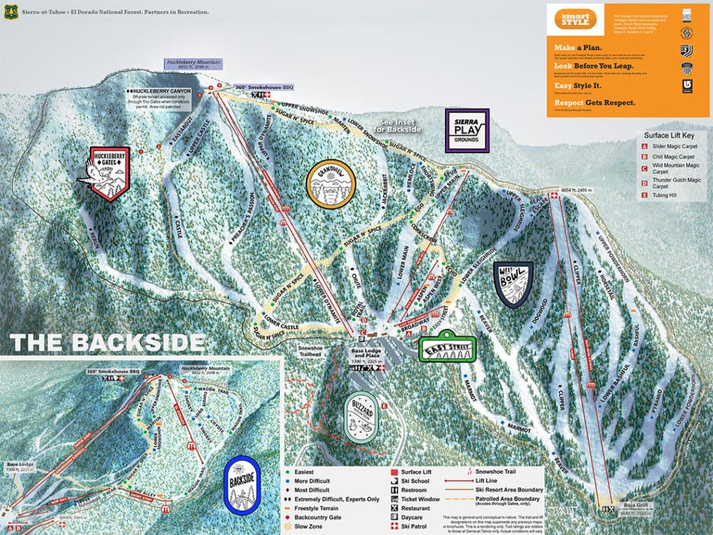
To accurately reflect the terrain, Sierra-at-Tahoe had to update its trail map before the last ski season. The most noticeable change was to the West Bowl, where the tree drawings were vanquished. The orange zones represented areas where skiers couldn’t go last winter due to the dead trees.

This summer, many more trees were removed across the ski resort. Sierra-at-Tahoe removed trees in the eastern areas between Rerun & Castle, the eastern portions of Castle & Preacher’s Passion, Huckleberry Canyon, and the front side (which includes the Avalanche Bowl, and around Chute & Main).
This week, Sierra-At-Tahoe revealed its newest trail map. The 2023 map is again, very different.

It’s pretty depressing to see Sierra-at-Tahoe lose most of its tree terrain. On the plus side, previously roped-off sections in the Avalanche Bowl and Huckleberry Canyon are now open to the public. This will be the first time they’ve had all 2000 of its skiable acres open in a couple of years.
After all this adversity, Sierra-at-Tahoe is still standing. Perhaps not better than they ever did, but they are looking like a true survivor…

Image/Video Credits: Sierra-at-Tahoe, PeakRankings