
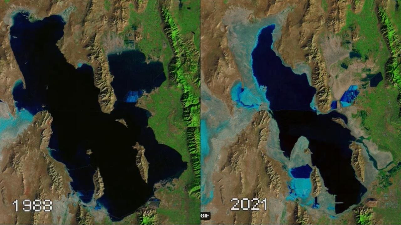

The drought in the American west is no secret. Rain and snow totals have been down for some time, and places like Utah’s Great Salt Lake show this on a massive scale.
The short GIF below shows satellite images of the Great Salt Lake from 1985 to 2021. You can clearly see how the lake’s surface area had dramatically diminished over the last 36 years.
The Great Salt Lake has decreased 20′ in elevation from the record high set in 1985 to the record low achieved last year. That’s pretty insane when you consider that The Great Salt Lake has a surface area of 1,699 mi²…
Pray to whatever god, gods, higher power, or whatever you believe in. Utah, and the American west need water, badly.
The Great Salt Lake #Utah, 1985 – 2021 showing its high of 4,211.65 ft. ASL, 1986 to its record low of 4191.3 in 2021. #GEE script can be modified to any area in the world. #Landsat #USGS #EarthEngine #NASA https://t.co/7VFd6Wxk6c pic.twitter.com/y8mnhs2oZi
— R. Douglas Ramsey (@dramsey0425) May 4, 2022
Header Image Credit: Mick Haupt on Unsplash