


Photo Credit: NASA
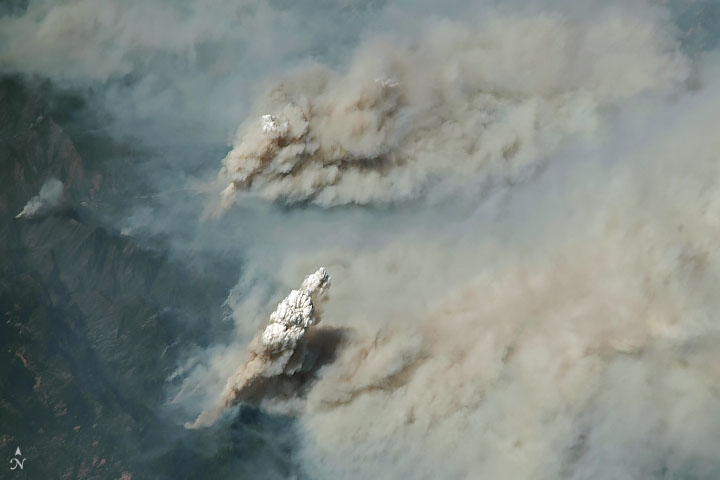
NASA released a few terrifying pictures today of the California fires, which can now be seen from space. This season is approaching the worst on record, as the Mendocino fire now covers an area larger than LA.
One of the fires—the Mendocino Complex—surpassed the 2017 Thomas fire to become California’s largest fire on record. As of August 7, 2018, the fire had charred 1,200 square kilometers (460 square miles), an area about the size of New York City.

While California is obviously the state immediately impacted by the fires, the smoke has reached well west, with places like Salt Lake, Jackson Hole, and Denver experiencing air quality issues.
Smoke injected above the boundary layer often travels hundreds or thousands of kilometers away from the source before descending. Satellites have observed smoke from the California fires spreading into nearly two dozen states, though the highest concentrations were found in California and the Great Basin.
— NASA (@NASA) August 8, 2018
Read the whole article from NASA’s Earth Observatory page Here