
If you’re in the North East don’t expect much action over the next 7 day but that is typical as a spring weather pattern is beginning to take form with fast moving weather and warmer temperatures.
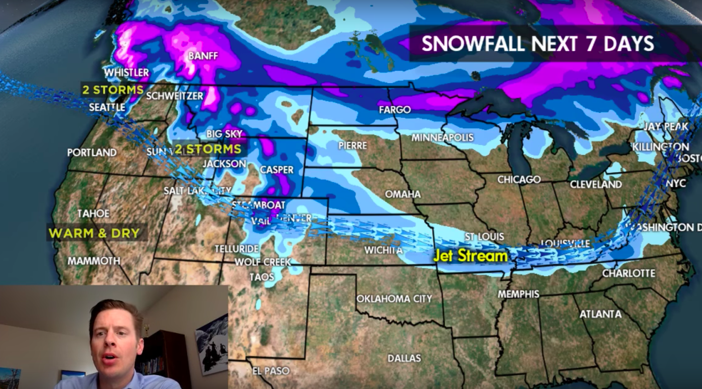
A warm high pressure cell is sitting off the coast of California so that pretty much negates any chance of snow in the Sierra and the same is true for the Wasatch but as you can see from the projection, a pair of storms could deliver decent precipitation starting around Whistler all the way to Colorado. Keep your eye on how those storms track and best of luck finding the deepness.
Thanks to Chris Tomer aka The Hardest Working Man In Snow-Business aka The Powder Predictor aka Snow Swami aka Snostradamus aka The Profit of Pow and OnTheSnow.com. For entire forecast from onthesnow.com go HERE. 