
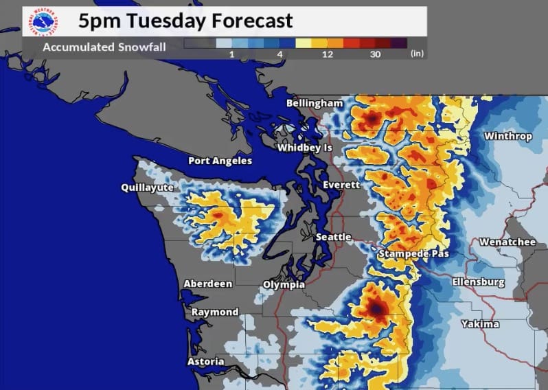

A strong winter storm is moving into Northern Cascades today with most ski areas in Washington State set to receive double digit snowfall totals by Wednesday.
Related: African Winds Transform Sochi’s Ski Slopes To Sand Dunes [Photos + Video]
Snoqualmie Pass is currently in the lead with up to 32″ forecasted. Crystal and Mt Baker fall just behind with anywhere between 18-24″. Temperatures and snow density will fluctuate depending on the time of day. Best bets for powder will be for the first couple of hours each day before temps begin to affect snow levels up to 7k feet.
Mt Baker:


Crystal Mountain:


Snoqualmie Pass:


Winter Weather Advisory
…WINTER WEATHER ADVISORY NOW IN EFFECT FROM 6 AM THIS MORNING TO 6 PM PDT TONIGHT ABOVE 2000 FEET…WINTER WEATHER ADVISORY IN EFFECT FROM 6 PM TONIGHT TO 6 AM TUESDAY MORNING ABOVE 3000 FEET…
* WHAT…Snow expected. New snow totals of 4 to 9 inches today and 2 to 9 inches tonight. Total snow accumulations of 6 to 18 inches are expected.
Planning to travel over the Cascade Passes MON or TUE? Check https://t.co/AVrmPaIl7v for the latest road conditions at Snoqualmie and Stevens Passes. #WAWX pic.twitter.com/hHpVgiMpvC
— NWS Spokane (@NWSSpokane) March 25, 2018
* WHERE…Cascades of Whatcom, Skagit, Snohomish, King, Pierce and Lewis Counties. This includes Mount Baker, Stevens Pass, Snoqualmie Pass, Mount Rainier, and White Pass.
* WHEN…From 6 AM this morning to 6 AM PDT Tuesday.
* ADDITIONAL DETAILS…Snow levels will start near 1500 feet this morning rising to 3000 to 3500 feet by early this evening. Plan on difficult travel conditions. Be prepared for reduced visibilities at times.