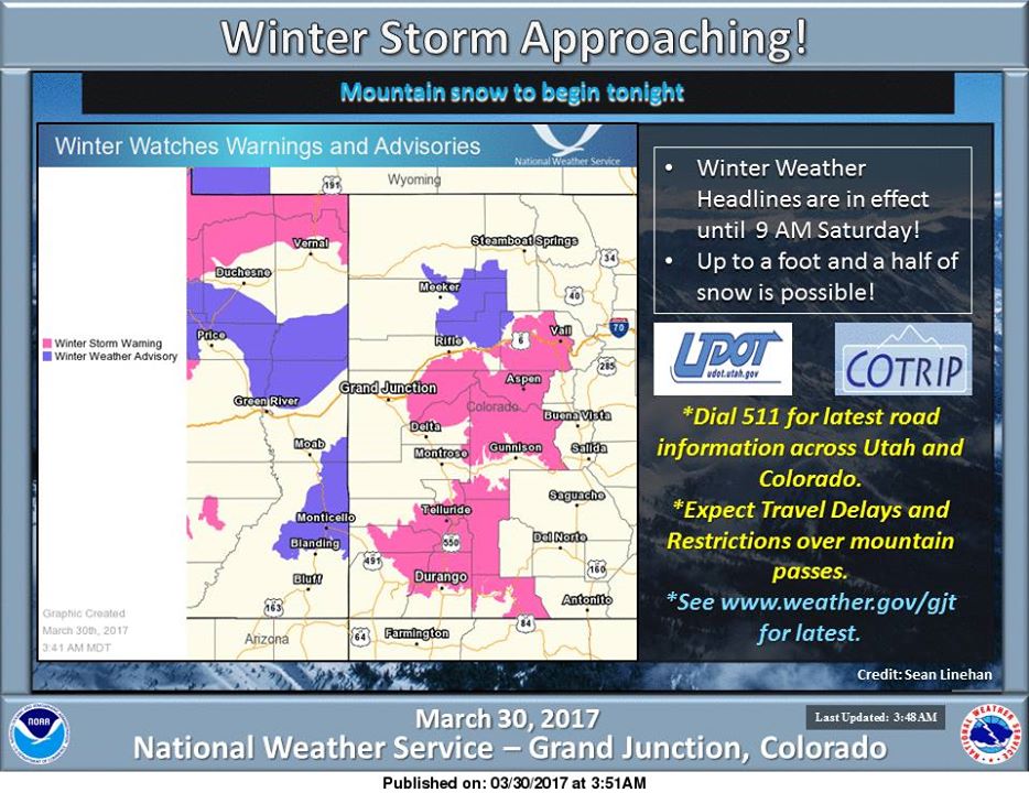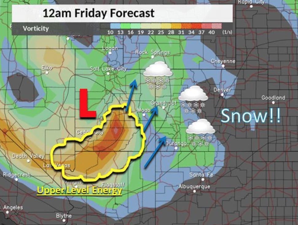
Another winter weather system is moving through the southwestern part of Colorado, with a bullseye currently set on the San Juan mountains.
Related: NOAA Just Released Their 2017 Spring Outlook | Who Will Get The Most Snow?
The storm is projected to be warm with snow levels starting near 8,000′ but that should all change this evening as colder weather comes into the picture.
“Up to a foot of new snow is possible with locally higher amounts to 18 inches. Be careful if traveling as roads will be heavily impacted. Snow will linger into this weekend before ending Saturday. Another storm is expected for Tuesday evening.” – NWS Grand Junction
The storm should follow the same “hook” trend that’s been bringing the winter weather systems south before moving up to the front range of Colorado. Expect bluebird pow days for front range resorts on Sunday morning while Friday/Saturday should be good in Southwestern/Central Colorado.
NOAA Forecasted Snowfall Totals:
(*Snow total forecasts are drawn from summit locations)
- Telluride – 17″
- Silverton – 16″
- Beaver Creek – 15″
- Vail – 14″
- Monarch Mountain – 14″
- Crested Butte – 12″
- Purgatory – 10″
- Aspen – 9″ (*Snowmass)
- Wolf Creek – 7″

Winter Storm Warning
…WINTER STORM WARNING IN EFFECT FROM MIDNIGHT TONIGHT TO 9 AM MDT SATURDAY…
The National Weather Service in Grand Junction has issued a Winter Storm Warning for heavy and blowing snow, which is in effect from midnight tonight to 9 AM MDT Saturday.
* LOCATIONS INCLUDE…Telluride, Ouray, Lake City, Silverton, Rico, and Hesperus.
* TIMING…Scattered rain and snow showers will develop Thursday afternoon with rain changing to all snow Thursday night and increasing in coverage. The snow will continue off an on through Friday night, before ending Saturday morning.
* SNOW ACCUMULATION…8 to 12 inches with locally greater amounts up to 18 inches possible over the higher terrain.
* SNOW LEVEL…7,000 to 8,000 feet greatest snow amounts are expected above 8,500 feet elevation.
* WINDS…Southeast 10 to 20 mph with gusts up to 35 mph.
* IMPACTS…The heavy snow will make many roads impassable and may produce widespread power outages due to the weight of the snow on tree limbs and power lines.


