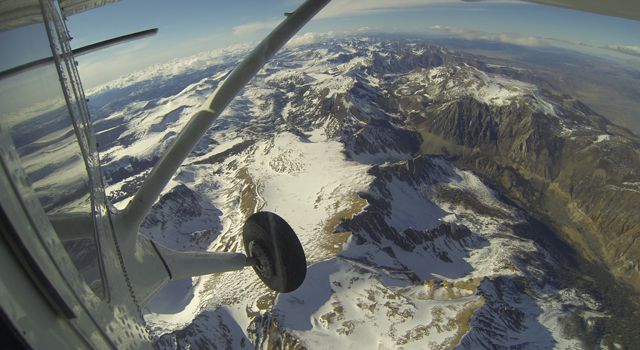
Mt. Dana and Dana Plateau in the Tuolumne River Basin within Yosemite National Park, Calif., as seen out the window of a Twin Otter aircraft carrying NASA’s Airborne Snow Observatory on April 3, 2013. The patchy snow cover this early in the snowmelt season is a reflection of the poor snowfall in the Sierra Nevada this winter and spring. The Airborne Snow Observatory is producing comprehensive weekly maps of how much water this basin holds, data that will be used to estimate how much water will flow out of the basins when the snow melts. The watershed and its Hetch Hetchy Reservoir are the primary water supply for San Francisco. Image credit: NASA/JPL-Caltech
NASA’s new Airborne Snow Observatory has created the first maps of the entire snowpack of two major mountain watersheds in California and Colorado, producing the most accurate measurements to date of how much water they hold. “The data from NASA’s Airborne Snow Observatory mission will be used to estimate how much water will flow out of the basins when the snow melts. The data-gathering technology could improve water management for 1.5 billion people worldwide who rely on snowmelt for their water supply.” –
The new system can calculate snow depth to within about 4 inches (10 centimeters) and snow water equivalent to within 5 percent. Data are processed on the ground and made available to participating water managers within 24 hours.
NASA Airborne Snow Observatory measurements of snow water equivalent (top image) and snow albedo, or reflectivity (bottom image) for the Tuolumne River Basin in California’s Sierra Nevada on April 21, 2013. The snow water equivalent measured the total water contained as snow in the basin on that date at 375 million cubic meters, or enough to fill the Rose Bowl about 1,180 times. The albedo map expresses the percentage of sunlight reflected back to space by the snow. The lower the albedo, the faster the snowmelt rate and runoff. Image credit: NASA/JPL-Caltech