

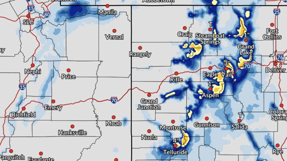
The National Weather Service has issued winter weather advisories and winter storm warnings across parts of Colorado, Wyoming, Utah, and Montana on Monday, November 2, as another round of mountain snow moves across the West. The heaviest snowfall is expected in Colorado’s San Juan Mountains, where some locations above 10,000 feet could receive 12 to 18 inches of fresh snow, with locally higher amounts possible.
Wyoming’s Bighorn Mountains are also facing significant snowfall, with up to 15 inches possible near Cloud Peak. The latest storm is bringing another boost to early-season snowpack while creating difficult travel conditions across several mountain ranges.
Colorado’s San Juan Mountains Under Winter Storm Warnings
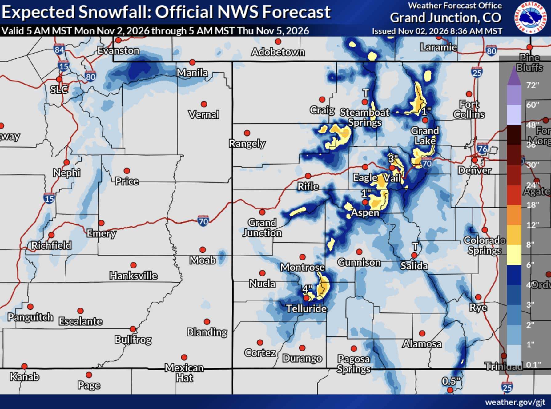
The most significant snowfall forecast is centered on the Northwest and Southwest San Juan Mountains. The National Weather Service has issued winter storm warnings for elevations above 10,000 feet, including the mountains surrounding Telluride, Silverton, Ouray, and Lake City.
Total accumulations of 12 to 18 inches are expected, with locally higher amounts possible. Winds could gust up to 45 mph, creating blowing and drifting snow across mountain passes.
A separate winter storm warning covers the Eastern San Juan Mountains above 10,000 feet, including Wolf Creek Pass and Cumbres Pass. Another 3 to 6 inches of snow is possible through Monday morning, with wind gusts reaching 50 mph.
The snowfall is particularly welcome for Colorado ski country, where areas like Wolf Creek, Telluride, and Silverton are continuing their preparations for the 2026-27 season.
Wyoming Mountains Could Receive 15 Inches
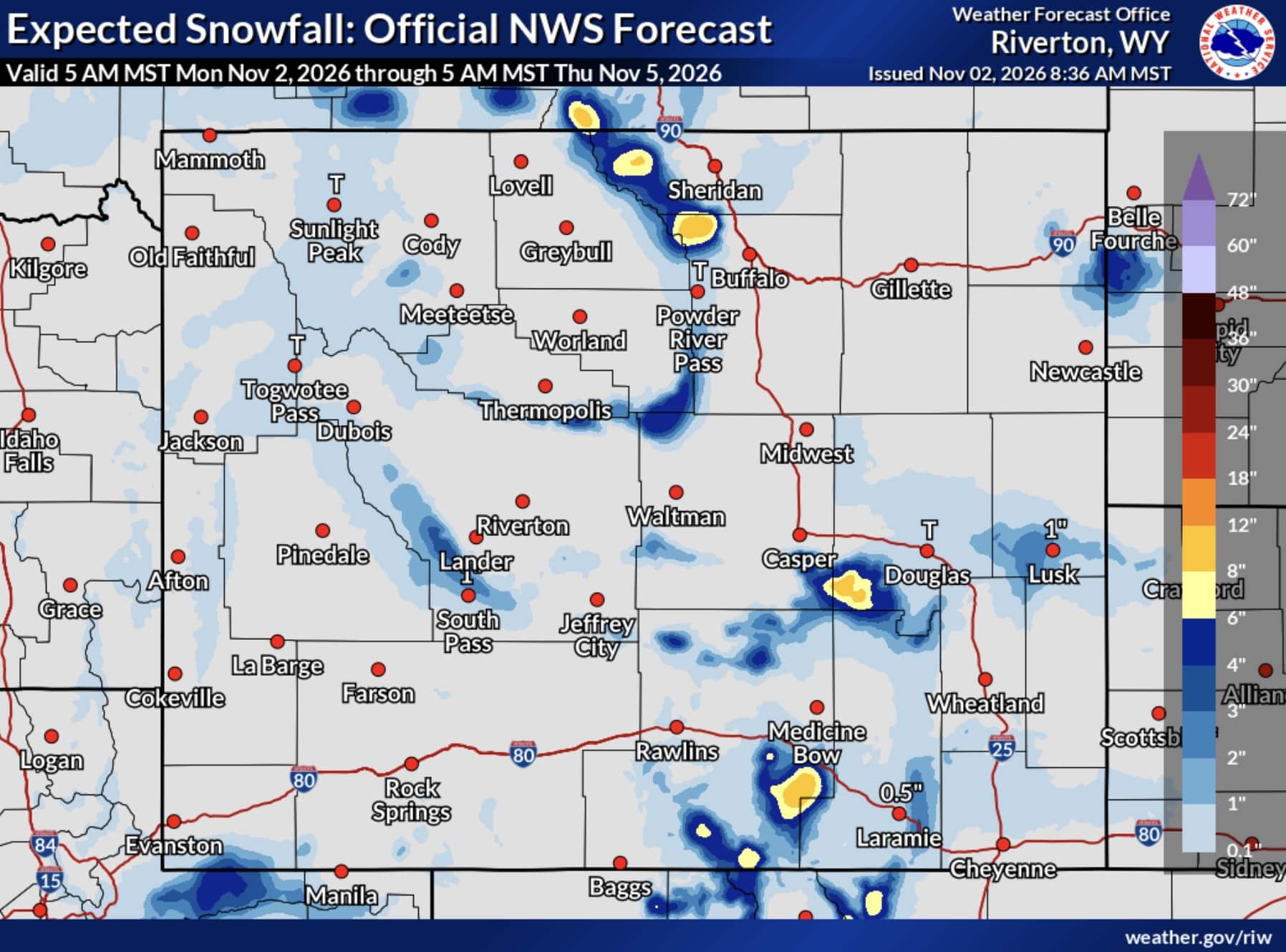
Wyoming’s Bighorn Mountains are also expected to see substantial snowfall. The highest elevations near Cloud Peak could receive 10 to 15 inches, while surrounding elevations above 9,000 feet are forecast to pick up 6 to 10 inches.
The Sierra Madre and Snowy Ranges could receive 6 to 12 inches above 9,000 feet. Similar totals are forecast for the North Laramie Range, particularly on north-facing slopes. The Wind River Mountains could pick up another 5 to 8 inches.
More Snow For Colorado, Utah, And Montana
Additional snowfall is expected across several other mountain ranges.
The Gore and Elk Mountains, West Elk Mountains, and Sawatch Range could receive 5 to 10 inches above 10,000 feet. That forecast includes areas surrounding Aspen, Snowmass, Vail, Crested Butte, and Monarch Pass.
Rabbit Ears Pass and Rocky Mountain National Park could receive 4 to 9 inches, while the mountains surrounding Breckenridge could see 3 to 7 inches. Utah’s Wasatch Mountains, including Alta and Brighton, could pick up another 2 to 4 inches.
Montana’s Pryor and Northern Bighorn Mountains could also receive up to 10 inches.