

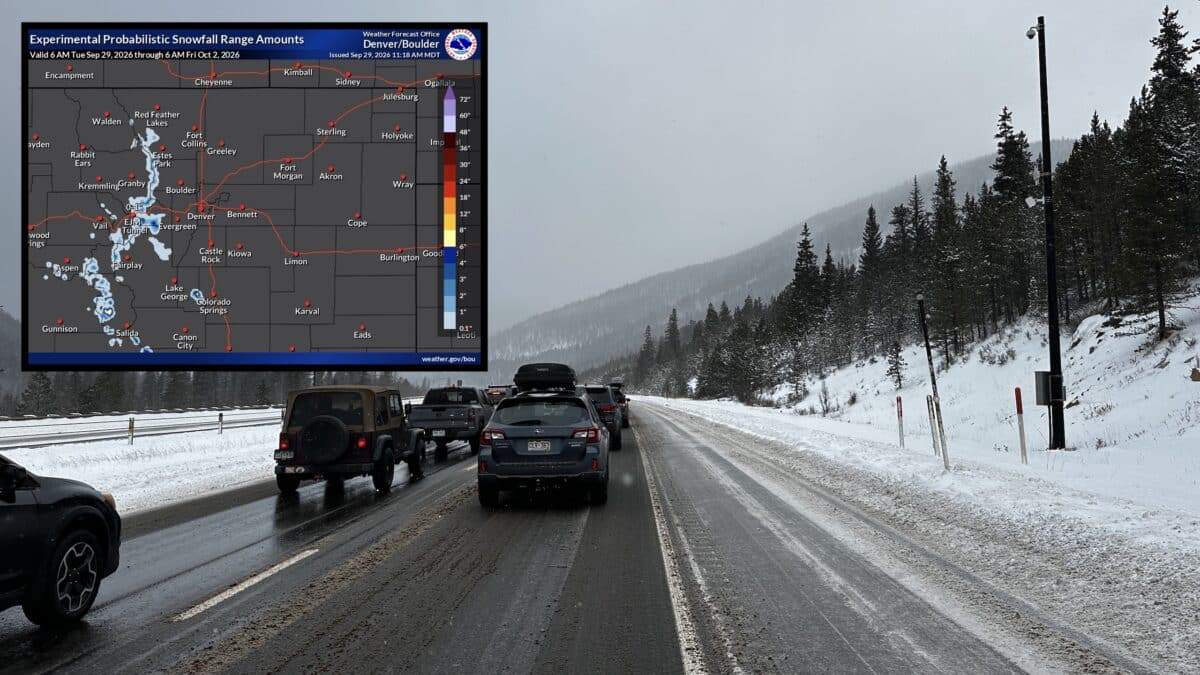
Colorado’s first real taste of accumulating snow is showing up in the latest National Weather Service forecast, with some high elevation locations potentially seeing nearly half a foot of snow over the next 72 hours.
While most of the state’s populated Front Range communities are forecast to stay dry, several mountain passes and high elevation areas have a meaningful chance of seeing snow. The biggest potential is currently centered around the higher terrain west of Denver.
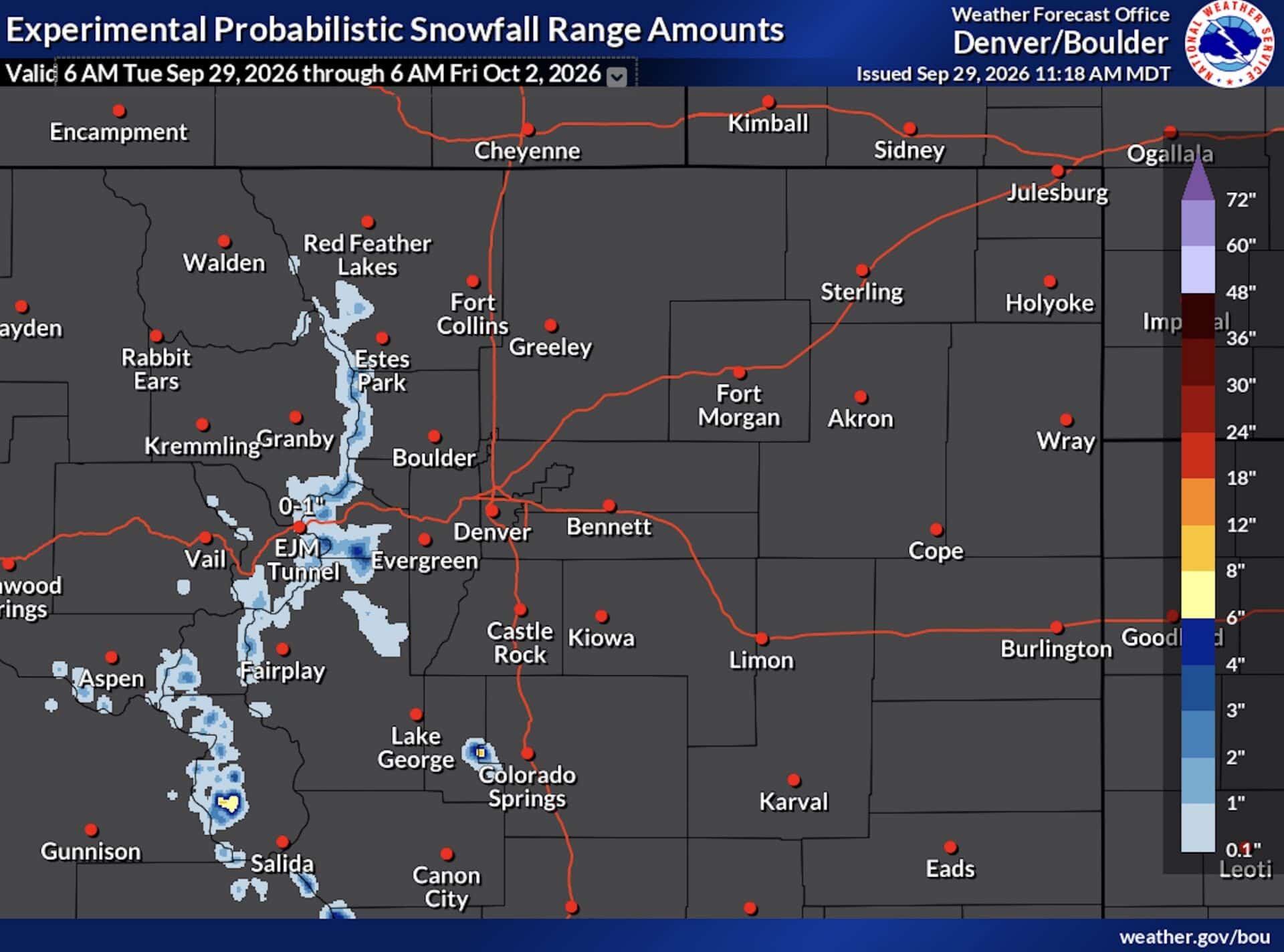
Echo Lake Could See Nearly Half a Foot
Echo Lake stands out in the latest forecast with an expected snowfall total of 1 inch and a high-end possibility of 5 inches.
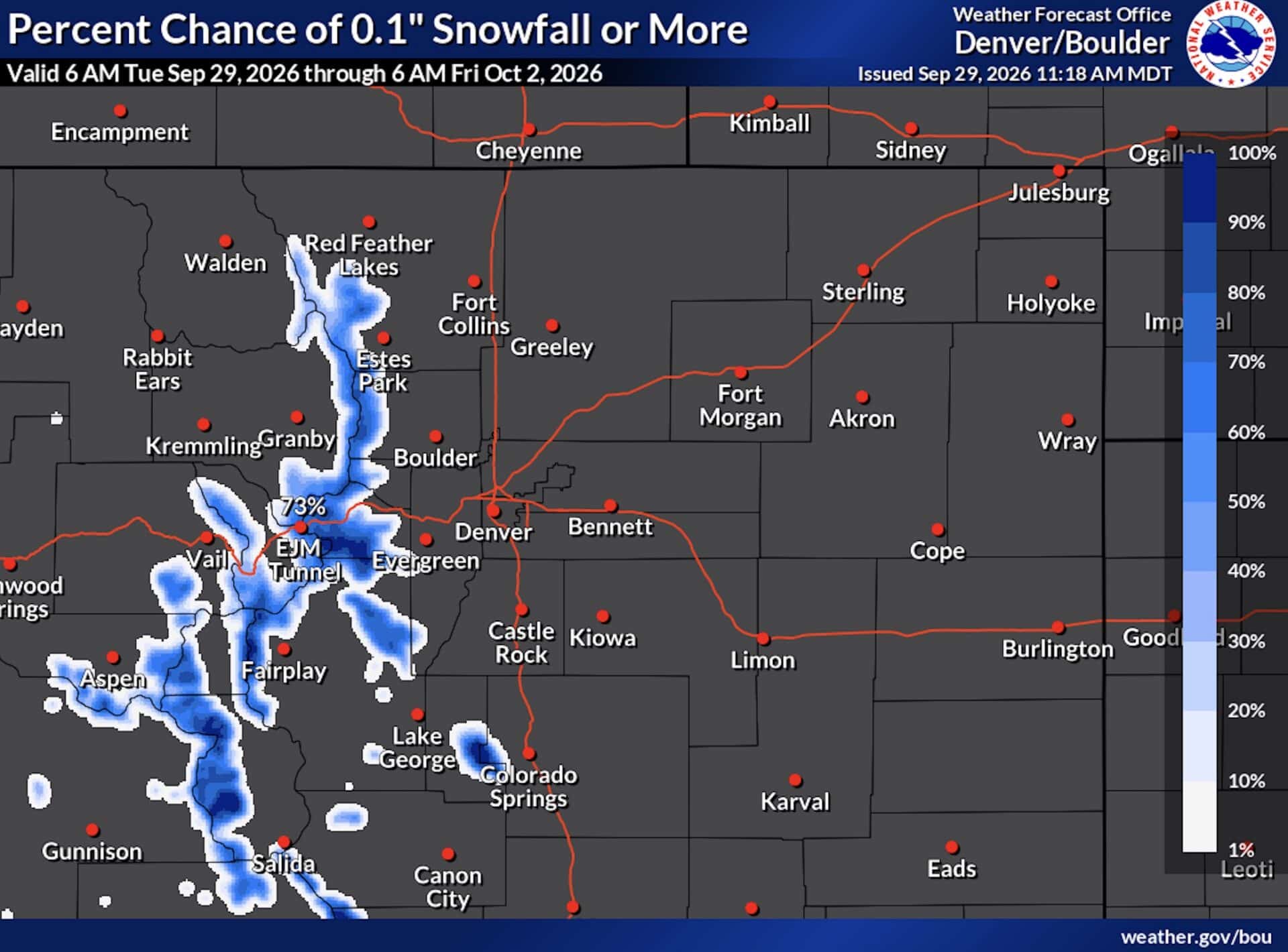
The location has a 76% chance of receiving more than 0.1 inches of snow. There is also a 45% chance of exceeding 1 inch and a 29% chance of seeing more than 2 inches.
Echo Lake is the most notable snow target in the current 72 hour forecast, with conditions potentially turning wintry at elevations where temperatures are cold enough to support accumulating snow.
Several Mountain Passes Could Turn White
Snow is also possible across several other high elevation locations. Loveland Pass has a 74% chance of seeing more than 0.1 inches, with a high-end forecast of 2 inches. Hoosier Pass has a 71% chance of measurable snow and could also see up to 2 inches.
Berthoud Pass has an expected total of 1 inch and a high-end total of 2 inches, while Cameron Pass could see up to 1 inch. Other locations including Fremont Pass, East Portal, Georgetown and Vail Pass also have measurable snow in their forecasts.
Front Range Mostly Stays Dry
The snow potential drops sharply at lower elevations. Denver, Boulder, Aurora, Fort Collins and numerous other Front Range communities are currently forecast to receive 0 inches during the 72 hour period. Denver International Airport is also forecast for no accumulation.
Even Winter Park is expected to receive 0 inches, although the National Weather Service gives the location a 3% chance of seeing more than 0.1 inches.