

Meteorologist Chris Tomer is watching another round of moisture that could bring additional snow to Colorado’s highest elevations over the coming days.
While some light snow is already falling across the highest peaks, Tomer’s latest mountain weather update focuses on the next several days and a larger storm system expected to move through the region. Moisture from the South Pacific is being pulled north through Mexico and into the Four Corners, with Colorado positioned to receive some of that moisture.
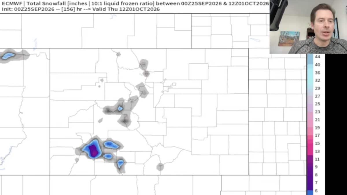
The San Juan Mountains and southern Colorado currently appear to have the best setup for additional snowfall. Tomer specifically points toward the southern mountains, including the areas around Wolf Creek and Berthoud Pass, where his AI snow plume shows roughly four inches of snow in the forecast.
Storm Track Could Change Colorado Snow Forecast
The biggest question for Colorado skiing is the eventual track of the incoming system. Tomer says the forecast has shifted considerably farther south compared with previous model runs. That change has reduced projected snowfall across Colorado’s central and northern mountains while keeping more precipitation focused across the San Juans and southern Colorado.
Resorts including Wolf Creek Ski Area and Telluride Ski Resort could benefit from the southern storm track if the current forecast holds. However, Tomer notes that the storm track could still shift north during the weekend. A relatively small change could significantly increase snowfall farther north across Colorado ski country.
The San Juans and southern Colorado are the primary areas to watch for upcoming snow, while skiers across the rest of the state will be watching closely for a northward shift in the forecast.
