
The National Oceanic and Atmospheric Association (NOAA) published new, high-resolution land cover maps for coastal Alabama, Mississippi, Northeastern Ohio, Rhode Island, and the Puget Sound in Washington, offering communities significantly more detailed geographic data for planning and environmental management.
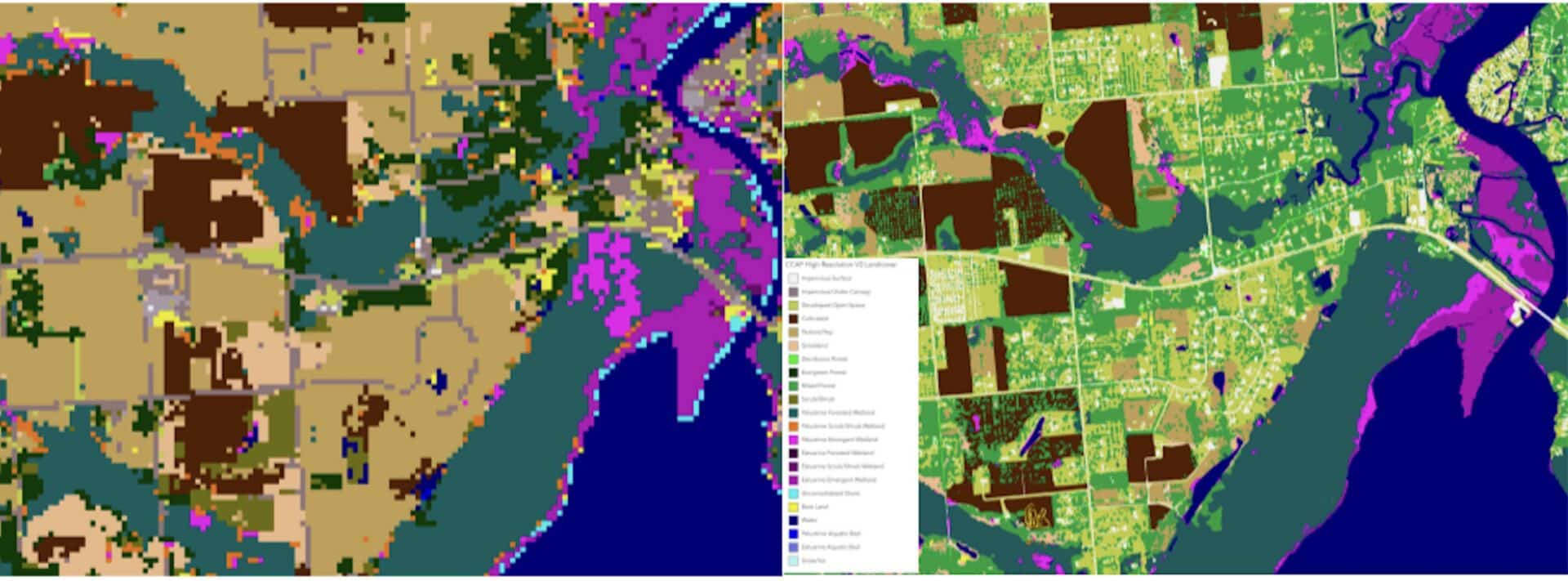
The updated maps are a major leap in resolution, moving from 30 meters down to 1 meter. That single-meter resolution means each pixel corresponds to a 1-by-1-meter area on the ground, making the new maps 900 times more detailed than data produced a decade ago. The maps are available through NOAA’s Digital Coast website.
The data is designed to support a wide range of applications, including stormwater management, water quality assessments, urban heat analysis, tree canopy projects, wetland restoration, flood mitigation, and land use modeling. The updated tool will provide up to 20 land cover categories, among them a variety of wetland types.
“This high-resolution land cover data is a powerful new tool for science-based decision-making. It gives local planners the precision needed to assess critical risks, such as water quality and storm protection, and to identify priority wetlands for preservation so they can meet local challenges head on.” – Nicole LeBoeuf, assistant administrator of NOAA’s National Ocean Service.
By comparing maps year over year, communities can track shifts in land use down to the county level, or even smaller areas. NOAA’s Office for Coastal Management has provided regional coastal land cover data for decades through its Coastal Change Analysis Program, and this latest update extends that capability to more localized communities.
Similar mapping has previously helped municipalities identify the causes of sand dune erosion, assess the viability of wetland restoration near lakes, and even pinpoint gaps in rural broadband coverage.
“These new maps are a great resource for state and local communities who often don’t have the resources needed for this type of mapping. These more precise products offer communities a wealth of opportunities.” – Nate Herold, data development lead and physical scientist in NOAA’s Office for Coastal Management.
Future updates are planned for additional regions across the country.