
A growing body of geological research is raising an intriguing question….could a massive, ancient fault lie hidden beneath the Canadian Rockies and could it explain how parts of western North America moved hundreds of miles over millions of years?
At the center of this discussion is the Tintina Fault, a major strike-slip fault that is clearly visible in Alaska and Canada’s Yukon Territory. Like California’s San Andreas Fault, it once accommodated large horizontal movements of Earth’s crust but unlike the San Andreas, the Tintina Fault appears to “disappear” on maps as it approaches the Canadian Rockies.
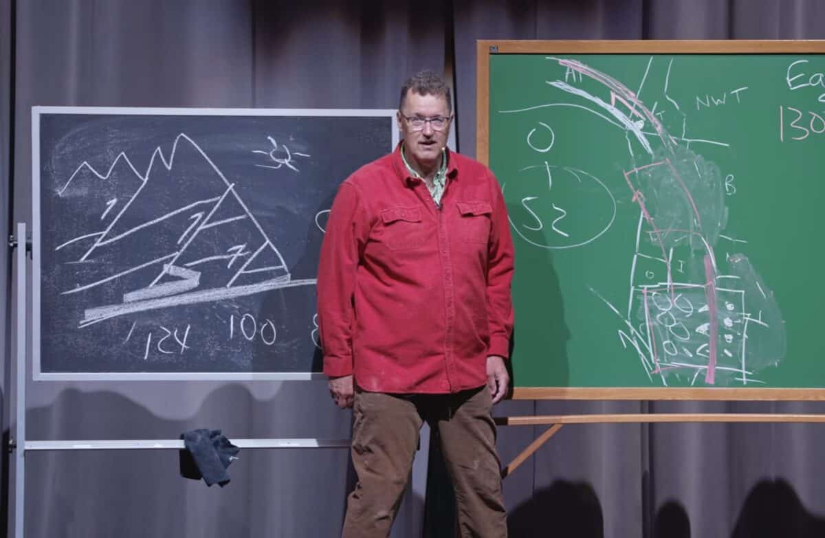
That gap has puzzled geologists for decades. The following lecture by geologist Nick Zentner explores the question.
Recent work, including research by geologist Robert Hildebrand, suggests the fault may not actually end, rather it may instead continue beneath the Rockies, hidden from view. One possible surface clue is the Rocky Mountain Trench, a long, straight valley running through British Columbia. Some scientists propose that this trench could mark the surface expression of the buried fault.
This idea ties into a larger and more controversial concept: that large sections of western North America may have shifted northward over time.
Evidence for this comes in part from paleomagnetism, the study of how rocks record Earth’s magnetic field when they form. By analyzing these records, geologists can estimate how far a piece of crust has moved relative to its original position. Some studies suggest that parts of the region may have moved more than over 600 miles north between roughly 70 and 50 million years ago.
However, it’s important to note that this interpretation up for debate. Not all geologists agree on the extent of this movement or the mechanisms behind it.
Another widely accepted piece of the puzzle is how the Canadian Rockies themselves formed. The mountains are known to have been pushed eastward along large thrust faults beginning around 54 million years ago. This process stacked layers of older rock on top of younger formations, creating the dramatic, tilted landscapes seen today in places like Banff and Jasper National Parks.
What remains uncertain is how all these processes connect.
Some researchers suggest that earlier episodes of mountain-building and faulting—dating back over 100 million years—may have occurred farther south, possibly in what is now the western United States. Later tectonic movements could have shifted those rock formations northward before they were pushed east to form the modern Rockies.
While this scenario links multiple geological features across a vast region, it remains an active area of research, with scientists continuing to analyze rock formations, fault structures, and magnetic signatures to better understand the continent’s history. What is clear is that western North America is far more complex than a simple east-west compression model, instead involving a mix of horizontal motion, vertical uplift, and multiple phases of deformation over tens of millions of years.
For now, the idea of a hidden fault beneath the Canadian Rockies remains a compelling hypothesis that could reshape our understanding of the region’s dramatic landscapes if supported by further evidence.