

The weekend of Martin Luther King Jr. Day was a nice taste of winter weather across the country, but things have been fairly dry since. We’ve seen a little bit of snow here in Colorado, but it hasn’t been enough to drive the powder hounds nuts. The rest of January, for much of the country, looks to include quite a bit of the same. BUT, early February, ladies and gentlemen, could be bringing quite the powder dumps across the West (and some snow in the East!).
Meteorologist Chris Tomer has spent the past 20 years forecasting mountain weather for skiers and climbers. Tomer combines his experience and knowledge in weather forecasting with his love for the outdoors, providing some of the best mountain weather forecasts for those hoping to plan around the weather for upcoming outdoor activities. You can find daily weather updates on both his YouTube channel and his blog.
Again, mellow snow totals through the end of January. Whistler might get a decent bit before February 1st, but not really enough to write home about. The fun comes around between February 1st and February 4th, when some mountains in Colorado, including some in the Front Range, could see well over a foot. Parts of California, Utah, and Idaho could also be looking at that >1′ rage, and Montana and Wyoming could see just under.
The groundhog might be looking at his shadow (or not) in a big ol’ pile of snow! (I know, that’s in Pennsylvania and he probably won’t be seeing much snow if he sees any at all).
Related: POWDER WATCH! February 2-7 Brings A Messy Week Of Heavy Precipitation (Warm to Cold)
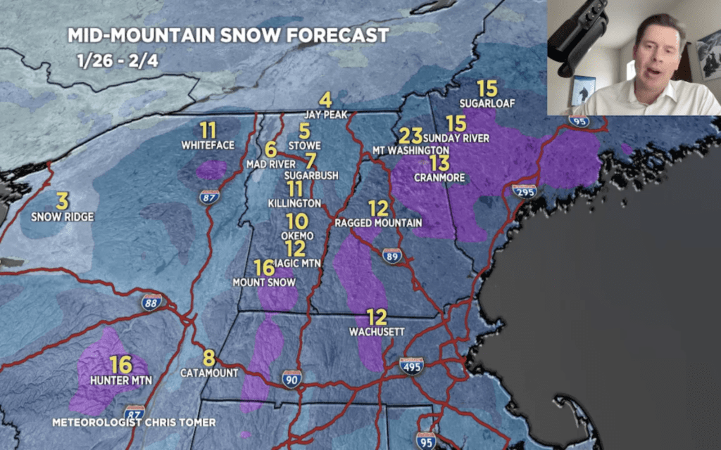
Image Credit: Chris Tomer via YouTube