

An avalanche demolished a Pakistani military camp in Kashmir today. Over 100 Pakistani mountain soldiers were bury with none of them recovered after a 12 hour period.
This avalanche occurred in the very remote Siachen Glacier area of the Karakoram mountain range. This place is way up in the mountains were humans cannot permanently live.
“This avalanche hit a (military) headquarters. Over 100 soldiers and personnel are trapped.” Army Spokesman Major-General Athar Abbas – Reuters

It’s no secret that Pakistan (once a part of India) and India have been battling over Kashmir (the northern Himalayas) for decades. This disputed land was the cause of the two of the three wars they’ve had.
“The no-man’s-land of Siachen is 20,000 feet above sea level. Military experts say the inhospitable climate and avalanche-prone terrain have claimed more lives than gunfire.” – Reuters
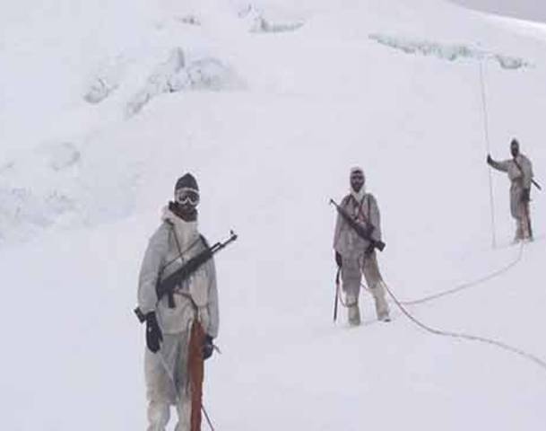
India and Pakistan have been fighting at altitudes above 20,000 feet in temperatures below -75F in Kashmir. It’s called “the world’s highest battlefield” and is hands-down one of the most spectacularly beautiful places on Earth.

ABOUT THE SIACHEN GLACIER:
The Siachen Glacier is located in the East Karakoram/Himalaya, at approximately 35.5° N 76.9° E. It is one of the five largest glaciers in the Karakoram, situated at an average altitude of 5,400 meters (~17,700 feet) above sea level. Most of the Siachen Glacier as is the LoC, a hotly contested territory between Pakistan and India.The Siachen glacier lies South of the great watershed that separates Central Asia from the Indian subcontinent, and Pakistan from China in this region. The 78 km long Siachen glacier lies between the Saltoro ridge line to the west and the main Karakoram range to the east. The Saltoro ridge originates from the Sia Kangri peak in the Karakoram range and the altitudes range from 5500 to 7300 m (18,000 to 24,000 feet). The major passes on this ridge are Sia La at 6100 m (20,000 ft) and Bila Fond La at 5800 m (19,000 ft). – siachenglacier.com


ABOUT THE KARAKORAM RANGE
The Karakoram is home to the highest concentration of peaks over eight kilometres (five miles) in height to be found anywhere on earth,[1] including K2, the second highest peak of the world (8,611 m/28,251 ft). K2 is just 237 m (778 ft) lower than the 8,848 m (29,029 ft) tall Mount Everest.
The range is about 500 km (311 mi) in length, and is the most heavily glaciated part of the world outside the polar regions. The Siachen Glacier at 70 km and the Biafo Glacier at 63 km rank as the world’s second and third longest glaciers outside the polar regions.[2]
The Karakoram is bounded on the northeast by the edge of the Tibetan Plateau, and on the north by the Pamir Mountains. The southern boundary of the Karakoram is formed, west to east, by the Gilgit, Indus, and Shyok Rivers, which separate the range from the northwestern end of the Himalaya range proper as these rivers converge southwestward towards the plains of Pakistan. – wikipedia.org
