

Everybody’s favorite skiing meteorologist Chris Tomer just issued his predictions for this winter and his forecast is defined by one thing: a “super” El Niño, one of the strongest and earliest on record.
Ocean temperature anomalies in the equatorial South Pacific are already running as high as +1.8°C, with models projecting a further rise to +3 to +3.5°C by November or December. Tomer calls it a “locomotive” pattern comparing it most closely to the historic 1997 super El Niño, though he notes this year’s warmth extends far beyond the Pacific into the Atlantic and Indian Oceans as well, an unprecedented global signal.
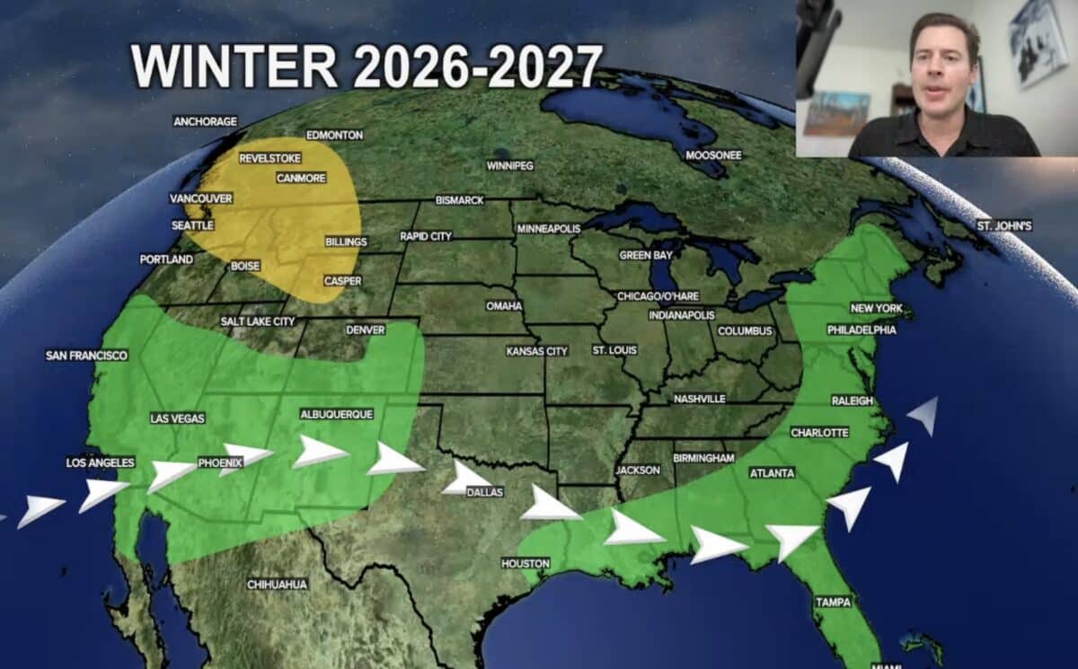
Tomer believes the defining feature will be a supercharged southern jet stream that repeatedly channels moisture-rich storms from the Pacific into California, the Sierra, Arizona, New Mexico, and the southern Rockies, echoing the “atmospheric river” pattern seen in 1997. Southern Colorado including the Front Range, should also benefit. However, Tomer warns of rising rain/snow lines as warm air rides in alongside the moisture, meaning some storms could bring rain instead of snow at lower elevations.
Meanwhile, the northern branch of the jet stays weak, leaving the Pacific Northwest, British Columbia, Alberta, Big Sky, and Jackson Hole trending drier than normal. Colorado’s central mountains (Vail, Breckenridge, Aspen, Crested Butte) and Utah’s Wasatch are expected to see roughly average snowfall. The Northeast looks slightly favored, with Tomer projecting 5–10% above-normal precipitation.
His rough resort-by-resort snowfall outlook: Tahoe/Sierra +30%, Colorado’s southern mountains and New Mexico +20%, Wasatch/Aspen/Vail near normal, Jackson Hole/Revelstoke/Big Sky/Baker below normal, and most of the Northeast modestly above normal.
Tomer stresses these are early, best-guess projections with significant uncertainty, and he plans regular updates as the season approaches.
