
After several months of mostly disappointing snowfall, the Western half of the United States is looking at a dramatic shift in weather patterns that could finally bring significant snow to ski resorts.
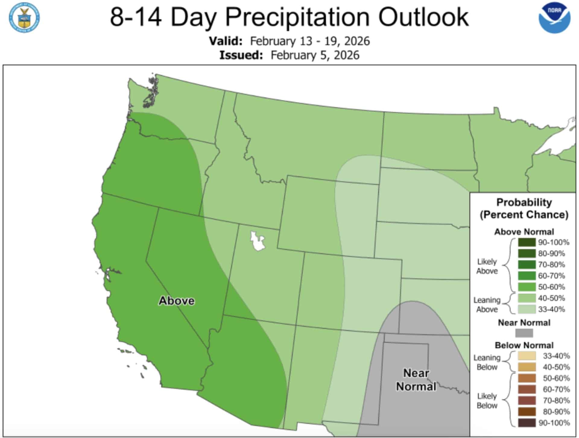
According to NOAA’s Climate Prediction Center (CPC), a much wetter pattern is expected from the West Coast to the Continental Divide as a developing trough strengthens over the region by mid-February. This Western snowpack currently sits at alarmingly low levels.
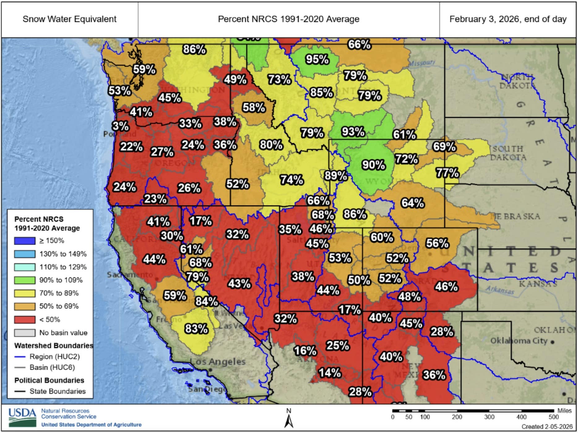
Historically Low Snowpack Across the West
Snow limited to the highest elevations in December, combined with an extended drier-than-normal period from January into early February, has resulted in unusually low Western U.S. snowpack. Snow water equivalent is currently less than 50% of average across parts of the Pacific Northwest, Great Basin, Four Corners, and California.
This deficit has left many ski resorts struggling with limited terrain and poor conditions throughout the early season.
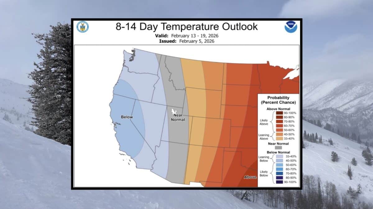
Temperature Transition
Following above-normal temperatures across the West during late January and early February, NOAA’s CPC predicts a transition to much cooler temperatures beginning February 13th through 19th. Below-normal temperatures are favored across the Pacific Northwest, Great Basin, and California during this period.
The combination of cooler temperatures and increased moisture would create ideal conditions for periods of snow, possibly heavy at times, to the Cascades, Sierra Nevada Mountains, and higher elevations of the Great Basin.
What This Means for Skiers
The forecast pattern change represents the best opportunity in months for Western mountains to build snowpack and open additional terrain. While the prediction focuses on mid-February, this type of trough pattern can often persist for extended periods once established.
Skiers and riders should monitor the Week-2 U.S. Hazards Outlook from NOAA’s Climate Prediction Center for more specific details on the heavy snow risk as the pattern develops.