
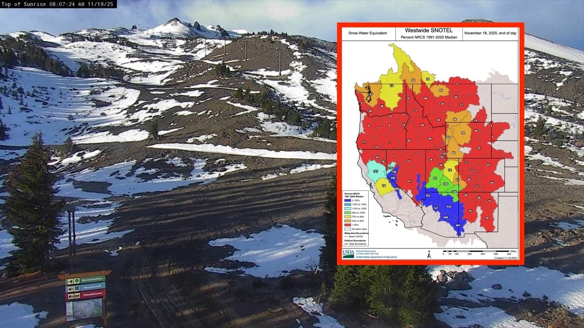
As the 2025-2026 water year progresses into mid-November, the latest USDA NRCS Westwide SNOTEL map paints a strikingly divided picture of early-season snow water equivalent (SWE) across the Western United States. While much of the region lags behind the 1991-2020 median — with vast swaths in deep red indicating 50% or less — pockets of abundance in the Southwest are delivering record-breaking numbers that could signal hope for drought-stressed areas.
The standout performers are in Arizona and southern Nevada, where several basins exceed 400% to over 750% of median SWE. Highlights include watersheds topping 767%, 600%, 533%, and 433% — fueled by early storms that dumped heavy, wet snow at higher elevations. Parts of southern California and the southern Sierra also show green and light blue, ranging from 110-149% and even isolated 150%+ zones. These robust accumulations provide a critical boost to regions still recovering from multi-year drought, potentially improving spring runoff for reservoirs like Lake Mead and Lake Powell.
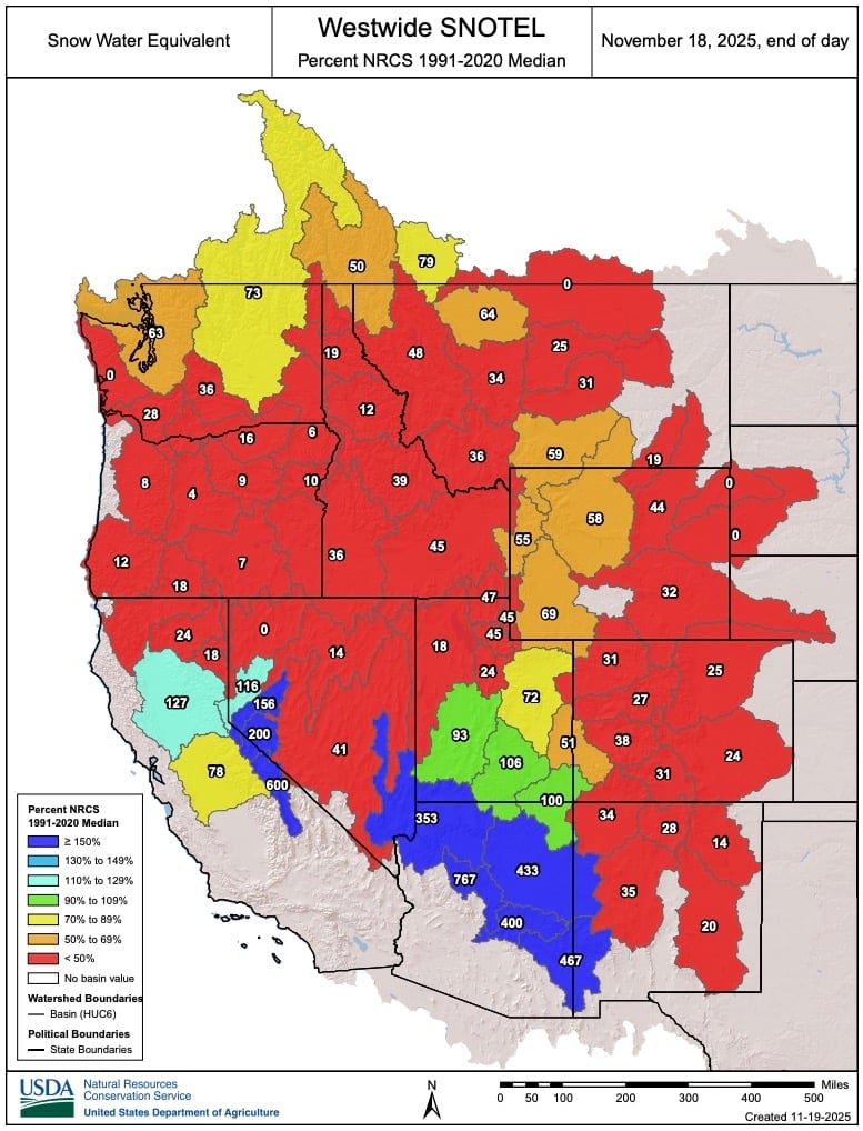
In stark contrast, the Pacific Northwest, Great Basin, and northern Rockies are off to a dismal start. Washington, Oregon, Idaho, Montana, Wyoming, Utah, and most of Nevada and Colorado are bathed in orange and red, with many basins at 50-89% or below 50% of median — some showing 0% or no measurable snowpack yet. This slow buildup raises concerns for water supplies, wildfire risk next summer, and ski resort operations heading into the holiday season.
Early November is historically variable for snowpack, and there’s plenty of winter left for catch-up storms, especially under evolving La Niña influences that often favor the northern tier later in the season. Water managers, farmers, and recreationists will be watching closely. For the latest interactive data, check the NRCS National Water and Climate Cent