
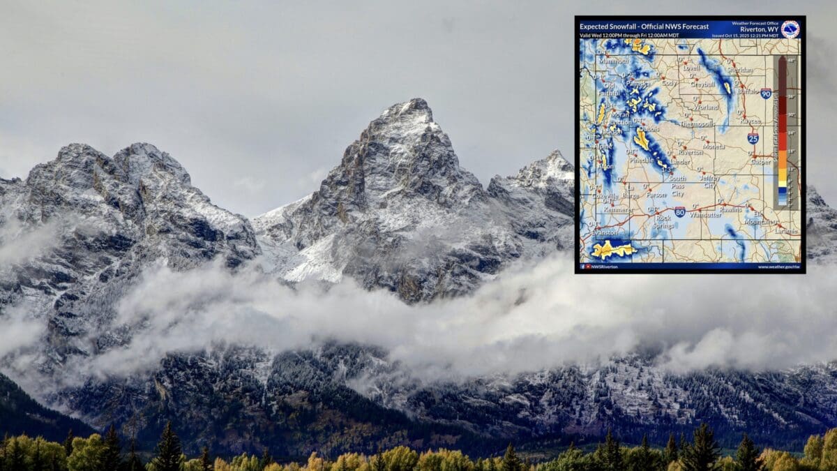
Winter is making a push into Wyoming’s high country, with the National Weather Service (NWS) in Riverton issuing Winter Weather Advisories for several mountain ranges. Snow accumulations could create hazardous conditions for travelers, hunters, and backcountry enthusiasts starting this evening and lasting through Thursday night.
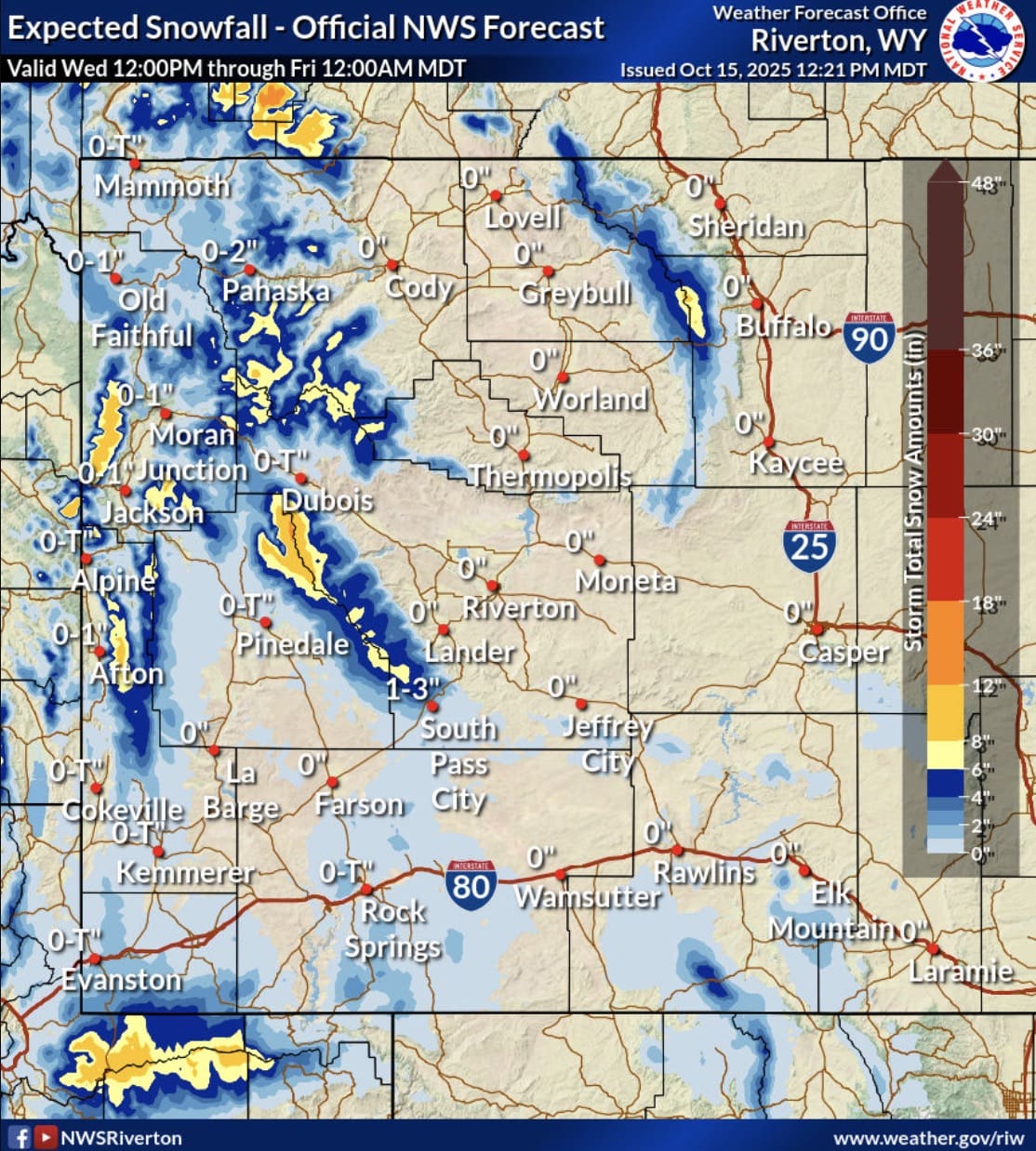
The advisories cover key areas including the Teton and Gros Ventre Mountains, Salt River and Wyoming Ranges, Absaroka Mountains, and Wind River Mountains. Expect slick roads over passes like Togwotee and Teton, where higher elevations could see up to 10-11 inches of snow.
Winter Weather Advisory Details
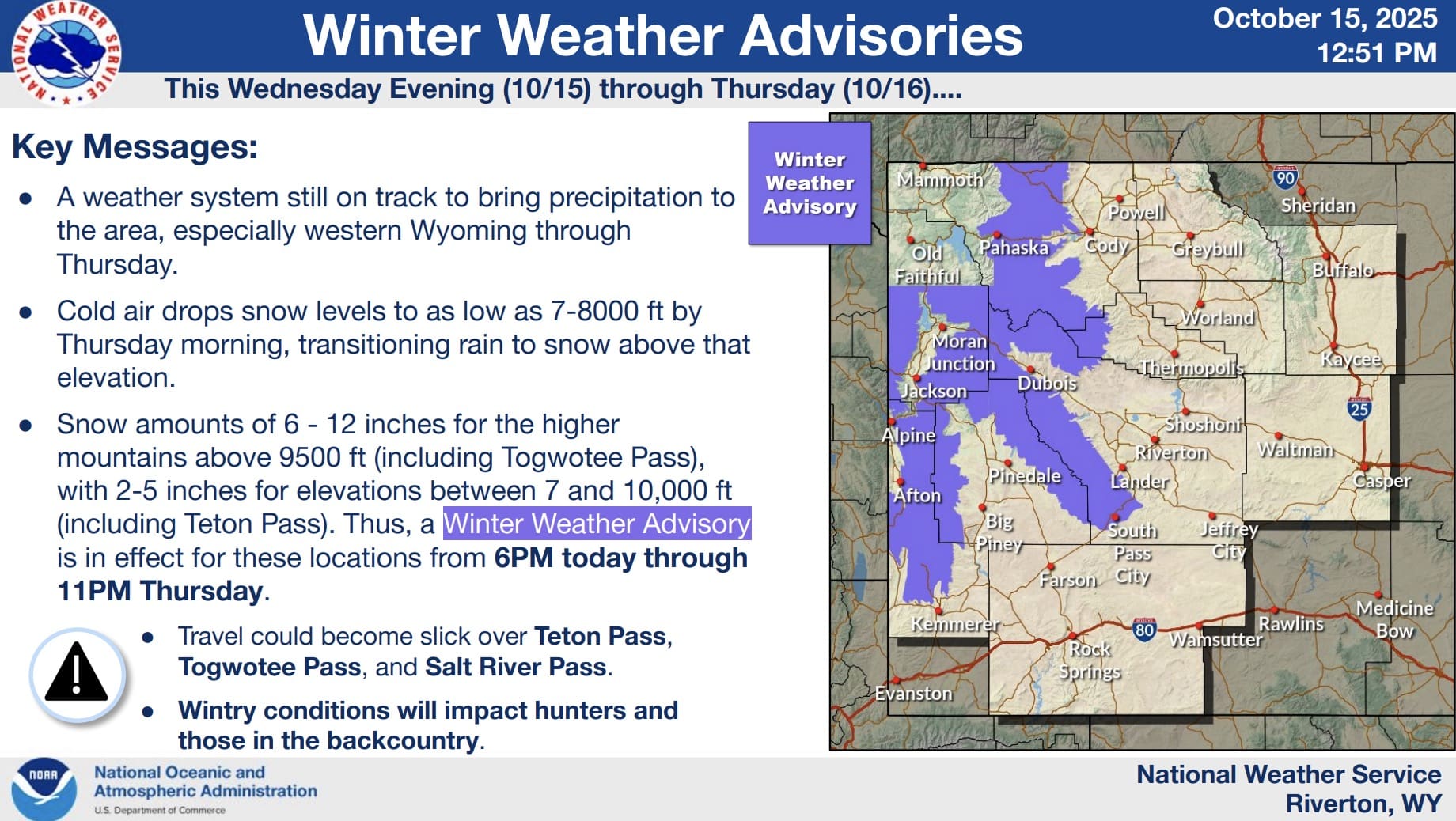
- Teton and Gros Ventre Mountains, Salt River and Wyoming Ranges: Snow expected with 2-5 inches between 7,500-9,000 ft, and 5-10 inches in higher terrain, including Togwotee and Teton Passes.
- Absaroka Mountains: 2-4 inches between 7,500-9,000 ft, and 4-9 inches higher up.
- Wind River Mountains (West and East): 3-6 inches between 7,500-9,000 ft, and 5-11 inches in the higher terrain.
The advisories remain in effect from 6 PM MDT Wednesday to 11 PM MDT Thursday. Impacts include slippery travel on mountain passes and challenges for those in remote areas during hunting season or backcountry activities.
NWS urges drivers to slow down and exercise caution. For the latest snowfall forecasts and range estimates, check weather.gov/riw/winter. Wyoming road conditions are available at wyoroad.info.