
It is a dry week ahead for the western half of the United States, with not much more than an inch or two showing up at resorts between today and early March. As meteorologist Chris Tomer reports, things are looking like they might be a good bit better at ski resorts in the Northeast.
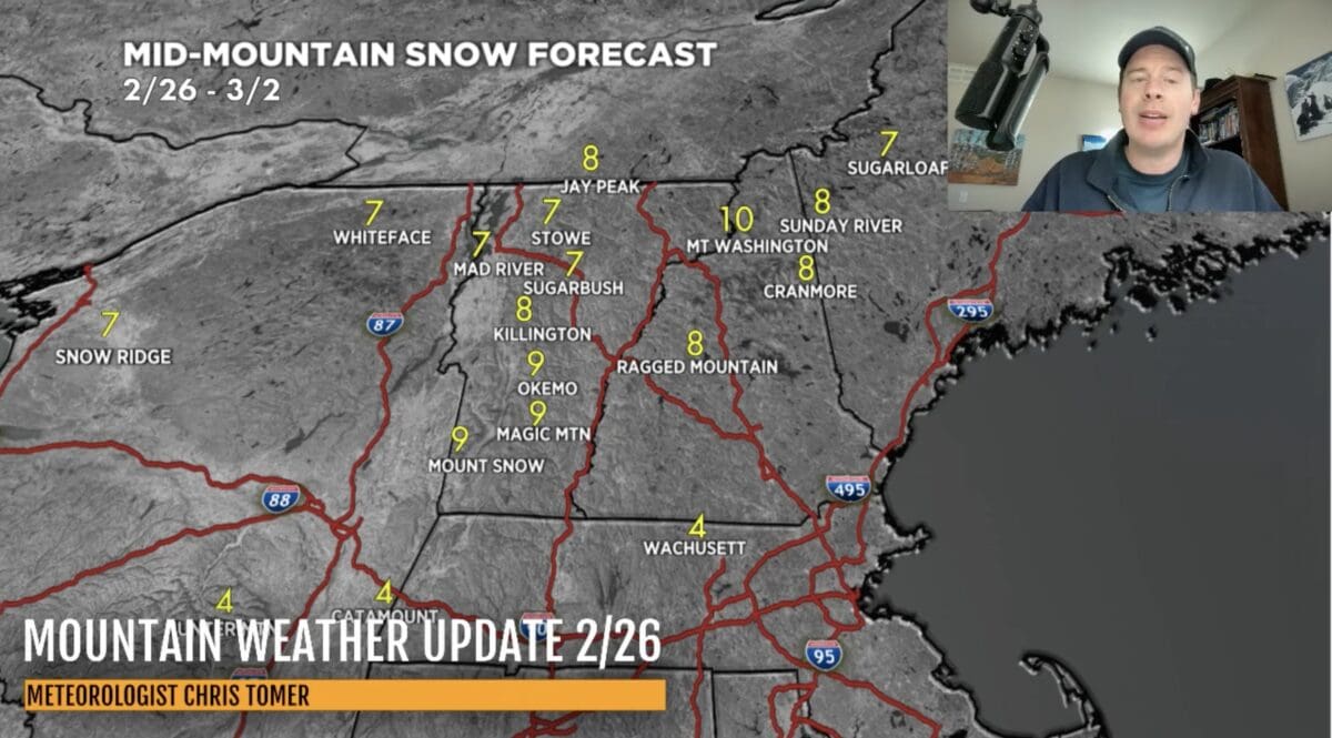
Between today, February 26, and Sunday, March 2, several New England and New York ski areas could see between 6-10 inches of new snowfall. In Maine, Sugarloaf is forecasted to receive 7 inches while Sunday River is looking at 8 inches. Southern Vermont resorts like Okemo, Magic Mountain, and Mount Snow are forecasted to receive 9 inches, while Jay Peak could see around 8 inches.
In the same period the western half of the country is looking at very little snowfall, but the powder could return to some areas by the middle of next week. Tomer forecasts 12 inches of new snowfall at Jackson Hole and 14 inches at Grand Targhee by March 6, with resorts in California looking at around a foot.
Heavier snowfall is expected in New England between March 5 and March 6 as well, though we don’t yet know what those totals will look like.
About Chris Tomer:
Tomer earned a B.S. in Meteorology from Valparaiso University graduating with Honors – where he also played basketball. Tomer minored in mathematics and broadcasting. Tomer is a fully certified meteorologist having earned the CBM and NWA Seal’s of Approval. Tomer also serves on the NWA panel of Television Seal evaluators. Chris has specialized knowledge of Mountain Meteorology.