
It’s time to get excited for some serious snowfall in the Rocky Mountains. Some areas in the northern United States are already seeing snow from this incoming storm system, while other areas have some huge snowfalls quickly incoming. Meteorologist Chris Tomer lays out what the next major snowfall will look like for much of the Intermountain West.
Chris Tomer’s love for the mountains shines through his mountain weather updates, providing skiers, snowboarders, and anyone else who loves snow with quality detailed snow forecasts covering most of North America. He’s been in meteorology for around 20 years, acting as a weather consultant on expeditions across the world, including expeditions on all fourteen of the world’s 8,000 meter peaks.
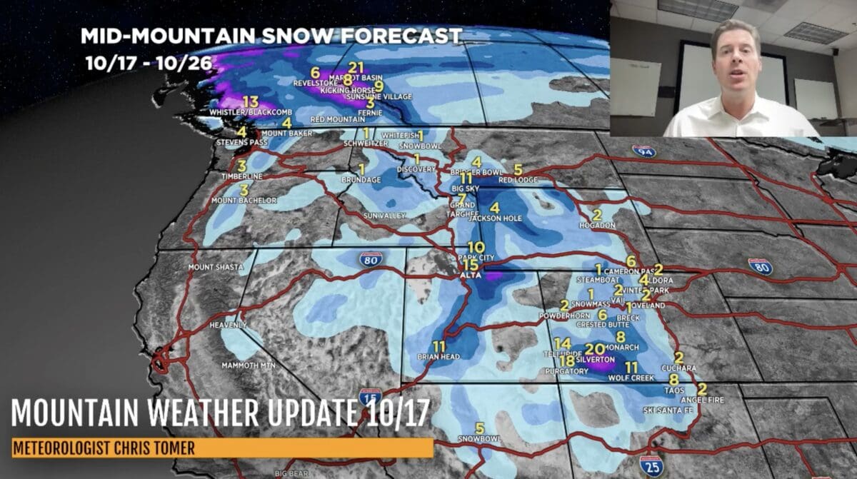
Through Idaho, Montana, Wyoming, and Utah, most of the snowfall is set to come down over today, October 17, and tomorrow. In Colorado the snowfall will likely begin in that period and continue through 10/19 & 10/20. In Utah, any spot above 9,000 feet are likely to see a foot or more of snowfall. In Southwest Colorado, sights above 8-9,000 feet will likely see the most snowfall, with more than 2 feet of snow possible at the highest locations. The mountains in Canada shouldn’t be forgotten, either. Over the next 10 days, Marmot Basin could see up to 21 inches of snowfall.
About Chris Tomer:
Tomer earned a B.S. in Meteorology from Valparaiso University graduating with Honors – where he also played basketball. Tomer minored in mathematics and broadcasting. Tomer is a fully certified meteorologist having earned the CBM and NWA Seal’s of Approval. Tomer also serves on the NWA panel of Television Seal evaluators. Chris has specialized knowledge of Mountain Meteorology.