

Has winter arrived early? After some snowstorms hit the Rockies over the past couple of weeks, more powder is on the way. If you want to shred this week though, you’ll probably want to bring out your rock skis. Powderchasers latest forecast is below.
Report Via Powderchasers.com:
Powder Alert- 5-10 inches of Snow, Snowliage, for the Northern Rockies.
By Steve Conroy

It has been a fantastic season for fall colors with areas in the 6500-7500 elevation currently peaking in the Rockies. Areas around Park City are full-on yellow. Aspen is peaking at lower elevations. Most of the upper peaks in the Cottonwoods, Maroon Bells, and the San Juan range are beyond peak.
Snow will be falling, heavy at times favoring the Northern Rockies, especially Utah and Colorado from Wednesday to Thursday.
Upwards of 10 inches are possible above 9,000 feet and 4-8 inches between 7-9K. Peak snowfall for the Rockies will be Tuesday for Montana/Idaho (Light to moderate amounts), increasing in intensity as you head south towards the Wasatch Range and most of northern Colorado. Wednesday/Thursday. This storm could be a photographer’s dream with snow/foliage abundant in many locations.
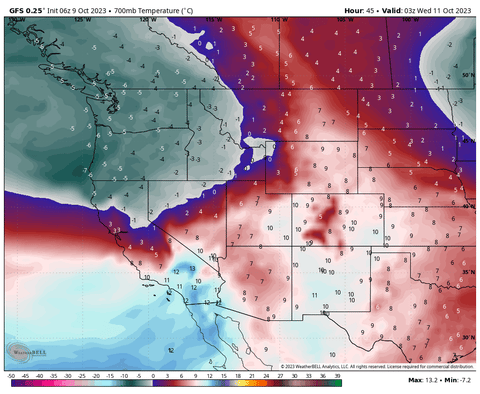
Below: A cold front enters the PNW early this week and drags over the Rockies Wednesday into Thursday (the Map is late Tuesday night to Thursday evening). You can see the PNW warms up by Thursday and most of the coldest air stays in the central and Northern Rockies midweek.
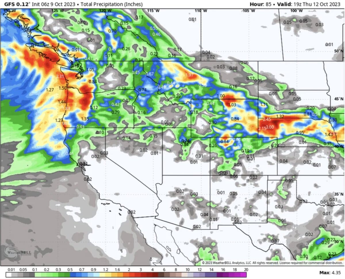
Below: Total moisture through midday Thursday is abundant for the PNW (1- 2 inches) with decent amounts (.5 to 1 inch) over central Montana, northern Utah, and especially northern Colorado (excess of 1 inch of water). Some higher-elevation light snowfall is likely in the Cascades earlier this week.

Below: Vail Pass- Snow will be falling over Vail Pass Wednesday night and Thursday with moderate amounts likely at the summit. Steamboat and areas north could see higher amounts by late Thursday night with over an inch of moisture possible.

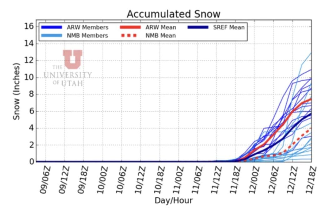
Below: Total snowfall for Alta could exceed 10 inches at the summits (University of Utah models using only the American Model). 4-8 inches is likely at mid-elevations from Wednesday to Thursday.
Below: Total snowfall through Thursday morning will favor northern Montana, the Wasatch Range in Utah, southern Wyoming areas along I-80, and much of north/central Colorado. An excess of 10 inches is possible above 9,000 feet for northern Utah and Colorado.

Announcements: It’s time to consider purchasing or mounting your snow tires. Please support Tire Rack here as our preferred provider for multiple brands and direct shipping here.
Ikon Pass rates go up on October 11th! You can purchase your pass here.
Our Concierge program rates go up this Friday. If you want to support Powderchasers please join our custom forecasting service here (Concierge) or make a donation here.
Enjoy the powder/foliage this week! You can follow my travel on Instagram @powderchasersteve
Powderchaser Steve