
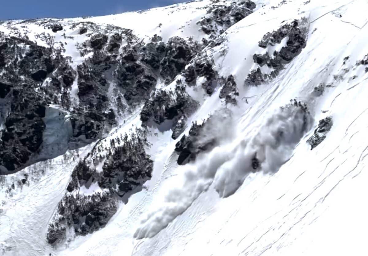
New Hampshire — Scary footage out of New Hampshire where multiple skiers where very nearly hit by an avalanche in Tuckerman Ravine on Mount Washington. The incident happened at 12:28pm on April 9th, 2026 and was witnessed by Mountain Washington Avalanche Center avalanche forecaster and snow ranger Charlotte MacDonald. Thankfully everyone in the slide path made it out in time:
Mount Washington Avalanche Center Incident Summary:
Small skier-triggered avalanche in Tuckerman Ravine, Chute. Slab was triggered high in the start zone around 12:28 PM. Snow at upper elevations stayed colder yesterday. It was likely that the slab triggered here stayed colder, as temperatures at Hermit Lake were just around 32 F. Summit temperature at the time was 27 F.
Observation date: April 9, 2026
Submitted: April 9, 2026, 5:30 p.m.
Zone/Region: Presidential Range
Observer: Charlotte MacDonald
Observer type: Forecaster
Affiliation: Mount Washington Avalanche Center
Activity: Skiing/Snowboarding
This is a good reminder that avalanches can occur during a General Bulletin, and the lack of a color hazard does not mean that conditions are necessarily safe. This slab was both small and isolated (one of the few areas that was not skied and where the snow remained cold). The avalanches triggered today and yesterday were high in the start zone and were a combination of cold snow or slabs that were warming. Luckily, no injuries have occurred from any of these slides.
The new snow is still undergoing changes and is very variable by aspect and elevation. As summit temperatures have remained above freezing, snow higher in terrain has stayed colder and retained more connected structure. Snow in solar aspects has received more solar gain and has been wetter and mushier. In general, snow surfaces are variable, so take time to assess any snow you may travel on or across.
Talking to skiers in Great Gulf, the snow there was found to have stayed cold and was a mix of frozen surfaces. Crampons remain a valuable tool as the crust underneath the surface snow is slick and hard.
In some shaded areas, the new snow may have stayed cold; in sun-exposed features, the bright white snow may have more moisture. The old crust (identifiable by shiny and gray surfaces) softened in some areas and remained firm in others. Time of day, aspect, and elevation may all cause subtle differences in the surface snow; build time into moving through terrain to assess, as things may change. Surfaces are variable- the snowpack is not yet predictable, corn snow.