

Colorado has seen a dry start to the 2025/2026 winter season, with Denver still waiting for its first snowfall and every open resort relying heavily on snowmaking. For a significant portion of the state, specifically down toward the Southwest, that dry spell looks like it’s about to come to an end.
What To Expect
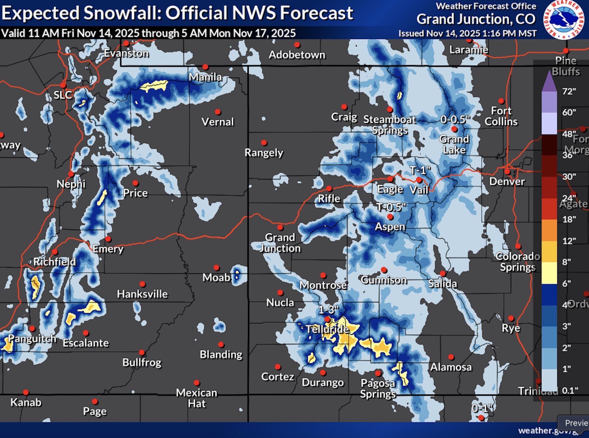
According to the latest report from the National Weather Service Grand Junction Office, several high elevation passes and mountain areas in Colorado and Utah are forecast to receive 4–9 inches of snow, with a few localized high-end totals reaching 7–12 inches. Lower elevation regions in the Four Corners and Utah desert likely won’t see much, if any, and the totals further North and East trend quite a bit lower.

Here’s a look at some of the deepest forecasted locations for between today, November 14th, and Monday, November 17th:
- Wolf Creek Pass, CO — Expect ~5″, with up to ~9″ possible. The chance of accumulating 6″ or more hovers around 42%.
- Red Mountain Pass, CO — Forecast ~6″, high-end ~8″. Roughly 36% chance of reaching 6″+.
- La Sal Mountains, UT — Forecast ~6″, potential ~7″. About 27% chance of 6″+.
- Molas Pass, CO — Forecast ~5″, possible up to ~7″. Approximately 30% chance of 6″+.
- Lizard Head Pass, CO — Forecast ~5″, up to ~7″. Around 25% chance of ≥6″.
- Coal Bank Pass, CO — Forecast ~6″, up to ~8″. Around 29% chance of 6″+.
- Grand Mesa, CO — Forecast ~4″, with a high-end ~6″. About 19% chance of 6″+.
- Silverton / Telluride region, CO — Forecast ~3–4″, with smaller odds of higher totals.
- Mt Werner, CO — Forecast ~2″ with a high-end near 4″; just ~3% chance of 6″+.
- Abajos Mountains, UT — Forecast ~3″, potentially ~4″; decent odds for measurable snow.