Early Season Atmospheric River Brings Big Snow to British Columbia and the Pacific Northwest
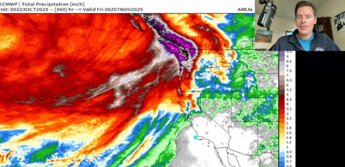
In Meteorologist Chris Tomer latest weather report from October 23, 2025, he reports that the Pacific Northwest and British Columbia are bracing for multiple atmospheric river events, bringing heavy snow to mountain regions and rain to coastal areas. Snow totals could easilly be 3-5 FEET at the higher elevations. Here’s a breakdown of what to expect:
Key Highlights from the Forecast / Prediction
- Three major surges of moisture (Atmospheric Rivers) will hit between October 24 and early November, driven by strong jet stream winds up to 180 mph.
- Whistler Blackcomb and the Fitzsimmons Range are in the bullseye — expect up to 4–5 feet of snow through the end of the month.
- Snow levels:
- Around 5,000 ft in BC and the Pacific Northwest
- Around 9,000 ft in Tahoe (October 25–26 timeframe)
- Resort-specific snowfall:
- Alta, UT: ~8 inches (Oct 25–27)
- Snowmass, CO: ~5 inches with a second wave incoming
- Mount Hood, OR: 20 inches in the first wave, 10 inches in the second
- Jackson Hole, WY: 8–9 inches through November 7
- Seattle could see 5.5 inches of total rainfall by early November.
- The axis of the jet stream is shifting north, focusing precipitation over BC, Washington, and Oregon, while Colorado and Utah see lighter totals.
Big Picture
This is a moderate atmospheric river event but an exciting start to the season — a rare late-October powder setup for coastal ranges and the northern Rockies. Early-season snowpack is building fast in BC and the Cascades, hinting at a strong start to the 2025 ski season.

