
Winter 2025 – 2026 Weather Forecast: Are we heading into the coldest winter since 2013?
As winter 2025-2026 approaches, Weather With Travis‘s recent forecast provides an intriguing outlook for the upcoming season, highlighting a dynamic setup with significant snowpack growth and shifting cold air patterns across the Northern Hemisphere. This forecast, based on insights from Weather With Travis, points to an active winter with potential for early storms, colder-than-average temperatures in parts of North America, and a weak La Niña influencing weather patterns.
Rapid Snowpack Buildup in Siberia and Canada
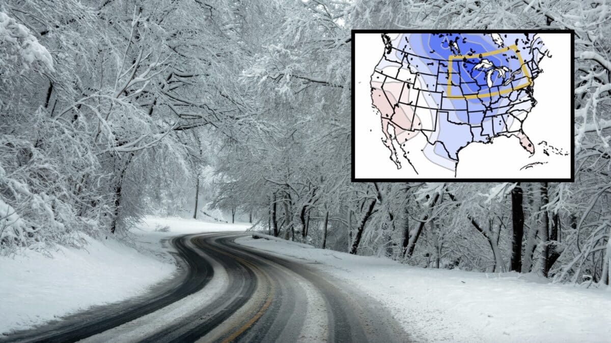
The forecast emphasizes a rapid buildup of snow across Siberia, which is already showing above-average snow cover compared to recent years. This increased snowpack is linked to a wavier polar jet stream, potentially leading to an active start to winter with strong storms in December and January. Cold air is also pooling across Siberia and parts of Canada, particularly in the Northwest Territories, where snow accumulation is expected to intensify through October and November. This trend could set the stage for a colder-than-average winter in regions east of the Rockies, including the Upper Midwest.
La Niña and Historical Analogues
A weak La Niña is on the horizon, with a 71% chance of developing between October and December, according to the Climate Prediction Center. This pattern mirrors conditions seen in the winter of 2013-2014, which brought extreme cold to the Upper Midwest, marking it as one of the coldest winters since 1978-1979. While this year’s La Niña is expected to be weak and transition toward neutral ENSO conditions by early 2026, it could still drive significant weather events, including rapid cooldowns and big warm-ups, particularly in February and March as the Pacific jet strengthens.
North Pacific Influence and Early Storms
Warm waters in the North Pacific, particularly near the Bering Strait, are contributing to storm activity in Alaska and western Canada. These storms may dislodge cold air, pushing it southward into central Canada and the Rockies. A potential early fall snowstorm is on the radar for western Canada, with models suggesting heavy precipitation, including snow in Alberta’s mountains and possibly extending to cities like Calgary and Edmonton. Additionally, tropical moisture could interact with these systems, bringing heavy rain to the Southwest and further cooling North America.
What to Expect in North America
While the Lower 48 may not see significant snow in October, the forecast suggests a colder trend developing by December, particularly east of the Rockies. The Upper Midwest and Great Lakes regions could experience intense cold snaps, though warm-ups are also likely due to the dynamic jet stream. As winter progresses, the strengthening Pacific jet may limit prolonged cold in February and March, but early winter storms could bring significant snow to higher elevations and northern regions.