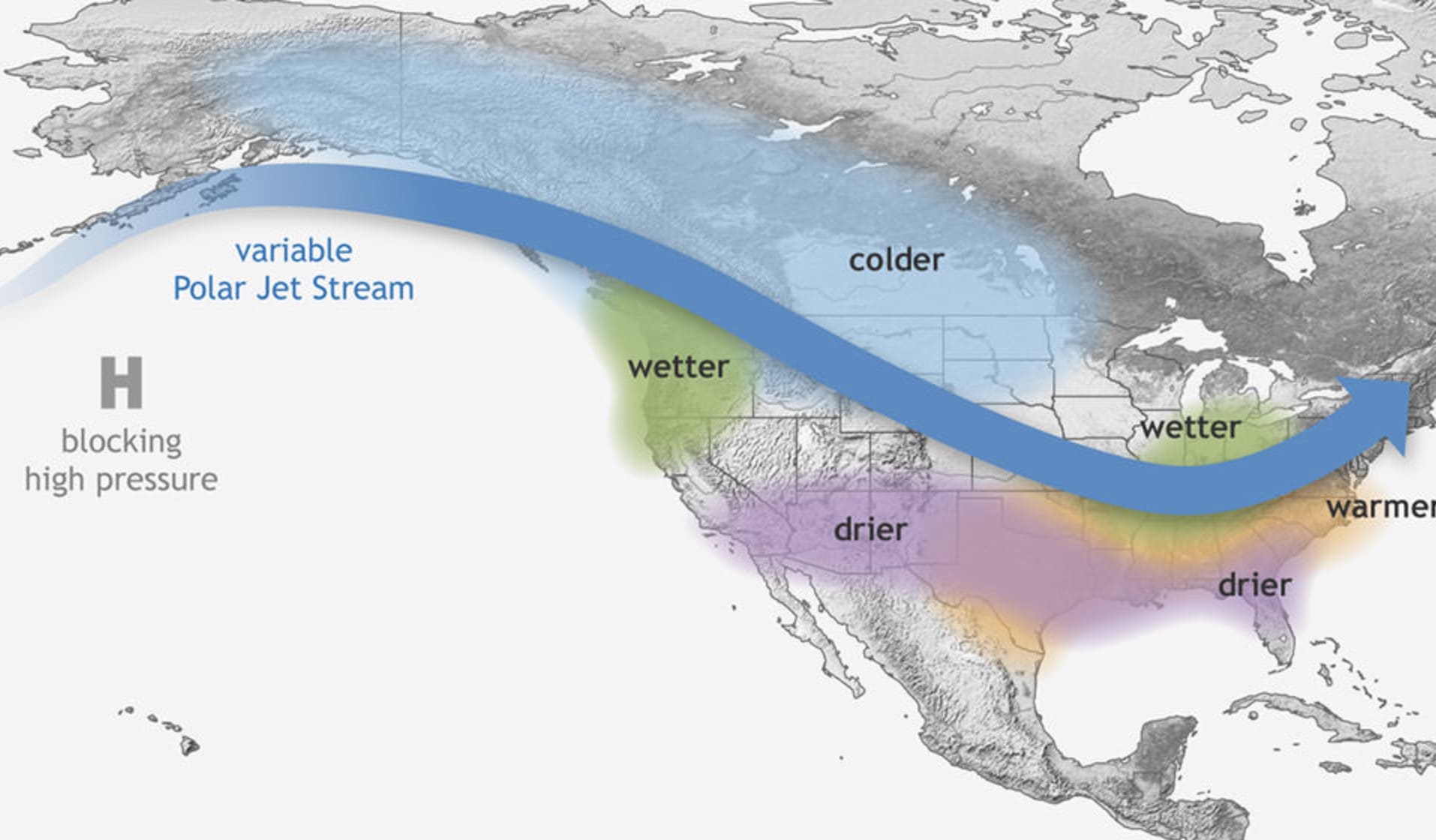
A new report from the National Oceanic and Atmospheric Association‘s Climate Prediction Center has increased the likelihood of La Niña emerging between October and early December of 2025 to 71%, indicating an interesting start to the winter. La Niña remains favored between December and February, but its chances decrease to 54%.
La Niña Chances Increase
The El Niño-Southern Oscillation (ENSO) remained neutral through August 2025, with near-to-below average sea surface temperatures sitting in the central and eastern equatorial Pacific Ocean. Recent Niño SST index values ranged from -0.4°C to -0.2°C while negative subsurface temperature anomalies strengthened. Below-average temperatures prevailed from the surface to 200 meter depth in the central and eastern Pacific.
The IRI multi-model predictions have been slightly favoring ENSO-neutral through the Northern Hemisphere throughout winter 2025/2026. However all models presented by the North American Multi-Model Ensemble favor La Niña to emerge and continue throughout the winter. As such, the Climate Prediction Center team also favors the pattern to develop. Based on their findings, there’s a 71% chance of the pattern through October and December 2025 and a 54% of La Niña holding on between December and February 2026.

What Is ENSO?
The El Niño-Southern Oscillation is a recurring climate pattern that involves the changes in the temperature of waters in the eastern and central tropical Pacific. Surface water temperatures across a large swath of the tropical Pacific Ocean cool by anywhere from 1°C to 3°C, compared to normal, on periods ranging from around three to seven years. These patterns directly affect the rainfall in the tropics and can have a major impact on North American weather.
In ENSO Neutral, the tropical Pacific sea surface temperatures are usually at or around average. That said, sometimes the temperatures show either an El Niño or La Niña pattern without the atmosphere playing along. In an El Niño, the tropical Pacific sea surface temperatures are above average. During La Niña, the sea surface temperatures are generally below average.

During a La Niña winter, temperatures tend to be warmer than normal in the South and cooler than normal in the North. Hurricane season is often more severe during a La Niña year, and the southern U.S. usually faces drought while the Pacific Northwest and Canada see heavy flooding.

