
Washington State is far more complex than rain and tech companies. It contains the only temperate rainforest in the contiguous United States, a landscape scarred by ancient mega-floods, an accidental American exclave, and some of the most impressive feats of human engineering anywhere on the planet. Geography By Geoff took a look at 15 incredible geography facts about Washington State that most people have never heard.
15 Geography Facts About Washington State
The Only Temperate Rainforest in the Lower 48 – The Olympic Peninsula receives up to 12 feet of rain per year thanks to Pacific air forced upward by the Olympic Mountains, creating the only temperate rainforest in the contiguous United States.
The Scars of the Missoula Floods – During the last ice age, a repeatedly bursting glacial dam sent walls of water hundreds of feet high racing across Eastern Washington, carving the Channeled Scablands and creating Dry Falls, which is five times the width of Niagara.
The Westernmost Point in the Lower 48 – Despite what most people assume, the westernmost point of the contiguous United States is not in California or Oregon but at Cape Flattery, Washington, reachable only by a 3-mile hike through coastal forest.
Mount Rainier’s Terrifying Glaciers – Mount Rainier holds more glacial ice than all other Cascade volcanoes combined, and because it is an active stratovolcano, a major eruption could trigger a catastrophic lahar threatening the densely populated valleys below.
A Ring of Fire Hotspot – Washington is home to five active volcanoes formed by the subducting Juan de Fuca plate, most famously Mount St. Helens, whose 1980 eruption blew 1,300 feet off the summit and flattened hundreds of square miles of forest.
The Accidental Exclave of Point Roberts – When the 1846 Oregon Treaty drew the 49th parallel as the US-Canada border, mapmakers accidentally sliced off the tip of a peninsula, creating an American exclave whose residents must drive through Canada to reach the rest of Washington by land.
A Border War Started By a Pig – A 12-year military standoff between the US and Britain over ownership of the San Juan Islands was triggered when an American farmer shot a British company’s pig for eating his potatoes, and the pig was the conflict’s only casualty.
Seattle’s Underground City – After the Great Seattle Fire of 1889, the city rebuilt its streets 12 to 30 feet higher to solve chronic tidal flooding, leaving the original ground floors buried as a network of underground corridors that still exist today.
The Hanford Site and the Manhattan Project – The federal government chose Eastern Washington for wartime plutonium production because the Columbia River, the Grand Coulee Dam, and the remote desert provided exactly the water, power, and isolation the work required, leaving behind what is now the most contaminated nuclear cleanup site in the Western Hemisphere.
A Name Change That Backfired – A congressman blocked the proposed territory name of Columbia in 1853 to avoid confusion with the District of Columbia, then renamed it Washington instead, accidentally creating the exact geographic naming confusion he was trying to prevent.
The World’s Longest Floating Bridges – Because Lake Washington’s lakebed is too deep and soft for traditional bridge foundations, engineers built bridges that float on concrete pontoons, and Washington is now home to four of the five longest floating bridges in the world.
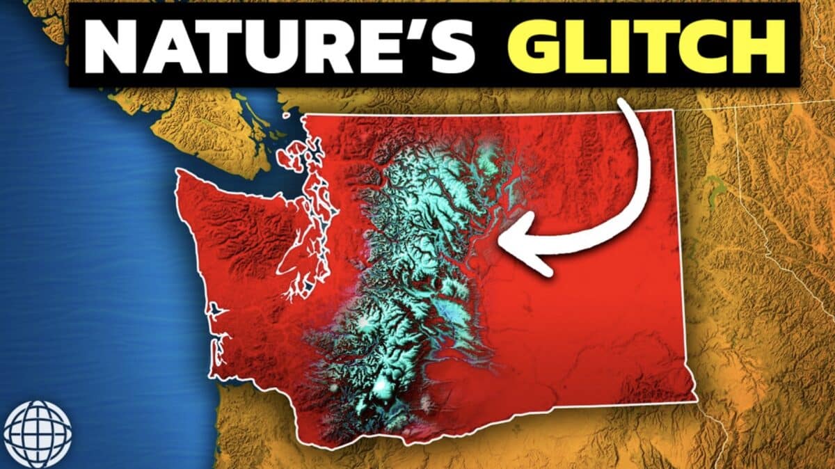
The Cascade Curtain – The Cascade Mountain Range splits Washington into two entirely different worlds, with a wet, densely populated, tech-driven west side and a dry, sparsely populated, agriculture-dependent east side living in the mountains’ rain shadow.
The Grand Coulee Dam’s Massive Power – The largest power-producing facility in the United States, the Grand Coulee Dam provided the cheap electricity that attracted aluminum smelters and powered Boeing’s wartime production, while also irrigating over 600,000 acres of former desert in Eastern Washington.
The Apple Capital of the World – Washington grows roughly 60% of all US apples not in its famously rainy west but in its dry eastern desert, where farmers channeled Columbia River water onto volcanic soil that gets 300 days of sunshine per year.
America’s Largest Ferry System – Because Puget Sound’s maze of islands, peninsulas, and glacier-carved fjords makes traditional highways impossible in many places, Washington built a ferry system that carries over 20 million passengers and 10 million vehicles per year, the largest in the United States.