
Meteorologist Chris Tomer is tracking two distinct storm systems that could bring meaningful snowfall to western ski resorts over the next two weeks, offering some hope after one of the worst snowpack seasons on record.
The first system arrives around April 8th and 9th, dragging a front through much of the central and northern Rockies. The more significant event follows shortly after, with a low pressure system potentially pushing into the Rockies between April 10th and 13th, bringing moderate to heavy snow to Utah and the Tetons.
For Utah, Tomer is forecasting 6 to 10 inches through Little and Big Cottonwood Canyons, with more accumulation expected after April 11th. Alta could see up to 24 inches total over the 15-day window. The Tetons are looking at over a foot, a region Tomer singled out as particularly favored in this pattern. Colorado is projected to see a more modest 3 to 8 inch swath across the ski zones, with a potential heavier event around April 15th worth watching.
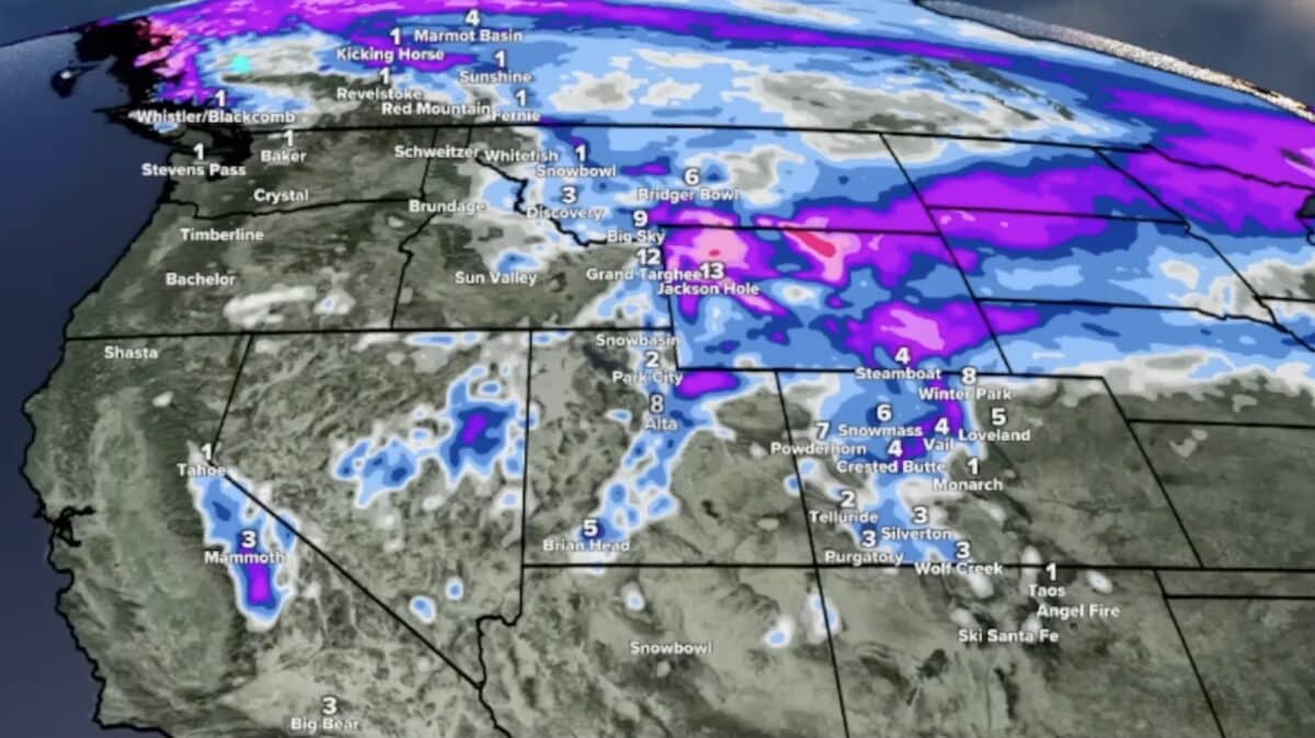
Friday’s storm already delivered, with Big Sky reporting a foot, Jackson Hole picking up 16 inches at the summit, and Alta adding 13 inches to push its season total to 291 inches.
Despite the fresh snow, Tomer was clear that the snowpack across the West remains in historically bad shape, sitting roughly 70 to 75 percent below normal. He noted that continued snowfall matters beyond skiing, as snowpack provides a slower, more sustained water supply than rain heading into spring.