

Multiple National Weather Service offices have issued Winter Weather Advisories covering a wide stretch of Colorado’s mountain ranges, with snow expected to create hazardous travel conditions through 9pm MDT Wednesday.
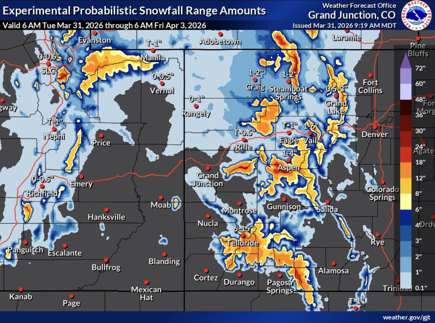
The advisories, issued by the NWS offices in Grand Junction, Pueblo, and Denver, affect a broad swath of the state’s high country. Areas under the advisory include the Elkhead and Park Mountains, the Flat Tops, the Gore and Elk Mountains, the Central Mountain Valleys, the Grand and Battlement Mesas, the West Elk and Sawatch Mountains, the Northwest and Southwest San Juan Mountains, and the Front Range high country including Rocky Mountain National Park, the Indian Peaks, the Mosquito Range, and the Mountains of Summit County.
Well-known communities falling within the advisory zones include Aspen, Snowmass, Vail, Crested Butte, Telluride, Breckenridge, Silverton, Ouray, and Winter Park, among many others.
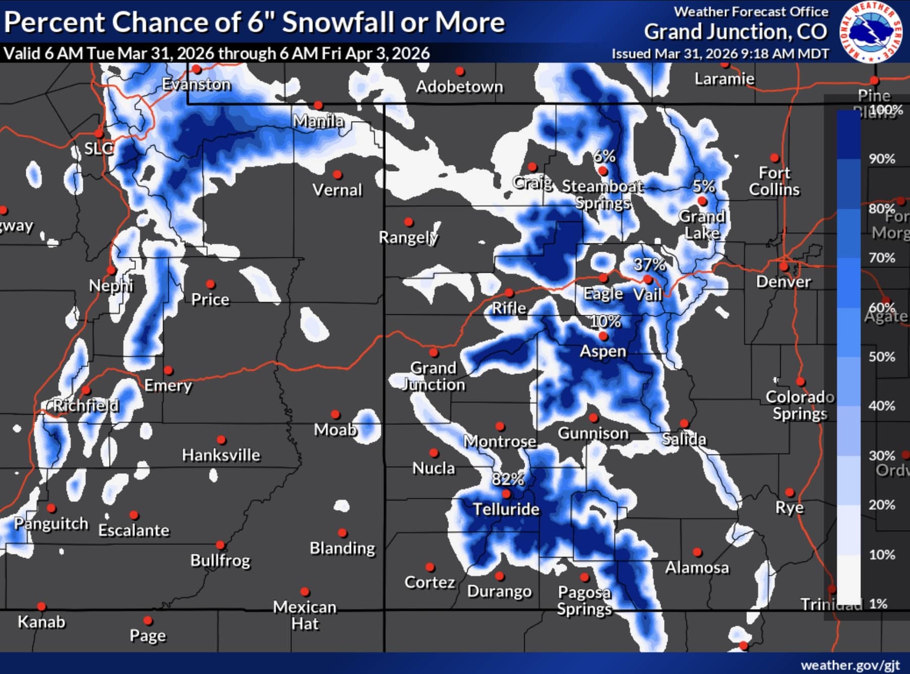
Snow is expected to begin accumulating above 9,000 feet starting at 6pm on Tuesday. Total accumulations of 6 to 12 inches are forecast across most affected areas, with some zones in the southwestern and central mountains expected to see 8 to 12 inches. Locally higher amounts are possible. Wind gusts could reach 40 to 50 mph in the higher terrain, adding to the difficulty of travel.
The timing of the storm raises particular concern for commuters, as the hazardous conditions are expected to overlap with both the Wednesday morning and evening commutes through mountain passes.
Travelers heading into or through the affected areas should slow down and use caution. For the latest road conditions in Colorado, call 511 or visit cotrip.org.