MANCHESTER, N.H. — The Mount Washington Avalanche Center is warning of dangerous conditions this week as new snow and strengthening winds increase the risk of avalanches.
Avalanche danger is rated “considerable” at elevations above 3000 feet through at least Wednesday, with both human triggered and natural avalanches possible.
“The bottom line, you could trigger an avalanche on north, east, and south facing slopes above 3000 feet. While you may see blowing snow and shooting cracks, look for smooth pillow drifts to identify areas of potentially unstable snow. Travel on firm surfaces to reduce your chances of triggering an avalanche today.” – Mount Washington Avalanche Center
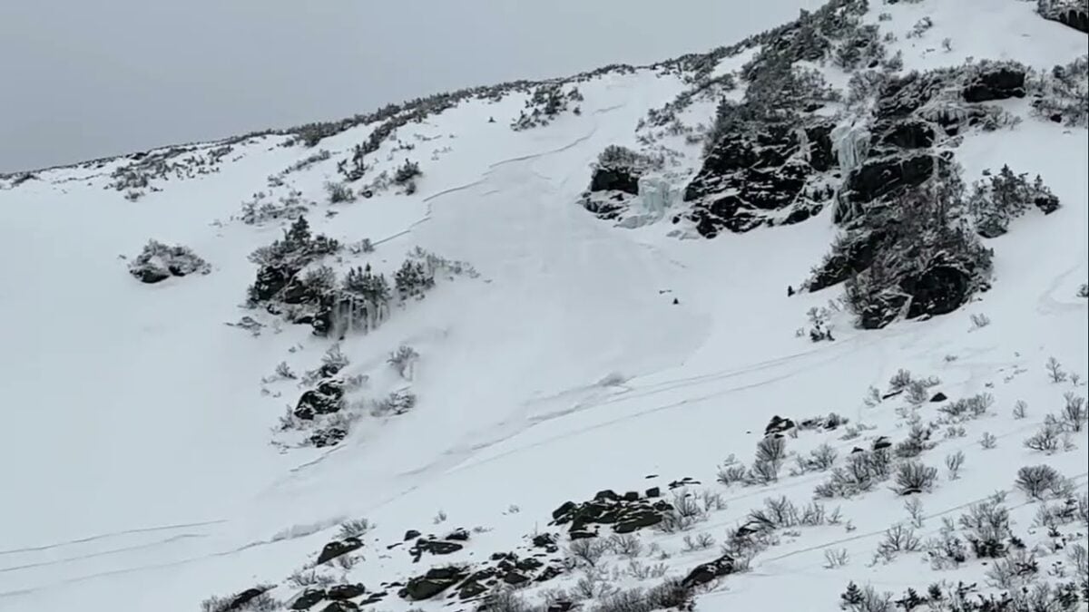
The warning follows an incident last week in which a skier triggered an avalanche while descending the Sluice in Tuckerman Ravine.
Officials said increasing winds are creating deep snow drifts on top of a weak snowpack, adding to the danger. The center is advising backcountry travelers to carefully assess conditions, choose routes cautiously and make conservative decisions, particularly on steep, east facing slopes.
Forecast Discussion
Recent forecaster observations (Obs 1, Obs 2) have found poor snowpack structure within the new snow found on top of the stout melt-freeze crust. If slabs are only sensitive on top of a thin rimed crust, the size will be small, whereas if it encompasses all of the snow down to the melt-freeze crust, avalanches could be large.
The big questions for today are how much snow is available for transport, and what will increasing winds do.
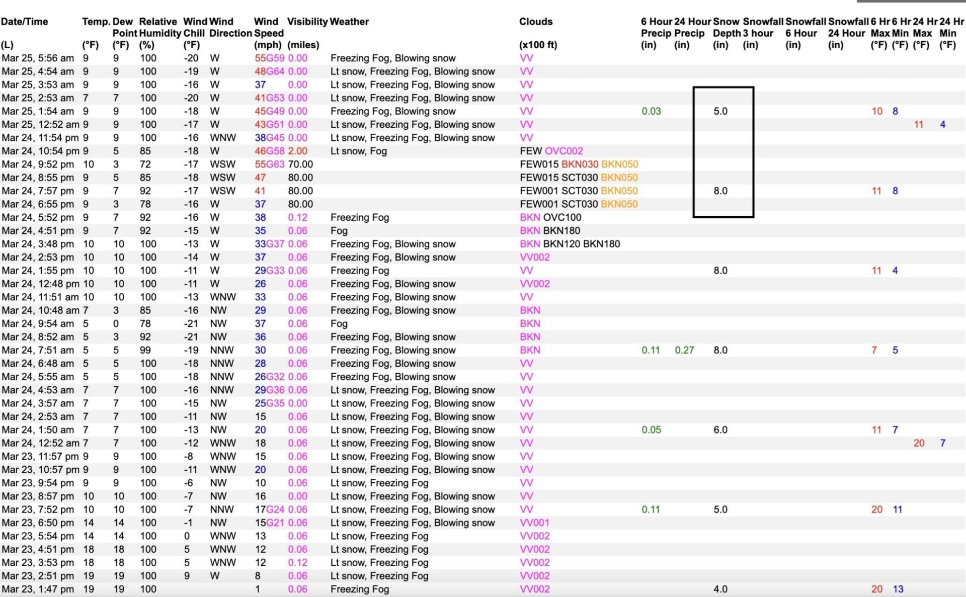
For snow available for transport, solar gain and riming may limit and cap snow surfaces, preventing it from being redistributed. Overnight, the Mount Washington Observatory recorded that the height of snow went from 8 inches at 6:55 PM 3/24 to 5 inches 6 hours later at 1:55 AM 3/25. The other component is that with significant snowpack loss in the alpine, new snow falls onto rocks and is more difficult to redistribute than it falling on smooth, planar snow surfaces. While the snowpack is improving in the alpine, in many areas it is still disconnected, which may limit loading potential.
The increase in winds has been driving an increase in avalanche hazard; however, the wind speeds recorded have been on the lower side of what has been forecast. Today, winds are forecast to increase to 50-70 mph early, before decreasing throughout the afternoon. This could transport snow, stiffen snow surfaces, and build slabs that are on top of poor structure deeper in the snowpack.
Enter avalanche terrain prepared to gather more information and track changes driven by the wind throughout the day.
OBSERVATIONS: Please consider submitting an observation on our website or in the new Avy phone app of what you are seeing in your travels. Submitting an observation hones your skills, informs other users, and improves our forecasts.